MyTopo
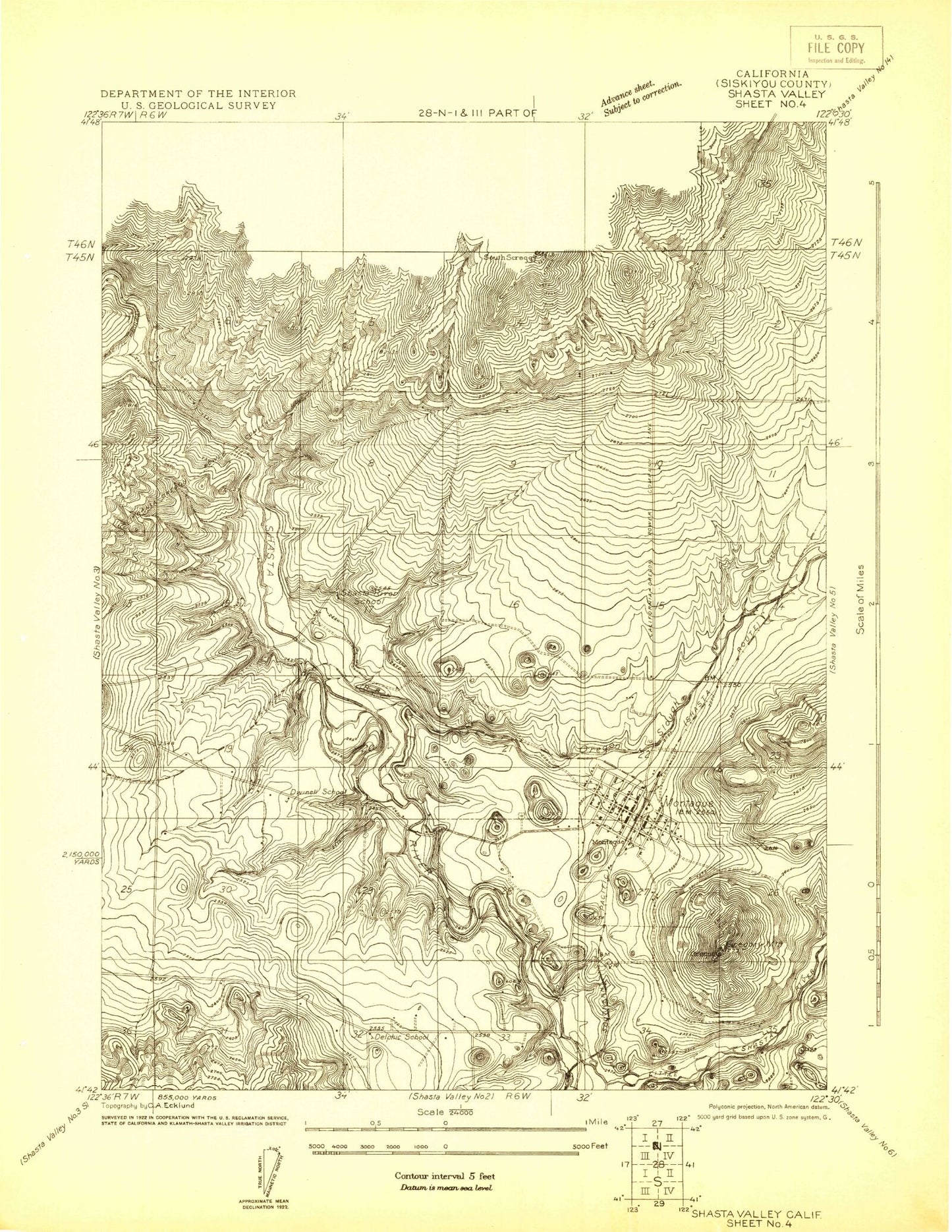
Classic USGS Shasta Valley Sheet No 4 California 7.5'x7.5' Topo Map
Couldn't load pickup availability
Historical USGS topographic quad map of Shasta Valley Sheet No 4 in the state of California. Map scale may vary for some years, but is generally around 1:24,000. Print size is approximately 24" x 27"
This quadrangle is in the following counties: Siskiyou.
The map contains contour lines, roads, rivers, towns, and lakes. Printed on high-quality waterproof paper with UV fade-resistant inks, and shipped rolled.
Contains the following named places: Bunton Hollow Creek, Cascade Sun Mobile Home Estates, City of Montague, Delphic Elementary School, Dwinell School, Fiock Number 2 2181 Dam, Gregory Mountain, Horizon Hills Mobile Home Park, Lake Suzanne 1186 Dam, Montague, Montague Airport-Yreka Rohrer Field, Montague Branch Siskiyou County Public Library, Montague Cemetery, Montague City Hall, Montague Elementary School, Montague Fire Department, Montague Number 2 2012 Dam, Montague Post Office, Montague Quarry, Mud Spring, Mutton Gulch, Oregon Slough, Shasta River School, Shelley Gulch, White Rock, White Rock Gulch, Yreka Creek