MyTopo
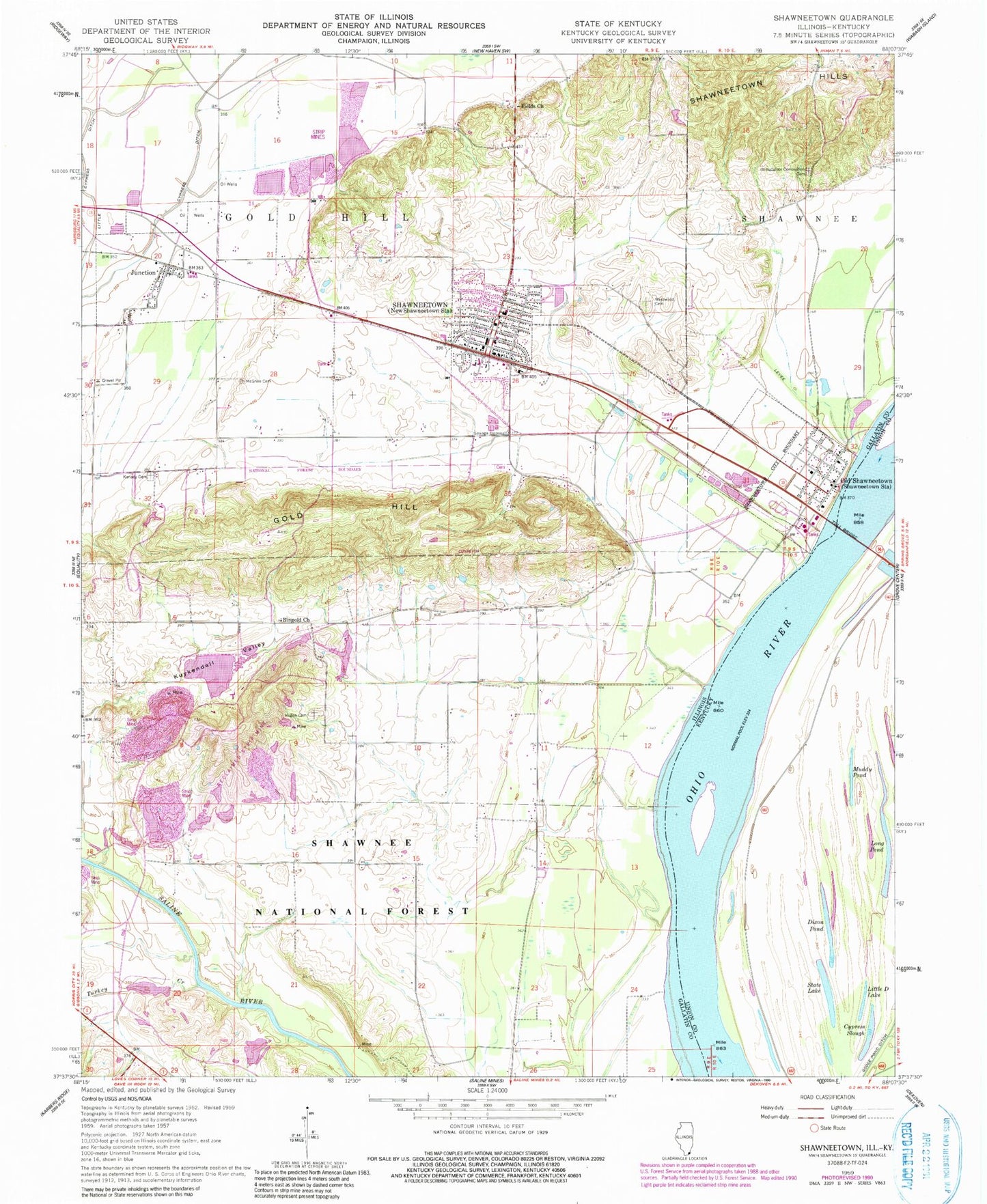
Classic USGS Shawneetown Illinois 7.5'x7.5' Topo Map
Couldn't load pickup availability
Historical USGS topographic quad map of Shawneetown in the states of Illinois, Kentucky. Map scale may vary for some years, but is generally around 1:24,000. Print size is approximately 24" x 27"
This quadrangle is in the following counties: Gallatin, Union.
The map contains contour lines, roads, rivers, towns, and lakes. Printed on high-quality waterproof paper with UV fade-resistant inks, and shipped rolled.
Contains the following named places: Bird School, Bowlesville, Brickyard School, Buckeye School, City of Shawneetown, Cypress Slough, Dixon Pond, Dortch Private Strip, Eagle Number 1 Fresh Water Lake, Eagle Number 1 Fresh Water Lake Dam, Eagle Number 2 Lake, Eagle Number 2 Lake Dam, Emmanuel United Methodist Church, Fields Church, First Baptist Church, First Presbyterian Church, Fresh Water Lake, Fresh Water Lake Dam, Gold Hill, Gum Springs School, Hogan Cemetery, Illinois No Name Number 2017 Dam, Immaculate Conception Cemetery, Junction, Junction Post Office, Kanady Cemetery, Kanady School, Kuykendall Valley, Little Cypress Ditch, Little Ditch Lake, Long Pond, McGehee Cemetery, Muddy Pond, Old Shawneetown, Old Shawneetown Volunteer Fire Department, Ringgold School, Ringold Church, Shawneetown, Shawneetown Fire Department, Shawneetown Hills, Shawneetown Police Department, Shawneetown Post Office, State Lake, Talley Ferry, Township of Bowlesville, Township of Gold Hill, Turkey Creek, Village of Junction, Village of Old Shawneetown, Westwood Cemetery, ZIP Code: 62984