

MyTopo
Classic USGS Shearing Corral Utah 7.5'x7.5' Topo Map
Regular price
$16.95
Regular price
Sale price
$16.95
Unit price
per
Couldn't load pickup availability
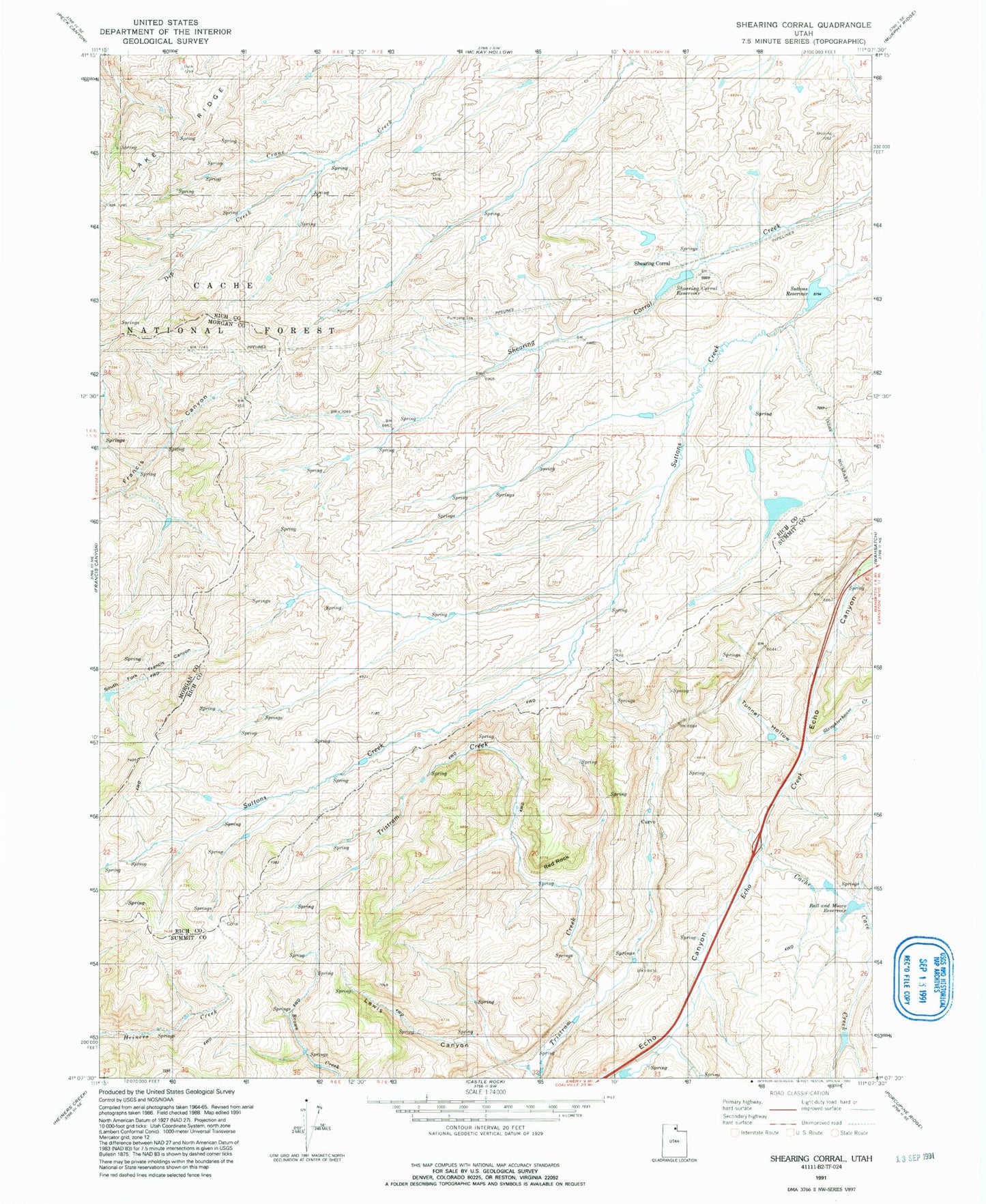
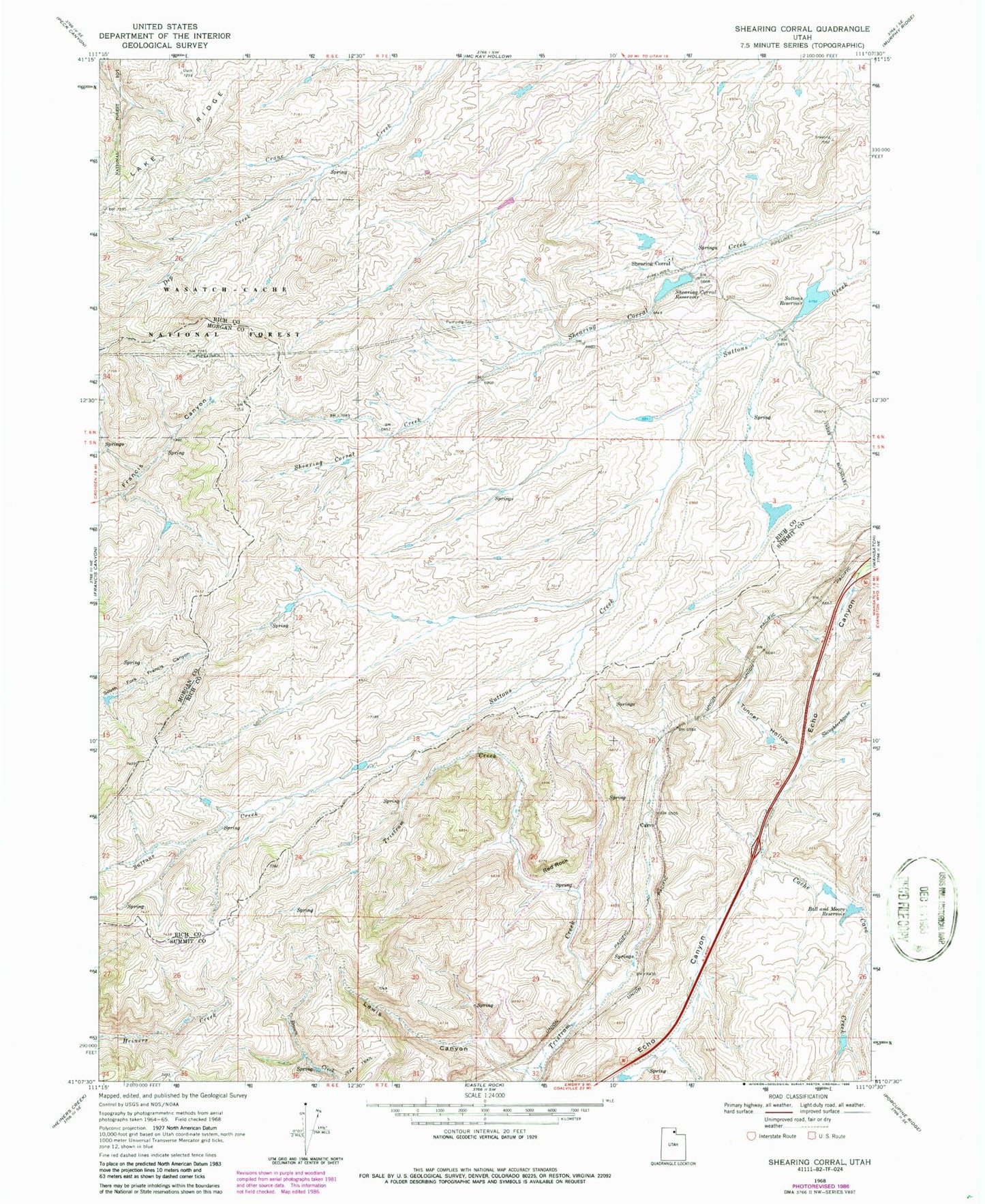
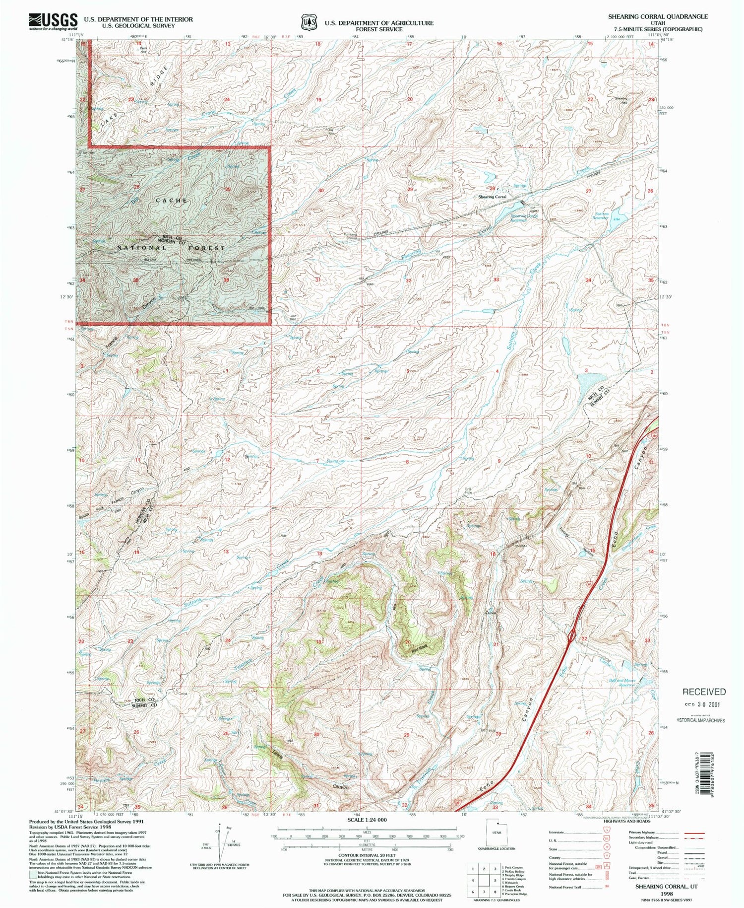
Historical USGS topographic quad map of Shearing Corral in the state of Utah. Map scale may vary for some years, but is generally around 1:24,000. Print size is approximately 24" x 27"
This quadrangle is in the following counties: Morgan, Rich, Summit.
The map contains contour lines, roads, rivers, towns, and lakes. Printed on high-quality waterproof paper with UV fade-resistant inks, and shipped rolled.
Contains the following named places: Ball and Moore Reservoir, Cache Cave Creek, Curvo, Dip Creek, Heiners Springs, Lake Ridge, Lewis Canyon, Red Rock, Shearing Corral, Shearing Corral Reservoir, Slaughterhouse Creek, Suttons Reservoir, Tunnel Hollow