MyTopo
Classic USGS Sheeks Texas 7.5'x7.5' Topo Map
Couldn't load pickup availability
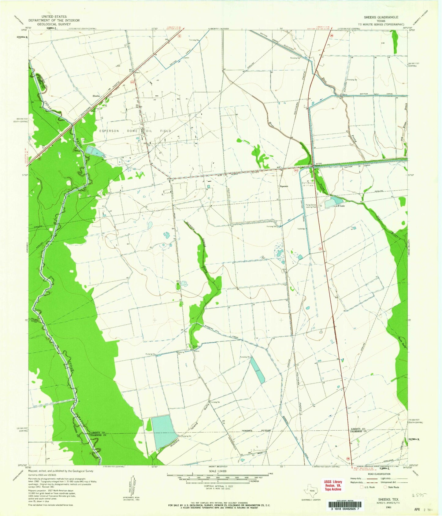
Historical USGS topographic quad map of Sheeks in the state of Texas. Map scale may vary for some years, but is generally around 1:24,000. Print size is approximately 24" x 27"
This quadrangle is in the following counties: Chambers, Harris, Liberty.
The map contains contour lines, roads, rivers, towns, and lakes. Printed on high-quality waterproof paper with UV fade-resistant inks, and shipped rolled.
Contains the following named places: Barbers Hill High School Baseball Field, Barbers Hill High School Stadium, Big Ditch, Cedar Bayou Lake, Cedar Bayou Lake Dam, Dayton Canal, Dayton Canal Company Dam, Dayton Canal Company Lake, East Prong Old River, Esperson, Esperson Dome Oil Field, Four-H Lake, Gum Bayou Oil Field, Gum Island Airport, J M Frost III Reservoir Number 3, J M Frost III Reservoir Number 3 Levee, J M Frost Reservoir Number 2, J M Frost Reservoir Number 2 Levee, KTRH-AM (Houston), Old River Drain, Red Bud Lake, Red Bud Lake Dam, Sheeks, W Scott Frost Reservoir Number 1, W Scott Frost Reservoir Number 1 Levee, West Prong Old River