MyTopo
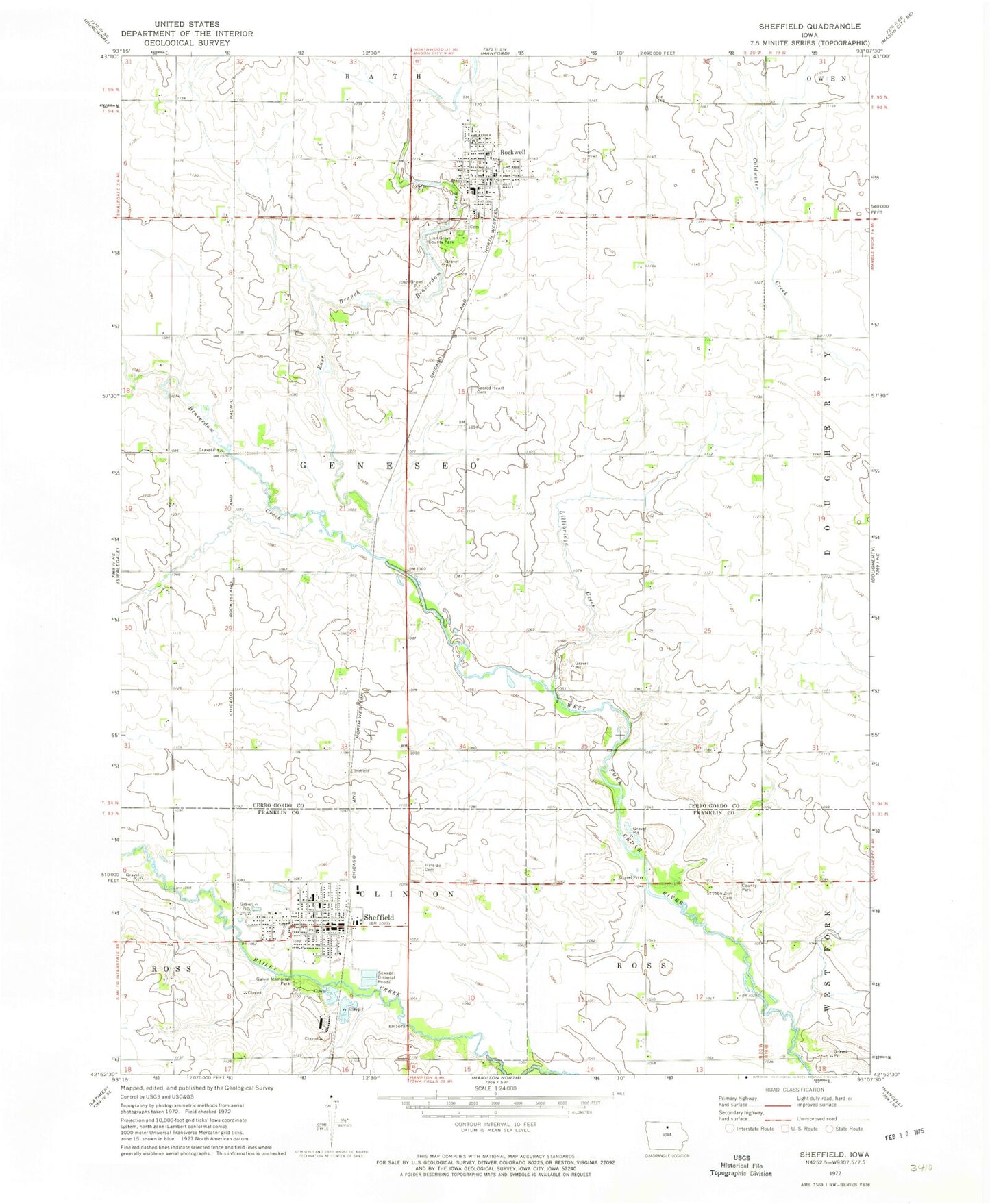
Classic USGS Sheffield Iowa 7.5'x7.5' Topo Map
Couldn't load pickup availability
Historical USGS topographic quad map of Sheffield in the state of Iowa. Map scale may vary for some years, but is generally around 1:24,000. Print size is approximately 24" x 27"
This quadrangle is in the following counties: Cerro Gordo, Franklin.
The map contains contour lines, roads, rivers, towns, and lakes. Printed on high-quality waterproof paper with UV fade-resistant inks, and shipped rolled.
Contains the following named places: Africa and North American Wildlife Museum, Beaverdam Creek, City of Rockwell, City of Sheffield, East Branch Beaverdam Creek, Edgington Grain Elevator, First Baptist Church, First United Methodist Church, Galvin Memorial Park, Grace Baptist Church, Hillside Cemetery, Lillibridge Creek, Linn Grove Country Club, Linn Grove County Park, Mercy Family Care Center - Sheffield, Rockwell, Rockwell - Swaledale Emergency Medical Services, Rockwell Cemetery, Rockwell City Hall, Rockwell Community Nursing Home, Rockwell Dental Clinic, Rockwell Fire Department, Rockwell Police Department, Rockwell Post Office, Rockwell Public Library, Sacred Heart Cemetery, Sacred Heart Parish, Saint John Lutheran Church, Saint John Zion Cemetery, Saint Peter Lutheran Church, Sheffield, Sheffield Care Center, Sheffield Emergency Medical Services, Sheffield Farmers Co-op Elevator, Sheffield Fire Department, Sheffield Police Department, Sheffield Post Office, Sheffield Public Library, Township of Geneseo, Ubben Quarry, United Methodist Church, West Branch Beaverdam Creek, West Fork Elementary School - Rockwell, West Fork Elementary School - Sheffield, West Fork High School, West Fork Middle School, Zion United Methodist Church, ZIP Codes: 50469, 50475