MyTopo
Classic USGS Shelbina Missouri 7.5'x7.5' Topo Map
Couldn't load pickup availability
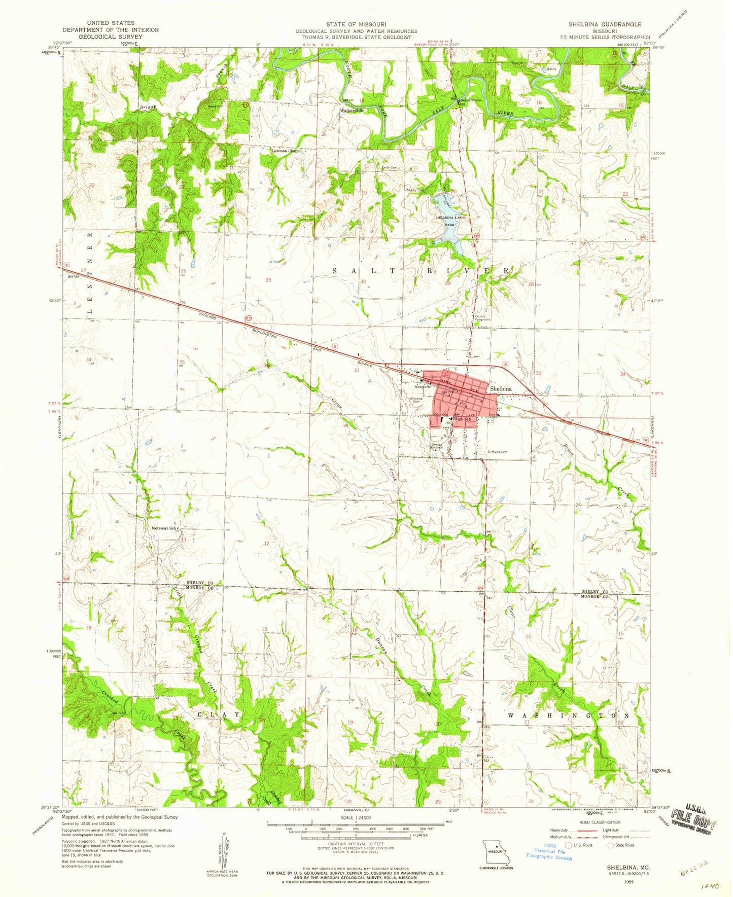
Historical USGS topographic quad map of Shelbina in the state of Missouri. Map scale may vary for some years, but is generally around 1:24,000. Print size is approximately 24" x 27"
This quadrangle is in the following counties: Monroe, Shelby.
The map contains contour lines, roads, rivers, towns, and lakes. Printed on high-quality waterproof paper with UV fade-resistant inks, and shipped rolled.
Contains the following named places: City of Shelbina, Combs School, Gurdane School, Hale Branch, Little Crooked Creek, Lowman Chapel, Moreman School, Prairie School, Ridge School, Saint Marys Catholic Church, Saint Marys Cemetery, Salt River Bridge, Shelbina, Shelbina Cemetery, Shelbina City Police Department, Shelbina Fire Protection District, Shelbina Lake, Shelbina Lake Dam, Shelbina Lake Park, Shelbina Post Office, Smith Cemetery, Township of Salt River, Walkers Mill, Walkersville, Walkersville School, West School, Wood Cemetery, ZIP Code: 63468