MyTopo
Classic USGS Shelburn Indiana 7.5'x7.5' Topo Map
Couldn't load pickup availability
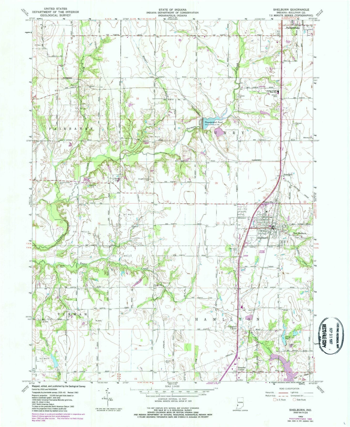
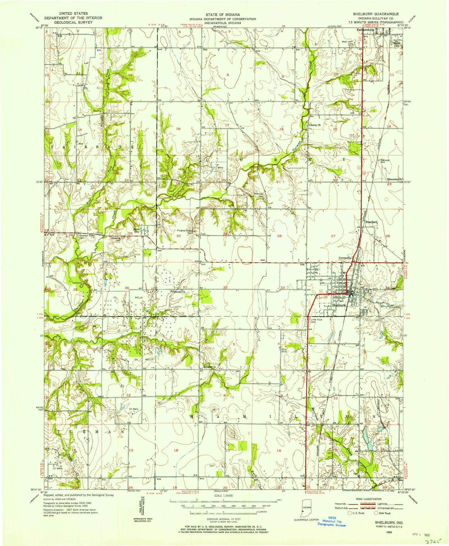
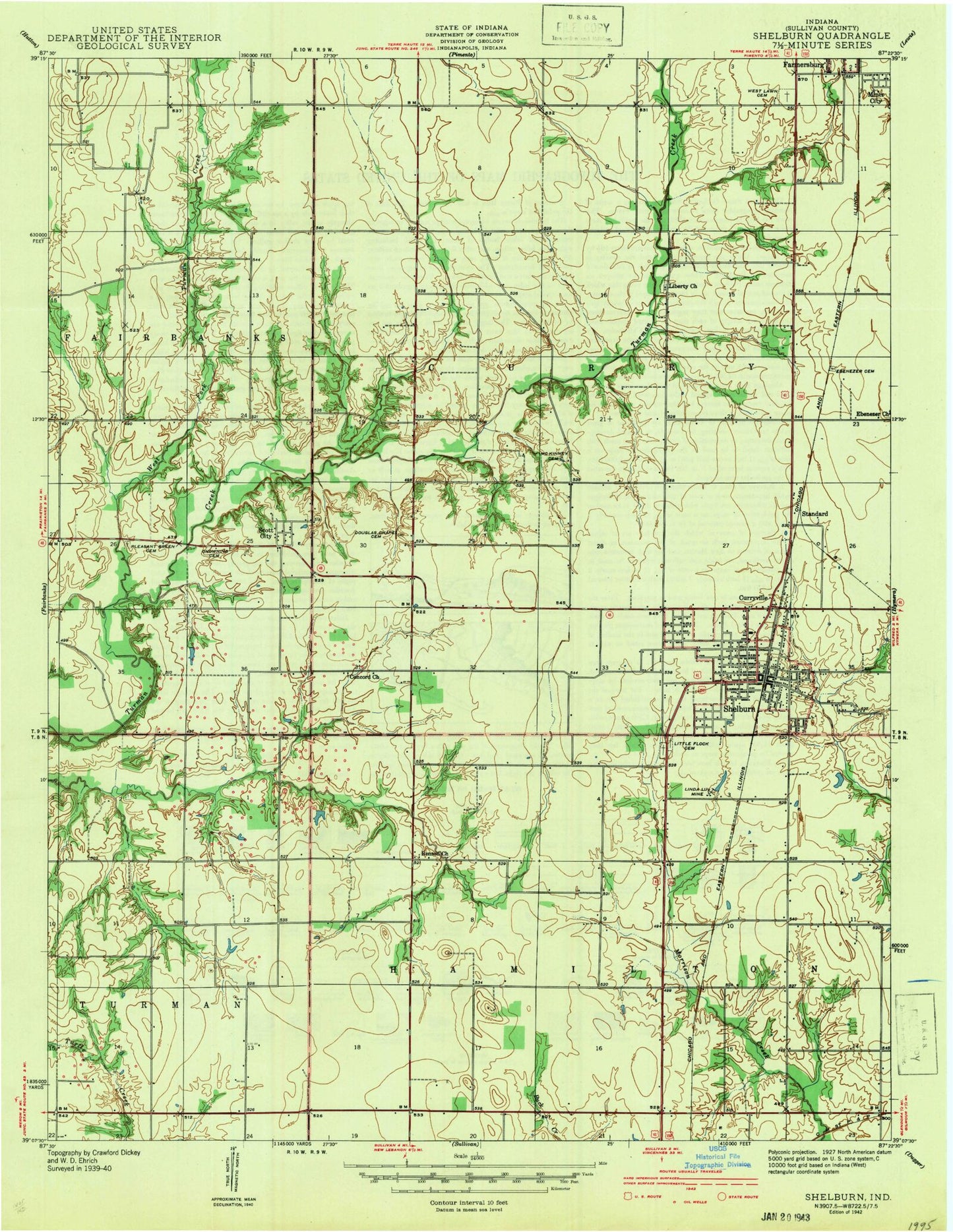
Historical USGS topographic quad map of Shelburn in the state of Indiana. Map scale may vary for some years, but is generally around 1:24,000. Print size is approximately 24" x 27"
This quadrangle is in the following counties: Sullivan.
The map contains contour lines, roads, rivers, towns, and lakes. Printed on high-quality waterproof paper with UV fade-resistant inks, and shipped rolled.
Contains the following named places: Alkire Cemetery, Benefiel Corner, Benson Church, Campbell Corner, Chowning Cemetery, Concord Church, Curry Prairie, Curry Prairie Creek, Curryville, Douglas Chapel Cemetery, Drake Airport, East Shelburn, Ebenezer Cemetery, Ebenezer Church, Farmersburg, Hauger Creek, Jonay Pond, Jonay Pond Dam, Liberty Church, Little Flock Cemetery, Massacre, McKinney Cemetery, Moore Cemetery, North Central High School, Pleasant Green Cemetery, Scott City, Shelburn, Shelburn Elementary School, Shelburn Fire and Rescue Department, Shelburn Post Office, Standard, Sullivan County Community Hospital, Tailings Pond, Thunderbird Fire Protection Territory Station 2 Shelburn, Thunderbird Pond, Town of Shelburn, Township of Curry, Turtle Creek Lake Dam, WBAK-TV (Terre Haute), West Fork Turman Creek, Westlawn Cemetery, WTHI-TV (Terre Haute), WTWO-TV (Terre Haute), ZIP Code: 47879