MyTopo
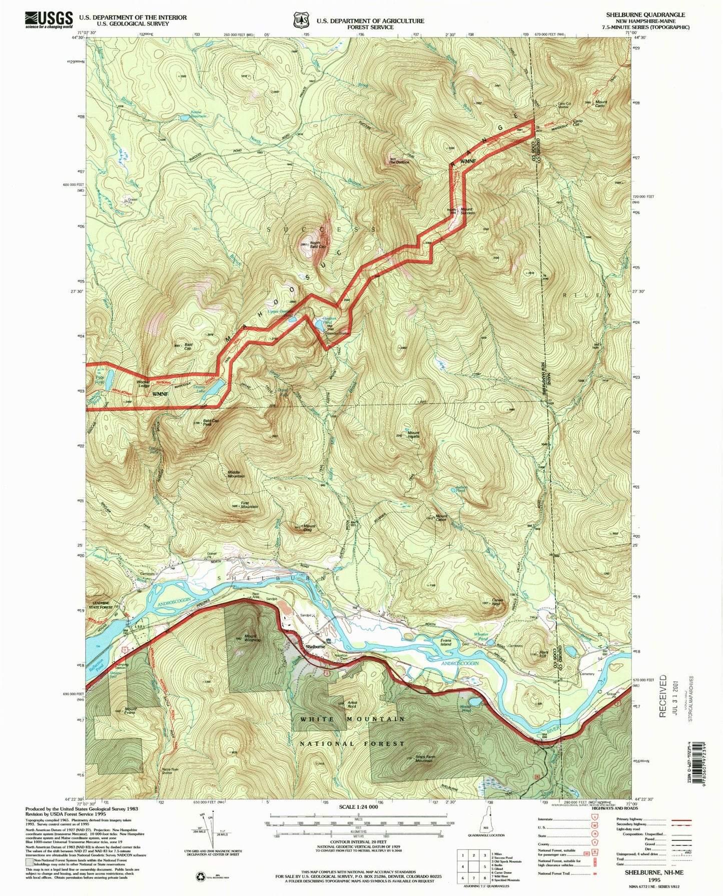
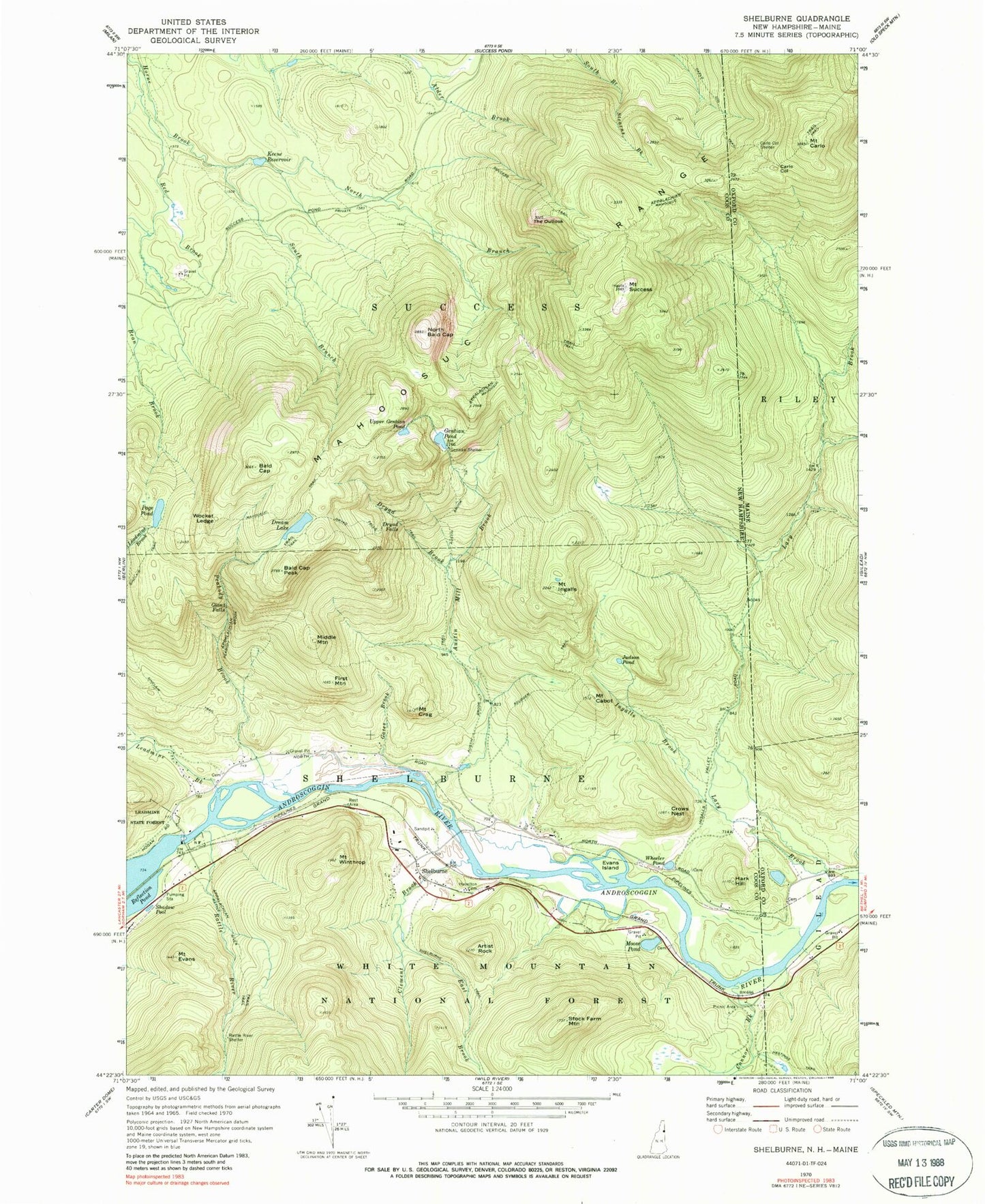
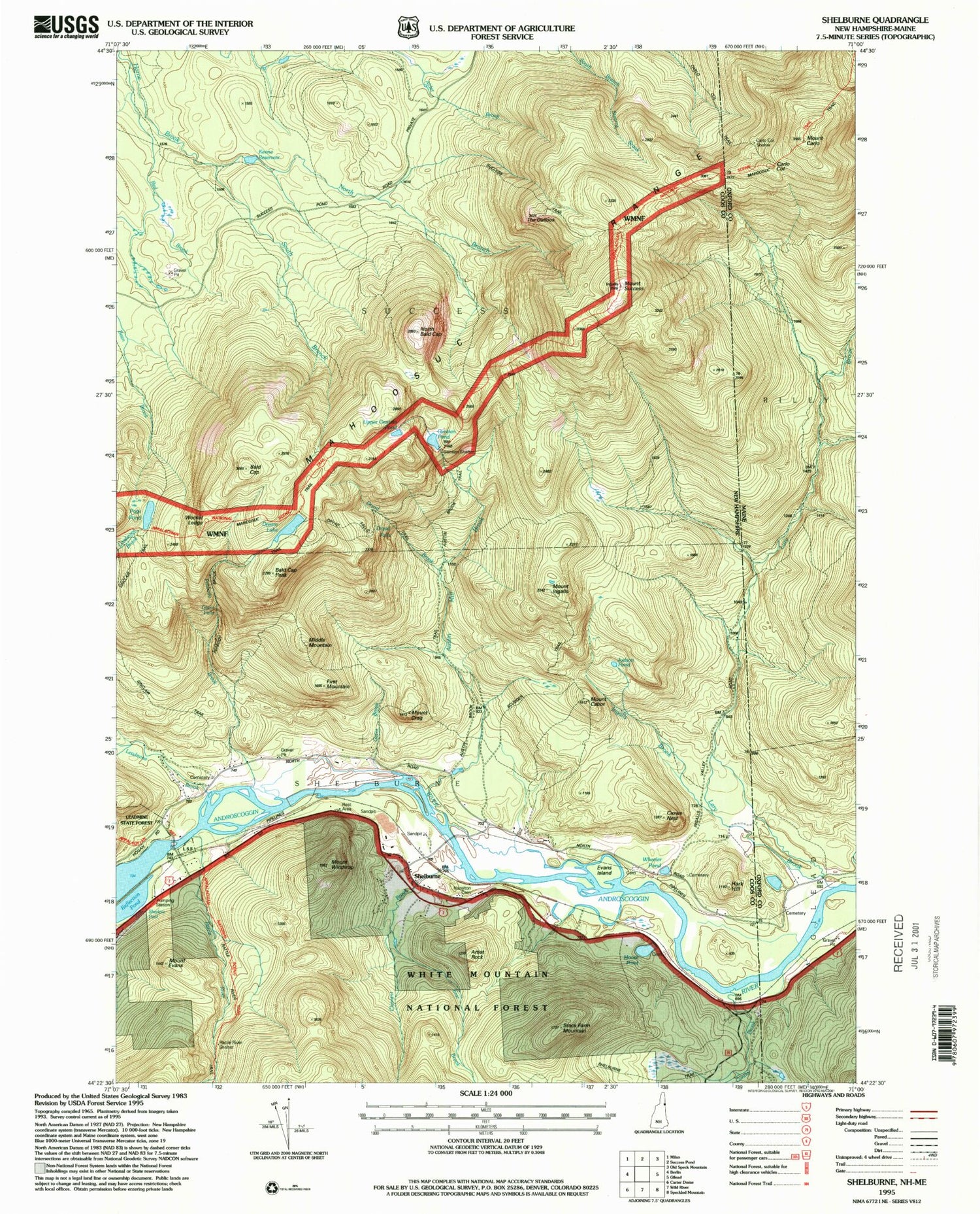
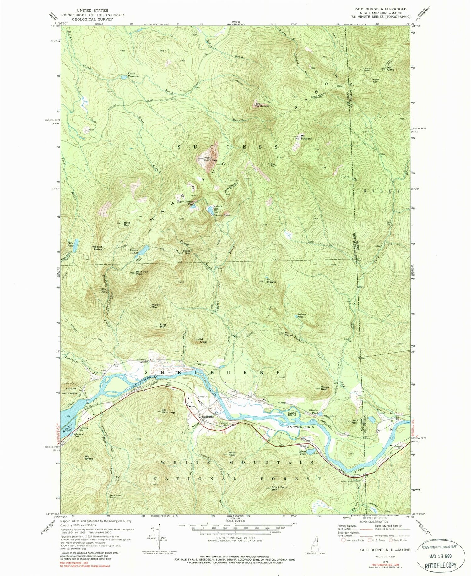
Classic USGS Shelburne New Hampshire 7.5'x7.5' Topo Map
Couldn't load pickup availability
Historical USGS topographic quad map of Shelburne in the states of New Hampshire, Maine. Typical map scale is 1:24,000, but may vary for certain years, if available. Print size: 24" x 27"
This quadrangle is in the following counties: Coos, Oxford.
The map contains contour lines, roads, rivers, towns, and lakes. Printed on high-quality waterproof paper with UV fade-resistant inks, and shipped rolled.
Contains the following named places: Artist Rock, Austin Brook Trail, Austin Mill Brook, Bald Cap, Bald Cap Peak, Carlo Col Trail, Clement Brook, Connor Brook, Mount Crag, Crows Nest, Dream Lake, Dryad Brook, Dryad Falls, Dryad Falls Trail, East Brook, Evans Island, Mount Evans, First Mountain, Gates Brook, Gentian Pond, Gentian Shelter, Giant Falls, Hark Hill, Hastings Trail, Hazelton Cemetery, Ingalls Brook, Mount Ingalls, Judson Pond, Keene Reservoir, Leadmine Brook, Mahoosuc Trail, Middle Mountain, Moose Pond, North Bald Cap, North Branch Horne Brook, Page Pond, Peabody Brook, Peabody Brook Trail, Rattle River, Rattle River Shelter, Red Brook, Reflection Pond, Scudder Trail, Shadow Pool, Shelburne, South Branch Horne Brook, Stock Farm Mountain, Success Trail, Mount Success, The Outlook, Upper Gentian Pond, Wheeler Pond, Mount Winthrop, Wocket Ledge, Town of Shelburne, Shelburne Dam, Androscoggin River Reservoir, Mollywocket Brook Dam, Larry Flume, Nansen Hut, Shelburne Fire Department, Shelburne Emergency Medical Services, Coos County Constable, Carlo Col, Carlo Col Shelter, Carlo Col Trail, Mount Carlo, Lary Brook, Mahoosuc Trail, Township of Riley, Lary Burbank Cemetery