MyTopo
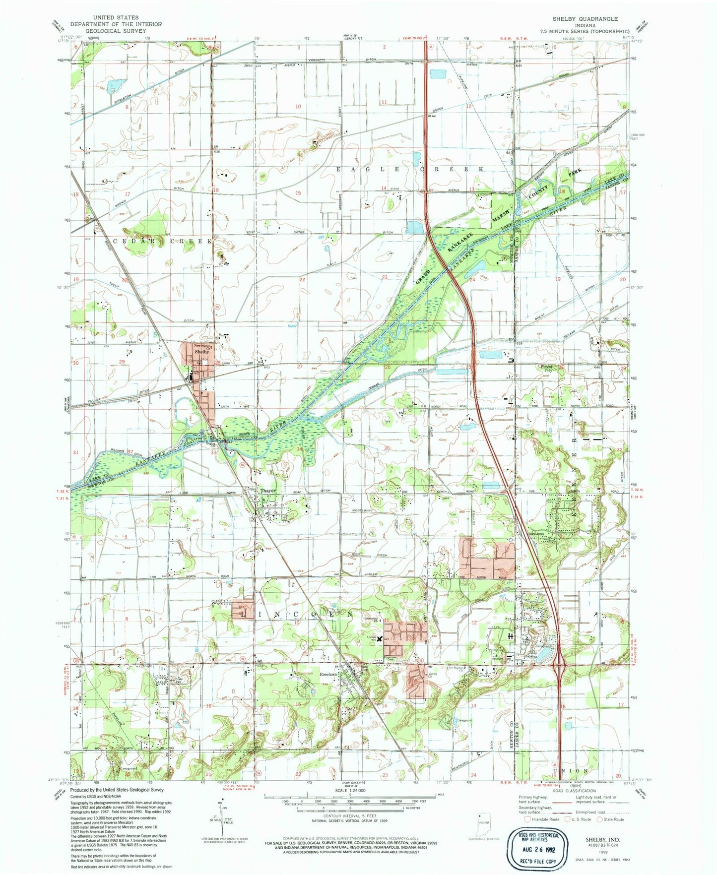
Classic USGS Shelby Indiana 7.5'x7.5' Topo Map
Couldn't load pickup availability
Historical USGS topographic quad map of Shelby in the state of Indiana. Map scale may vary for some years, but is generally around 1:24,000. Print size is approximately 24" x 27"
This quadrangle is in the following counties: Jasper, Lake, Newton.
The map contains contour lines, roads, rivers, towns, and lakes. Printed on high-quality waterproof paper with UV fade-resistant inks, and shipped rolled.
Contains the following named places: Brown Ditch, Community Christian Reformed Church, Defries Ditch, Dehaan Ditch, Dick Drosts Naked City Airport, First Baptist Church, Forest City, Hibler Ditch, Lake Holiday, Lincoln Elementary School, Lincoln Township Volunteer Fire Department, Naked City Airstrip, Newton County Emergency Medical Services - North Base, Otis Ditch, Otis-Boyle Ditch, Rich Ditch, River View Field, Roselawn, Roselawn Cemetery, Roselawn Census Designated Place, Shelby, Shelby Census Designated Place, Shelby Community Park, Shelby Elementary School, Shelby Post Office, Shelby Volunteer Fire Department, Singleton Ditch, Thayer, Township of Lincoln, Tully Ditch, Vannatti Ditch, Victory Baptist Church, Walstra's Greenhouse, Wedelburg Ditch, ZIP Codes: 46377, 46381