
MyTopo
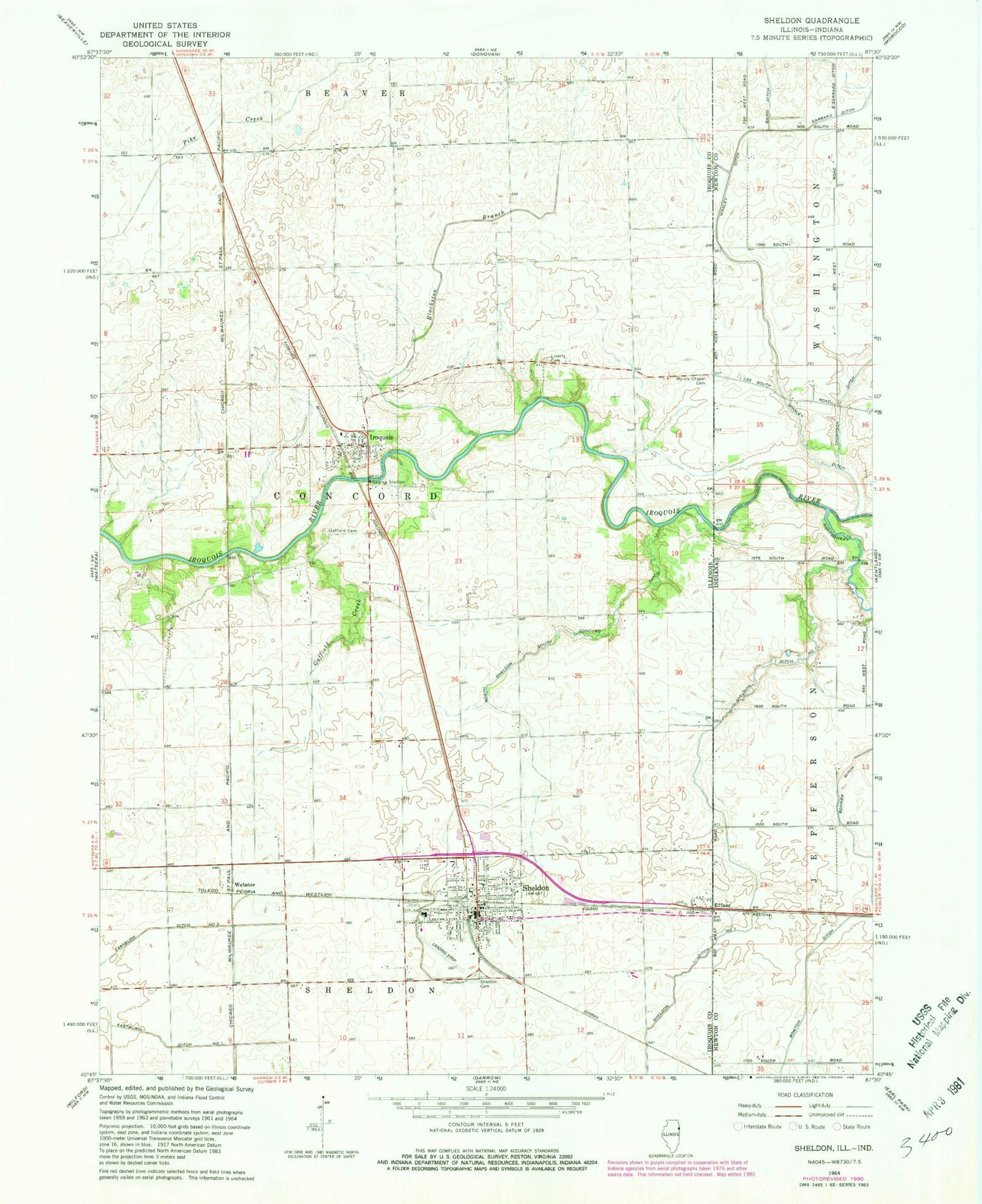
Classic USGS Sheldon Illinois 7.5'x7.5' Topo Map
Couldn't load pickup availability
Historical USGS topographic quad map of Sheldon in the states of Illinois, Indiana. Map scale may vary for some years, but is generally around 1:24,000. Print size is approximately 24" x 27"
This quadrangle is in the following counties: Iroquois, Newton.
The map contains contour lines, roads, rivers, towns, and lakes. Printed on high-quality waterproof paper with UV fade-resistant inks, and shipped rolled.
Contains the following named places: Baird Ditch, Blackston Branch, Bowton Ditch, Clark School, Concord Fire Protection District, Eastburn Ditch Number 1, Eastburn Ditch Number 2, Effner, Gaffield Cemetery, Gaffield Creek, Hesperian School, Iroquois, Iroquois Post Office, Liberty Cemetery, Liberty School, Morris Chapel Cemetery, North Sheldon South Concord Ditch, Rhode Island School, S Garrard Ditch, Sheldon, Sheldon Cemetery, Sheldon District Fire Department, Sheldon Ditch, Sheldon Ditch Number 1, Sheldon Elementary School, Sheldon Emergency Medical Services, Sheldon High School, Sheldon Police Department, Tipton Farms, Township of Concord, Village of Iroquois, Village of Sheldon, Webster, West Union School, Whaley Ditch, Youngs School, Zoomer Field, ZIP Codes: 60945, 60966


