MyTopo
Classic USGS Sheldon South Carolina 7.5'x7.5' Topo Map
Couldn't load pickup availability
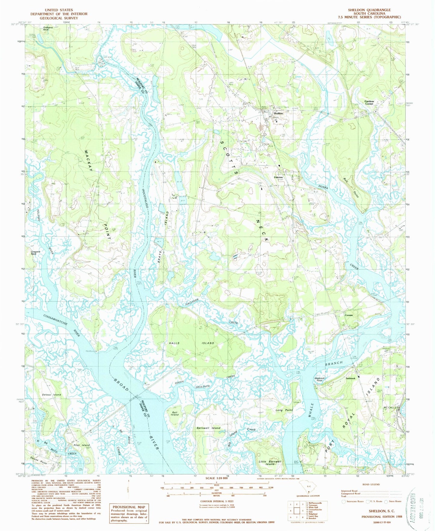
Historical USGS topographic quad map of Sheldon in the state of South Carolina. Typical map scale is 1:24,000, but may vary for certain years, if available. Print size: 24" x 27"
This quadrangle is in the following counties: Beaufort, Jasper.
The map contains contour lines, roads, rivers, towns, and lakes. Printed on high-quality waterproof paper with UV fade-resistant inks, and shipped rolled.
Contains the following named places: Ball Island, Barnwell Island, Brays Island, Bull Point, Deloss Island, Fairview, Huspa Creek, Haulover Creek, Little Barnwell Island, Long Island, Mackay Point, Pilot Island, Pocotaligo River, Scotts Neck, Seabrook, Sheldon, Gregorie Neck, South Haulover Creek, Long Point, Coosaw, Brays Island Plantation, Clarendon Plantation, Field Creek, Huspah Church, Huspah Plantation, Jerusalem School (historical), Oak Grove Plantation, Pages Point, Paige Point School (historical), Prescot School (historical), Seabrook School (historical), Sheldon Church Ruins, Sheldon Lookout Tower, Sheldon School (historical), Tomotley Plantation, Knowles, Mackays Point School (historical), Halls Island, Coosawhatchie River, Gardens Corner, Seabrook Point, Tulifiny River, Sheldon Fire Department Station 40, Town of Yemassee, Seabrook Post Office, Seabrook Census Designated Place, Sheldon Census Designated Place