MyTopo
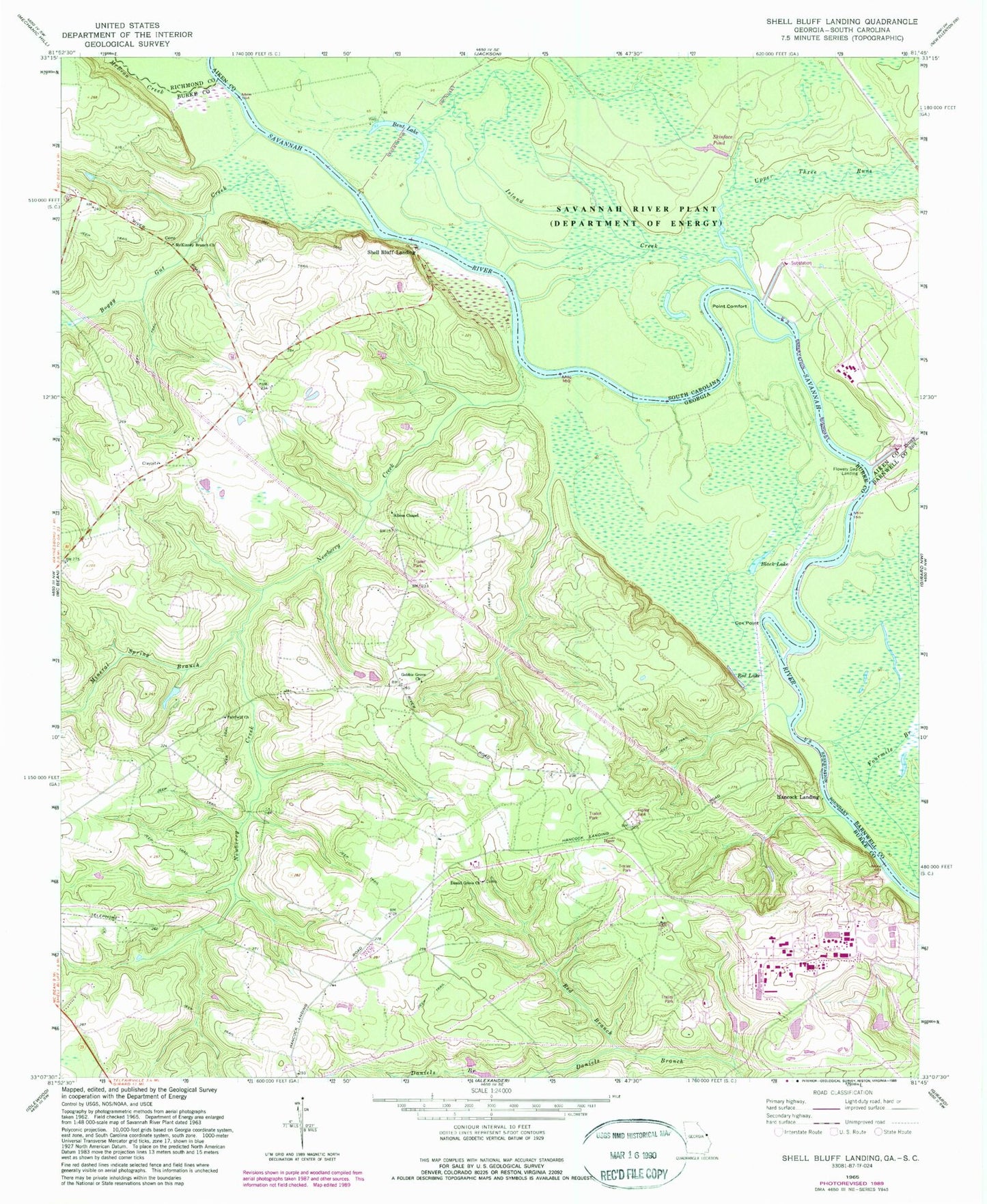
Classic USGS Shell Bluff Landing Georgia 7.5'x7.5' Topo Map
Couldn't load pickup availability
Historical USGS topographic quad map of Shell Bluff Landing in the states of Georgia, South Carolina. Map scale may vary for some years, but is generally around 1:24,000. Print size is approximately 24" x 27"
This quadrangle is in the following counties: Aiken, Barnwell, Burke, Richmond.
The map contains contour lines, roads, rivers, towns, and lakes. Printed on high-quality waterproof paper with UV fade-resistant inks, and shipped rolled.
Contains the following named places: Allens Chapel, Bent Lake, Black Lake, Boggy Gut Creek, Daniel Grove Church, D'Antignac Swamp, Demaries Ferry, Dog Ferry, Dog Ferry Landing, Ellenton, Fairfield Church, Fairfield School, Flowers Point, Flowery Gap Landing, Gobbie Grove Church, Hancock Landing, Island Creek, McBean Creek, McKinney Branch Church, Mineral Spring Branch, Newberry Creek, Point Comfort, Pump House Number 1, Pump House Number 3, Pump House Number 5, Red Branch, Red Lake, Rhodes Air Ranch Airport, Rouse Store, Shell Bluff, Shell Bluff Landing, Skinface Pond, Smiths Pond, Stewart Branch, Upper Three Runs, Vogtle Electric Generating Plant