MyTopo
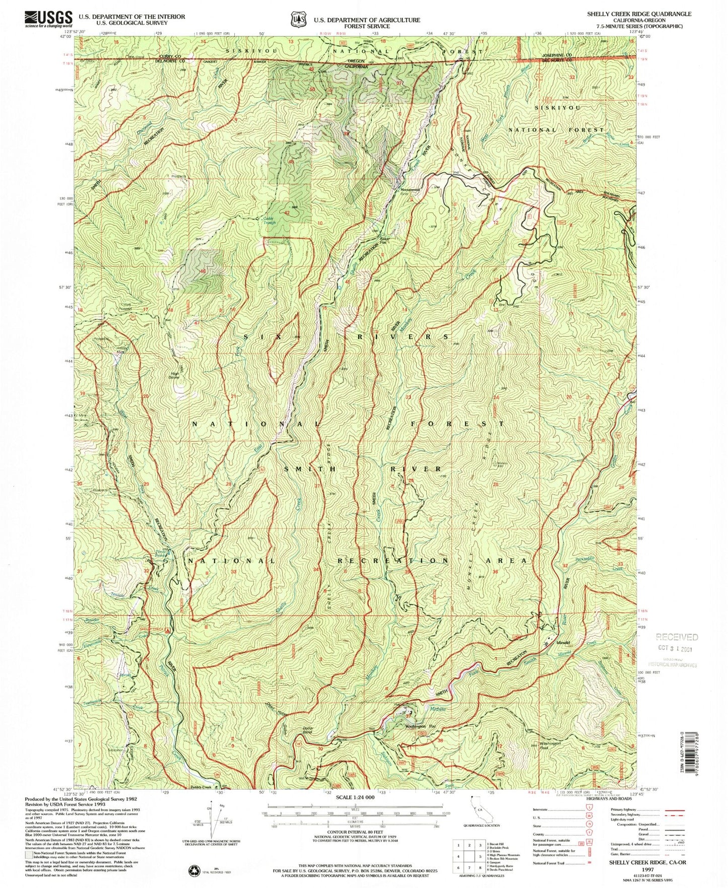
Classic USGS Shelly Creek Ridge California 7.5'x7.5' Topo Map
Couldn't load pickup availability
Historical USGS topographic quad map of Shelly Creek Ridge in the state of California. Map scale may vary for some years, but is generally around 1:24,000. Print size is approximately 24" x 27"
This quadrangle is in the following counties: Curry, Del Norte, Josephine.
The map contains contour lines, roads, rivers, towns, and lakes. Printed on high-quality waterproof paper with UV fade-resistant inks, and shipped rolled.
Contains the following named places: Baker Flat, Blue Rock Mine, Boulder Creek, Cedar Rustic Campground, Cedar Trough, Cedar Trough Camp, Cedar Trough Camp Ground, Continental Mine, Dead Horse Gulch, Dollar Bend, East Fork Patrick Creek, Elevenmile Creek, Griffin Creek, High Dome, Holiday Mine, Horse Flat, Idlewild, Idlewild Creek, Idlewild Resort, Logan Mine, Monkey Creek, Monkey Creek Lookout, Monkey Creek Ridge, Monumental, Old Patrick Creek Station, Packsaddle Creek, Patrick Creek, Patrick Creek Tavern, Richey Mine, Shelly Creek, Shelly Creek Campground, Shelly Creek Ridge, Siskiyou Fork, Stephens Creek, Tenmile Creek, Twelvemile Creek, Washington Flat, Washington Peak, Washington Ranch, West Fork Patrick Creek