
MyTopo
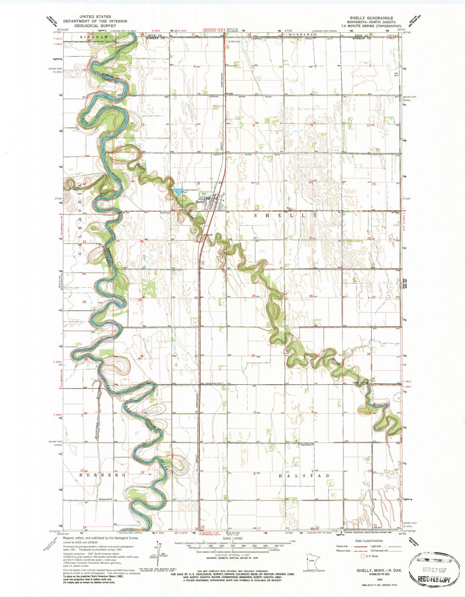
Classic USGS Shelly Minnesota 7.5'x7.5' Topo Map
Couldn't load pickup availability
Historical USGS topographic quad map of Shelly in the states of Minnesota, North Dakota. Map scale may vary for some years, but is generally around 1:24,000. Print size is approximately 24" x 27"
This quadrangle is in the following counties: Norman, Polk, Traill.
The map contains contour lines, roads, rivers, towns, and lakes. Printed on high-quality waterproof paper with UV fade-resistant inks, and shipped rolled.
Contains the following named places: Augustana Cemetery, Augustana Church, City of Shelly, Colenso Post Office, County Ditch Number Three, Goose River, Herberg School, Herberg Town Hall, Judicial Ditch Number Fiftyfour, Judicial Ditch Number Two, Kalmer Post Office, Marsh River, Marsh River Cemetery, Saint Petri Cemetery, Shelly, Shelly Cemetery, Shelly City Hall, Shelly Fire Department, Shelly Lutheran Church, Shelly Post Office, Steenerson Drain, Township of Shelly, Traill County Poor Farm Cemetery, Zion Cemetery, Zion Church, ZIP Code: 56581


