MyTopo
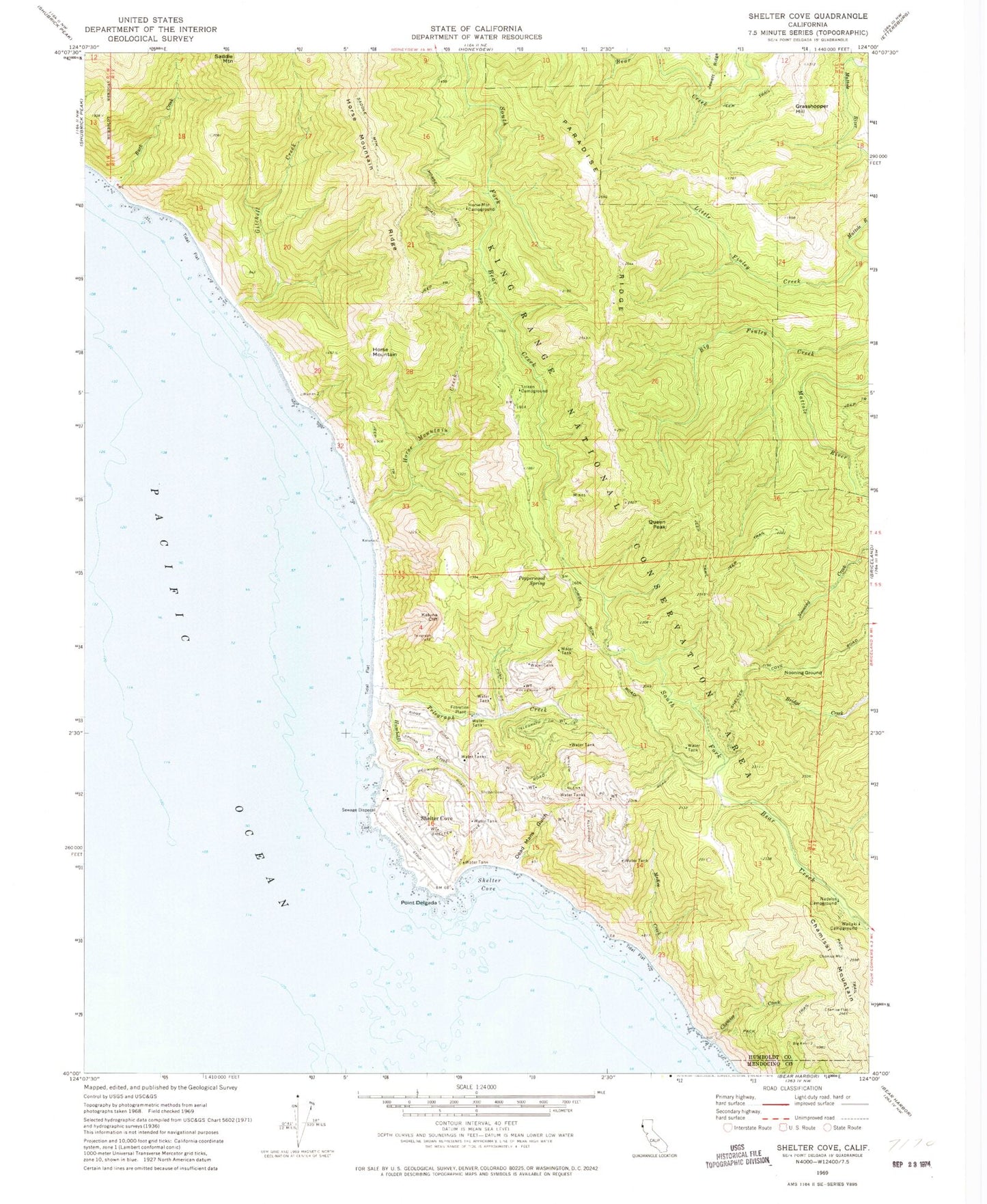
Classic USGS Shelter Cove California 7.5'x7.5' Topo Map
Couldn't load pickup availability
Historical USGS topographic quad map of Shelter Cove in the state of California. Typical map scale is 1:24,000, but may vary for certain years, if available. Print size: 24" x 27"
This quadrangle is in the following counties: Humboldt, Mendocino.
The map contains contour lines, roads, rivers, towns, and lakes. Printed on high-quality waterproof paper with UV fade-resistant inks, and shipped rolled.
Contains the following named places: Big Finley Creek, Buck Creek, Chemise Creek, Dead Mans Gulch, Gitchell Creek, Horse Mountain Campground, Horse Mountain Creek, Horse Mountain Ridge, Humboldt Creek, Kaluna Cliff, Little Finley Creek, McKee Creek, Nadelos Campground, Nooning Ground, Paradise Ridge, Pepperwood Spring, Point Delgada, Shelter Cove, Telegraph Creek, Tolkan Campground, Wailaki Campground, Chamisal Mountain, Shelter Cove Airport, Grasshopper Hill, Horse Mountain, Queen Peak, Shelter Cove, Shelter Cove Census Designated Place, Shelter Cove Volunteer Fire Department, Rocks and Islands Wilderness