MyTopo
Classic USGS Shenandoah Peak Nevada 7.5'x7.5' Topo Map
Couldn't load pickup availability
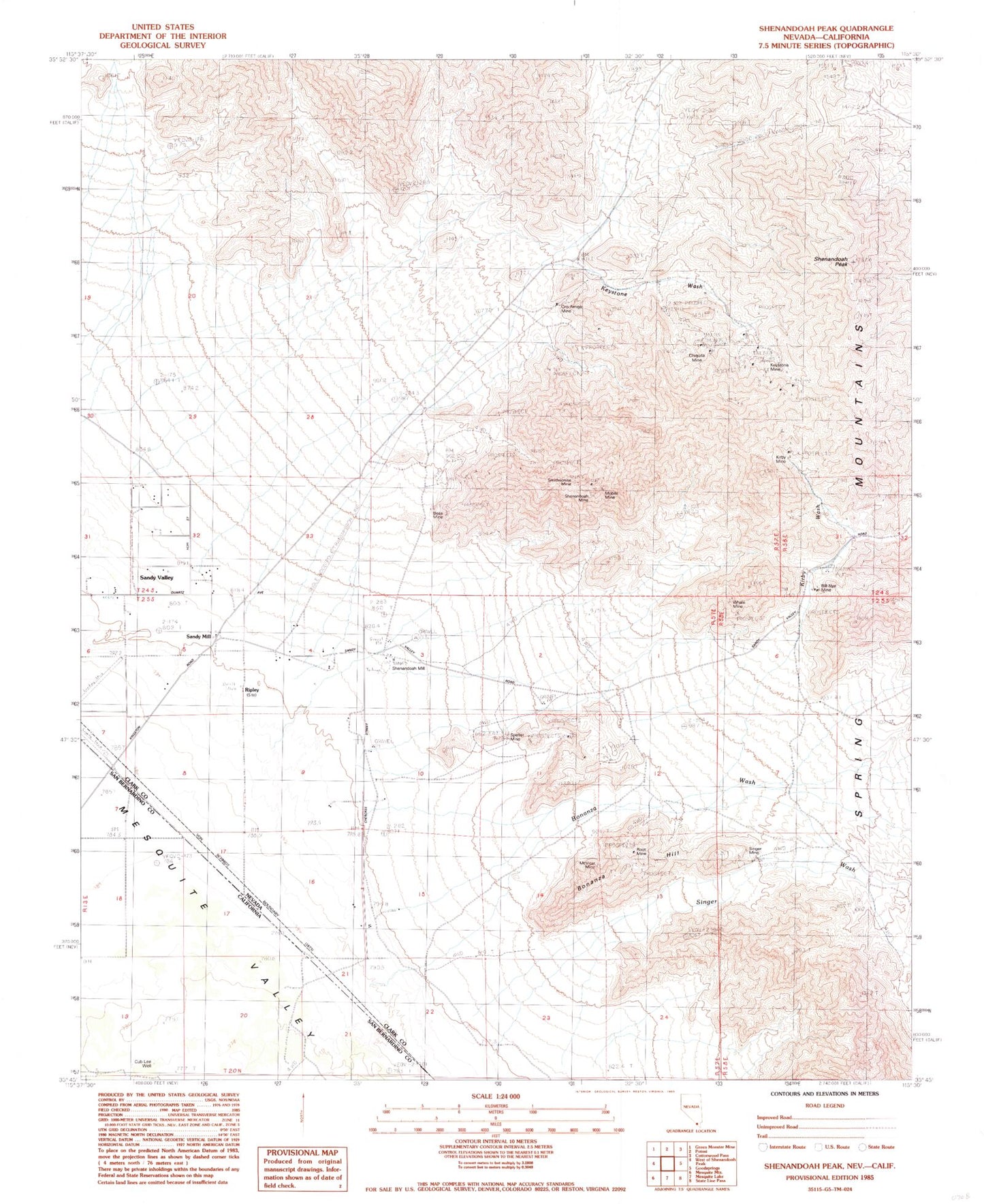
Historical USGS topographic quad map of Shenandoah Peak in the states of Nevada, California. Map scale may vary for some years, but is generally around 1:24,000. Print size is approximately 24" x 27"
This quadrangle is in the following counties: Clark, San Bernardino.
The map contains contour lines, roads, rivers, towns, and lakes. Printed on high-quality waterproof paper with UV fade-resistant inks, and shipped rolled.
Contains the following named places: Akron Mine, Azurite Mine, Bill Nye Mine, Bonanza Hill, Bonanza Wash, Boss Mine, Cairn East of Shenandoah Mine, Chiquita Mine, Clementina Mine, Copper Chief Mine, Copper Flower Mine, Copperside Mine, Cub Lee Well, Galena Wash, Golden Chariot Mine, Goodsprings Mining District, Highline Mine, Hoodoo Mine, Ironside Mine, Keystone Academy, Keystone Mill, Keystone Mine, Keystone Post Office, Keystone Wash, Kirby Mine, Kirby Wash, Lincoln City, McVicar Mine, Mobile Mine, Oro Amigo Mine, Platina, Platina Mine, Platina Post Office, Ragged Peak, Rattler Hill, Ripley, Ripley Post Office, Root Camp, Root Mine, Sandy Mill, Sandy Post Office, Sandy Valley Middle School, Shenandoah Mill, Shenandoah Mine, Shenandoah Peak, Singer Mine, Singer Wash, Smithsonite Mine, Spelter Mine, Sultan Mine, Tiffin Mine, Whale Mine