MyTopo
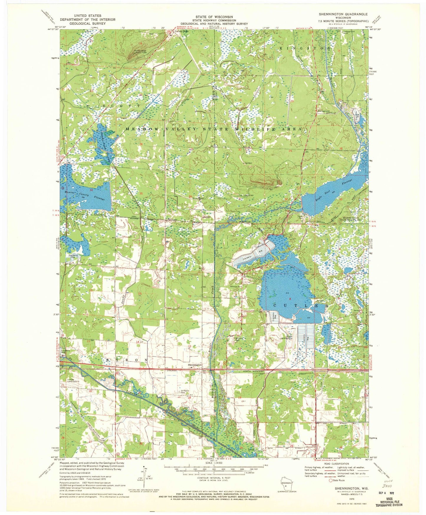
Classic USGS Shennington Wisconsin 7.5'x7.5' Topo Map
Couldn't load pickup availability
Historical USGS topographic quad map of Shennington in the state of Wisconsin. Map scale may vary for some years, but is generally around 1:24,000. Print size is approximately 24" x 27"
This quadrangle is in the following counties: Juneau, Monroe.
The map contains contour lines, roads, rivers, towns, and lakes. Printed on high-quality waterproof paper with UV fade-resistant inks, and shipped rolled.
Contains the following named places: 2 Reservoir, 5 Reservoir, Adventist Church, Beaver Creek, Beaver Creek 2 Dam, Campground Number Four, Cutler Ditch, Cutler Volunteer Fire Company, Dandy Creek, Dandy Creek 6 C6118d6 Dam, Dandy Creek 9 C6118-D9 Dam, Dandy Creek Flowage, Eagle Nest Flowage, East Fork Lemonweir River, Holiday Landing Strip, Mayflower School, Monroe County Flowage, Mud Ditch, Norway Ridge, Norway Ridge Lookout Tower, Potter Landing Strip, Potters Reservoir 2WP 188 Dam, Saint Johns Cemetery, Saint Peters Cemetery, Shennington, Silver Creek, South Fork Lemonweir River, Town of Byron, Town of Cutler, Town of Scott