MyTopo
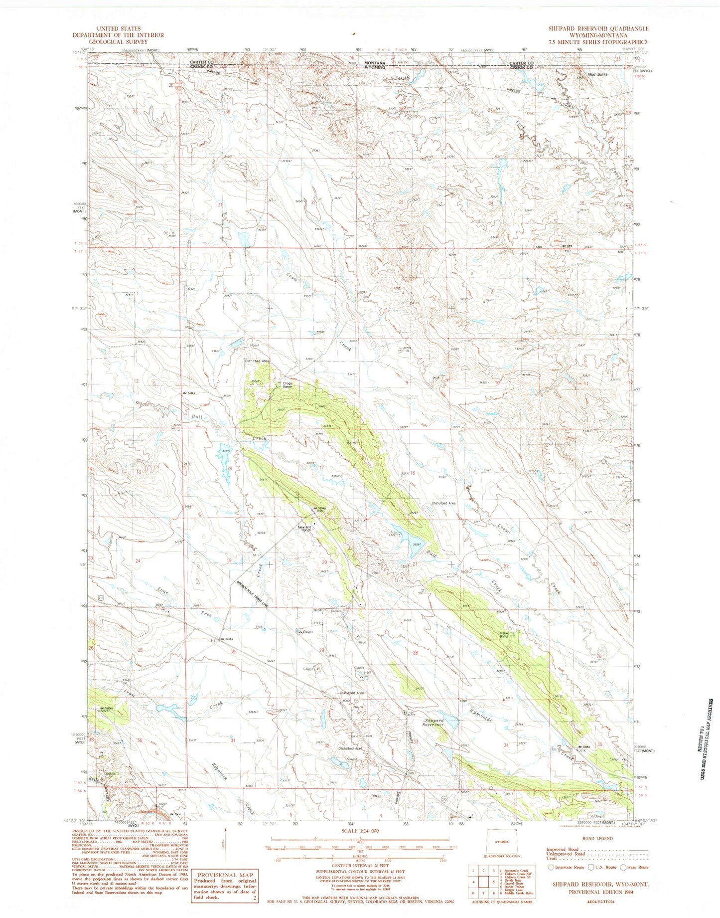
Classic USGS Shepard Reservoir Wyoming 7.5'x7.5' Topo Map
Couldn't load pickup availability
Historical USGS topographic quad map of Shepard Reservoir in the state of Wyoming. Map scale may vary for some years, but is generally around 1:24,000. Print size is approximately 24" x 27"
This quadrangle is in the following counties: Carter, Crook.
The map contains contour lines, roads, rivers, towns, and lakes. Printed on high-quality waterproof paper with UV fade-resistant inks, and shipped rolled.
Contains the following named places: Antelope Hill Dam, Antelope Hill Reservoir, Bull Creek, Bull Creek Dam, Bull Creek Reservoir, Colony Mine, Colony Radar Bomb Scoring Site, Crago Ranch, Crow Creek Dam, Crow Creek Mine, Crow Creek Reservoir, King Dam, King Reservoir, Lone Tree Creek, Lone Tree Dam, Lone Tree Reservoir, Mud Butte, Newland Ranch, Raber Ranch, Shepard Reservoir, South Fork Owl Creek, Strawberry Hill Dam, Strawberry Hill Reservoir