MyTopo
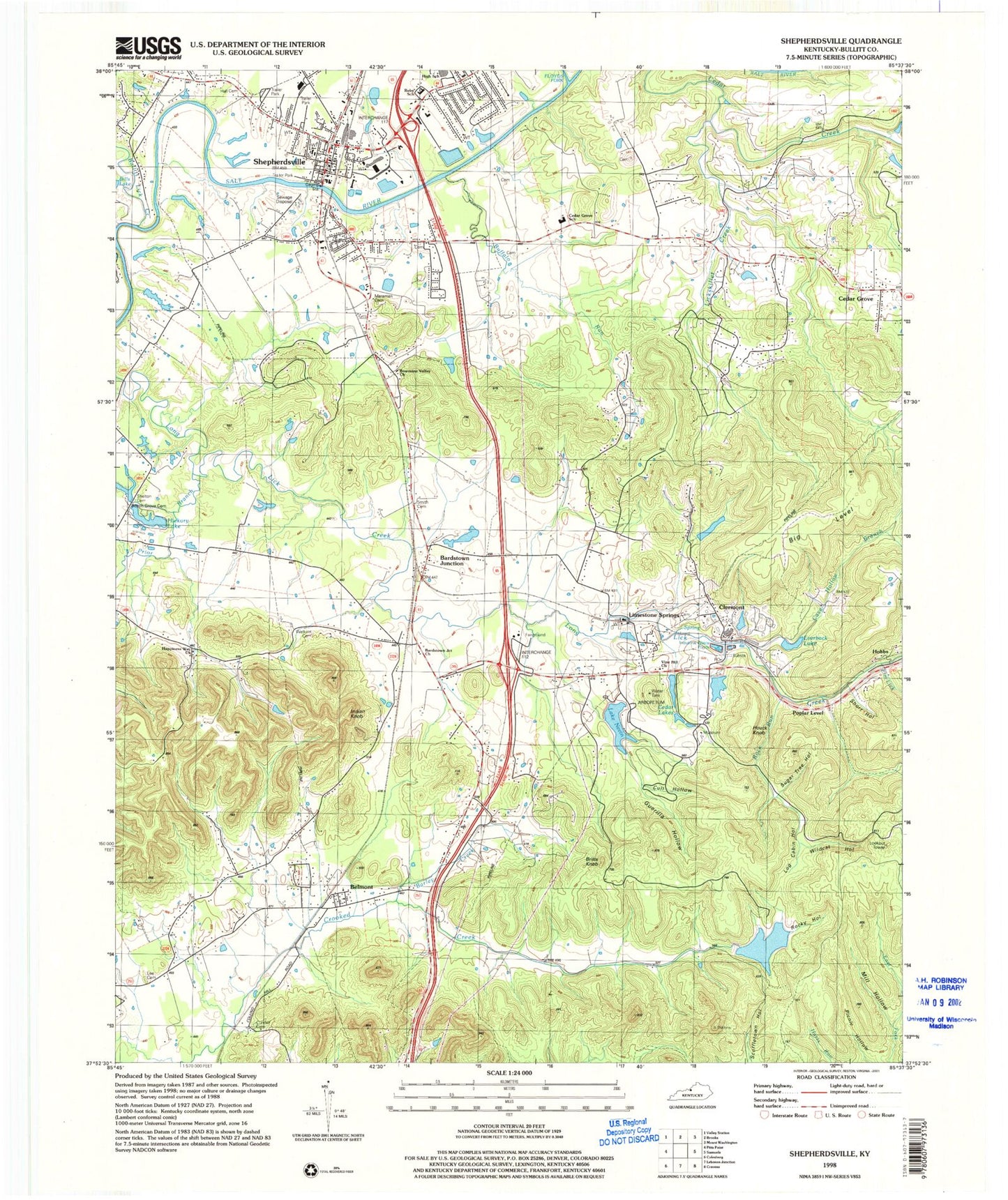
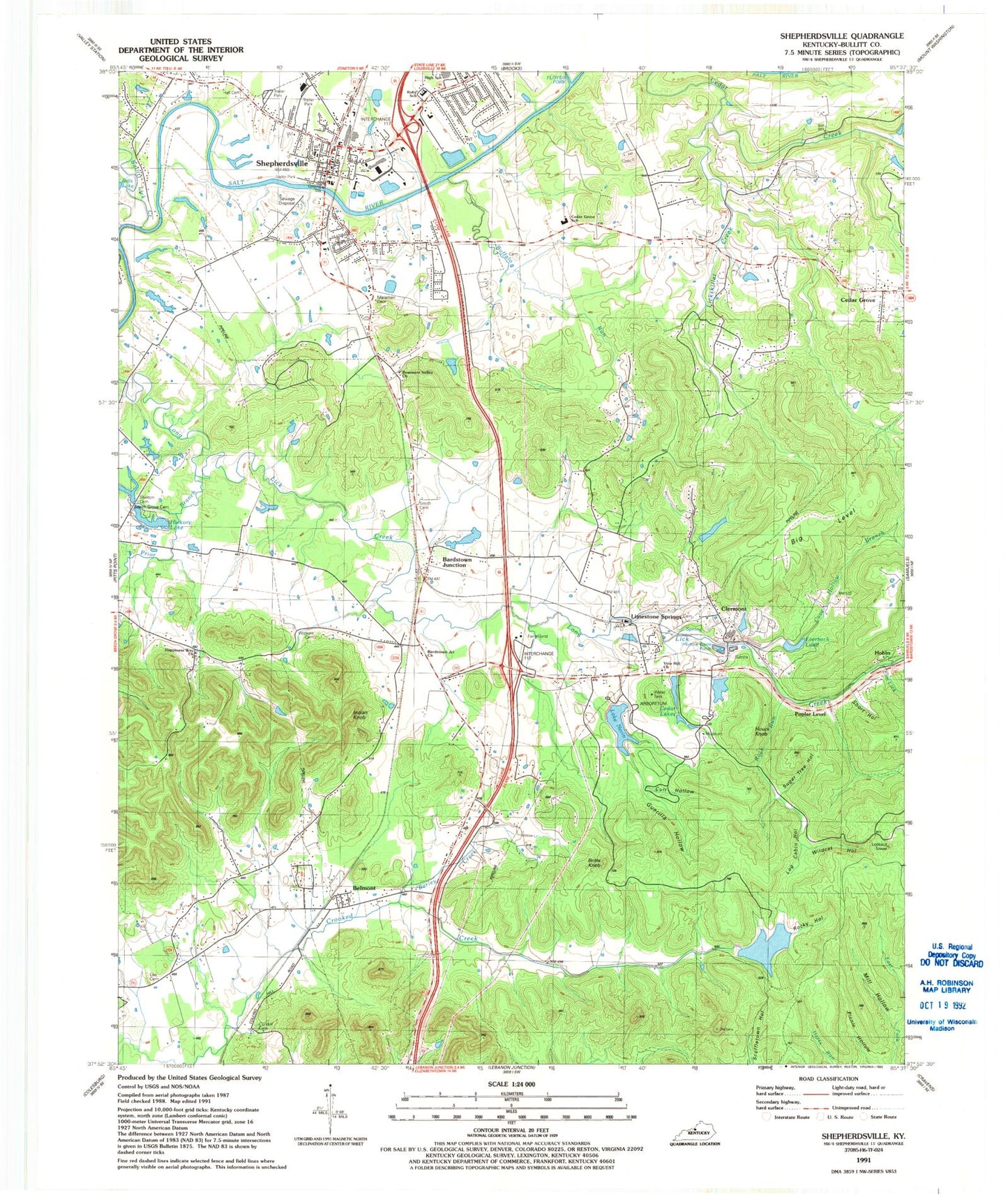
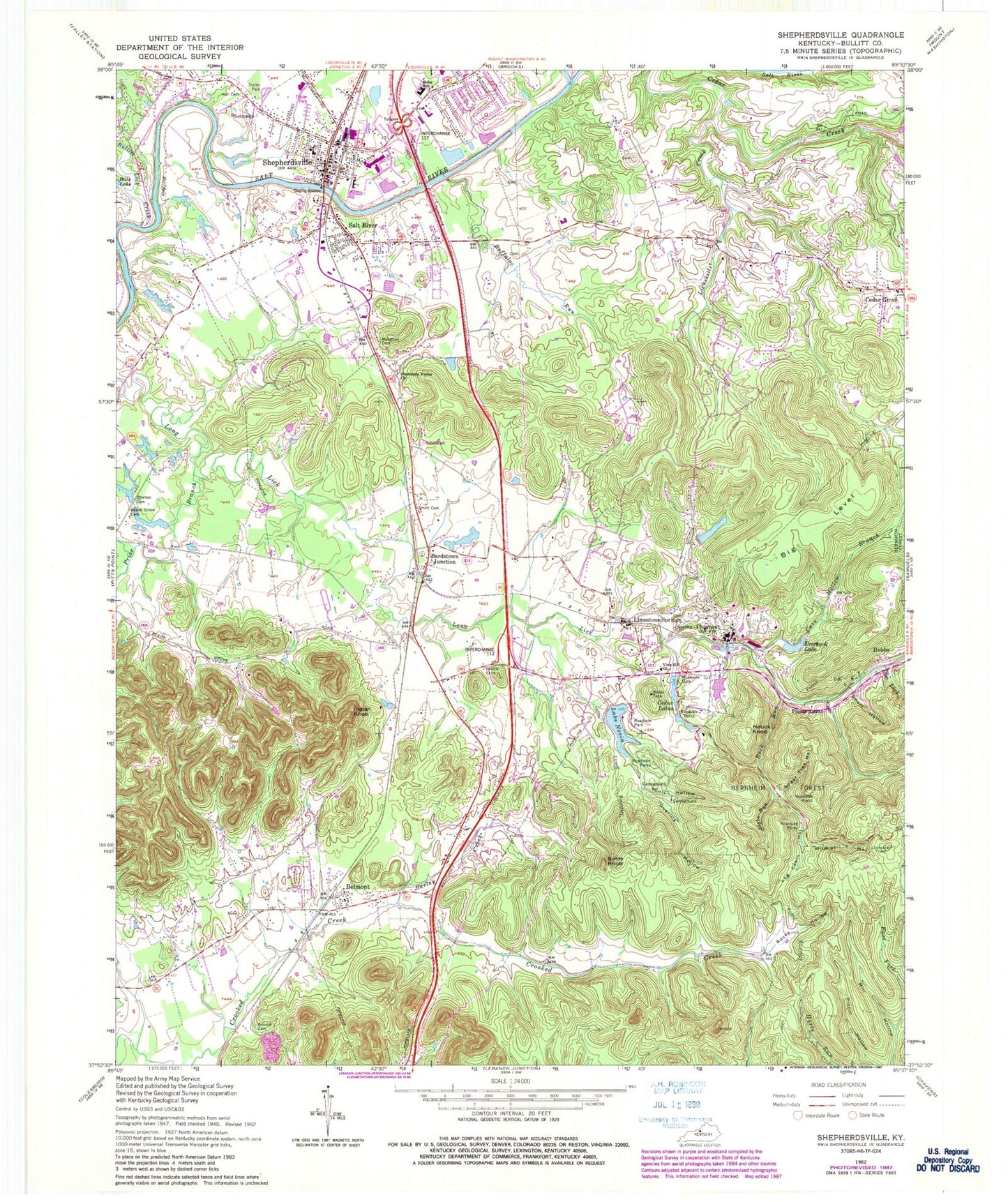
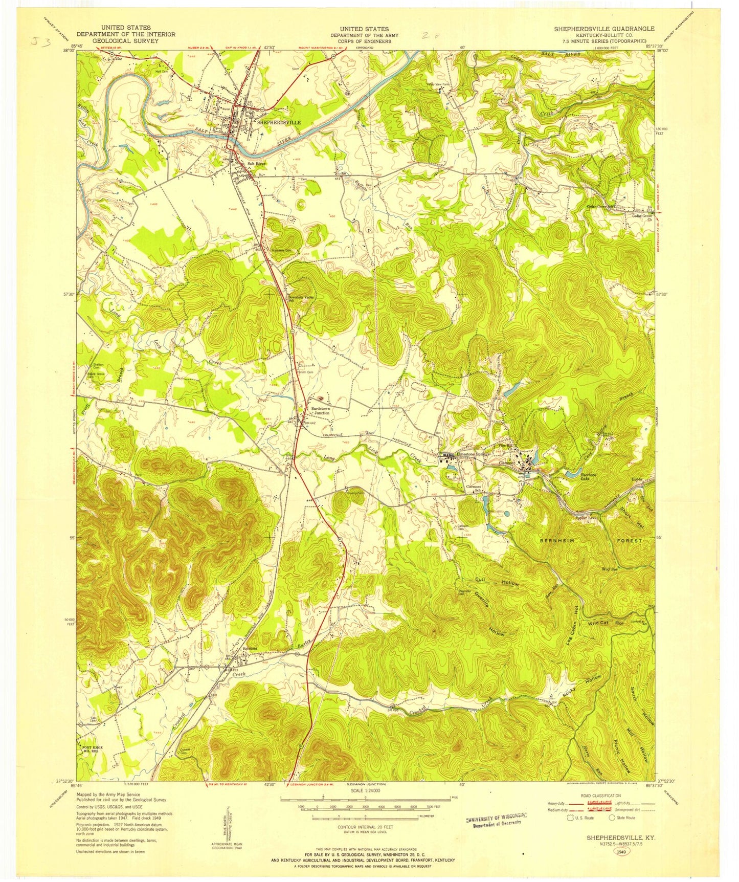
Classic USGS Shepherdsville Kentucky 7.5'x7.5' Topo Map
Couldn't load pickup availability
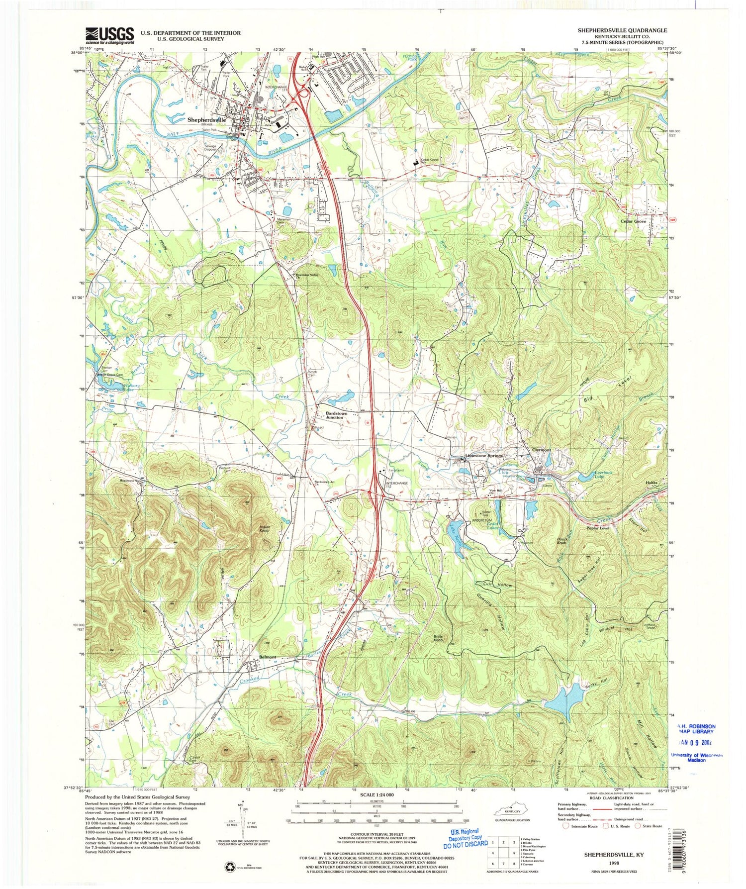
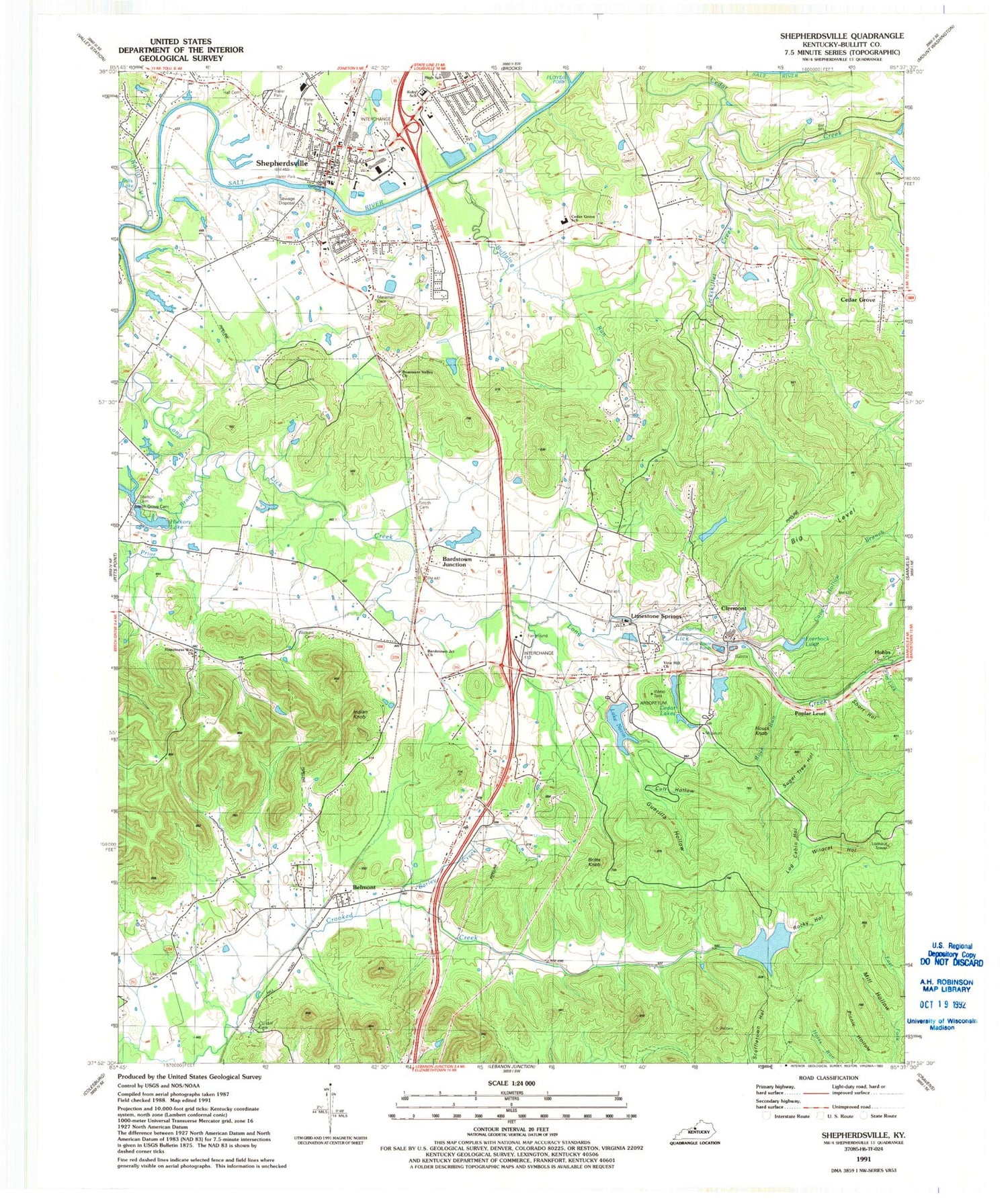
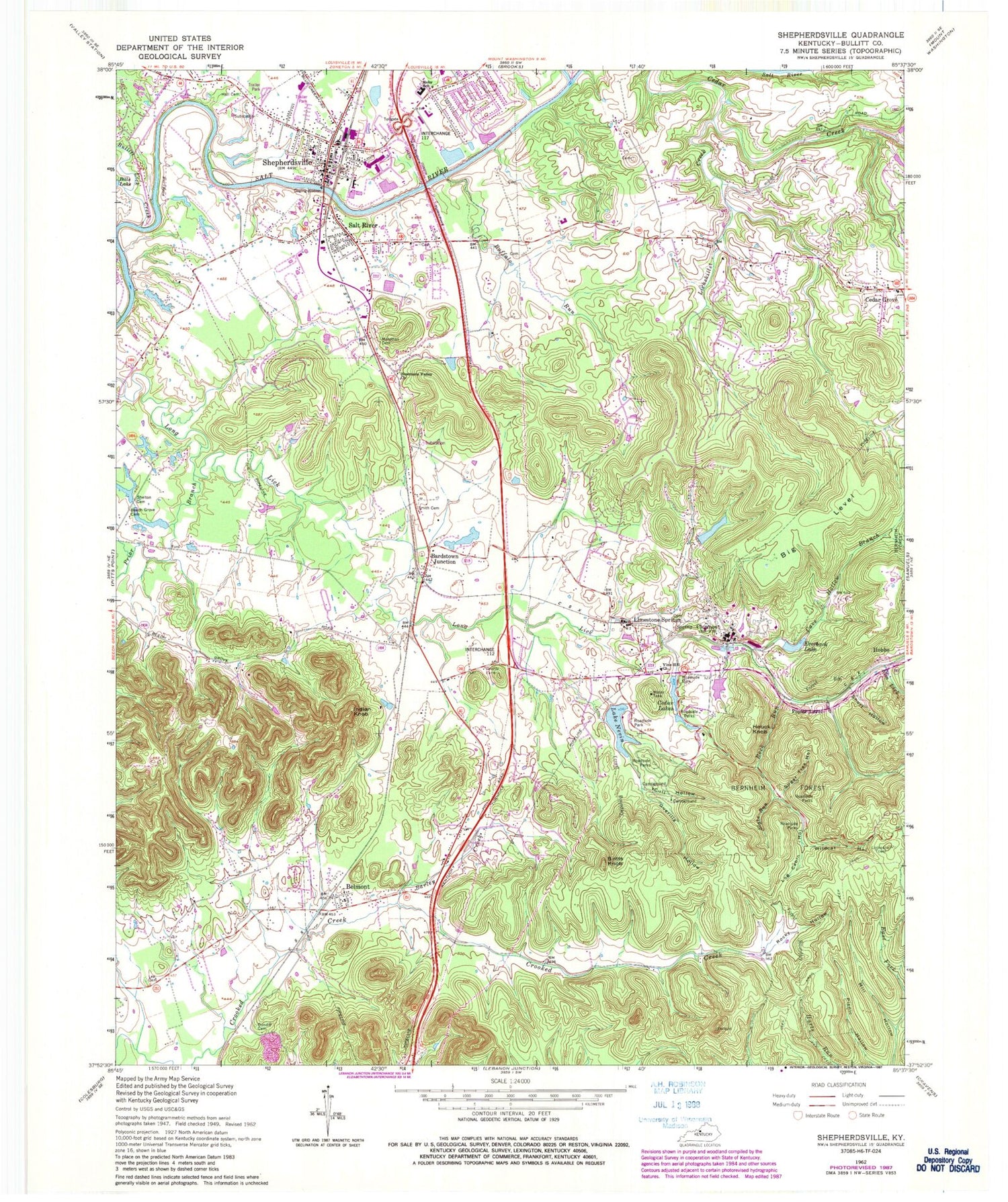
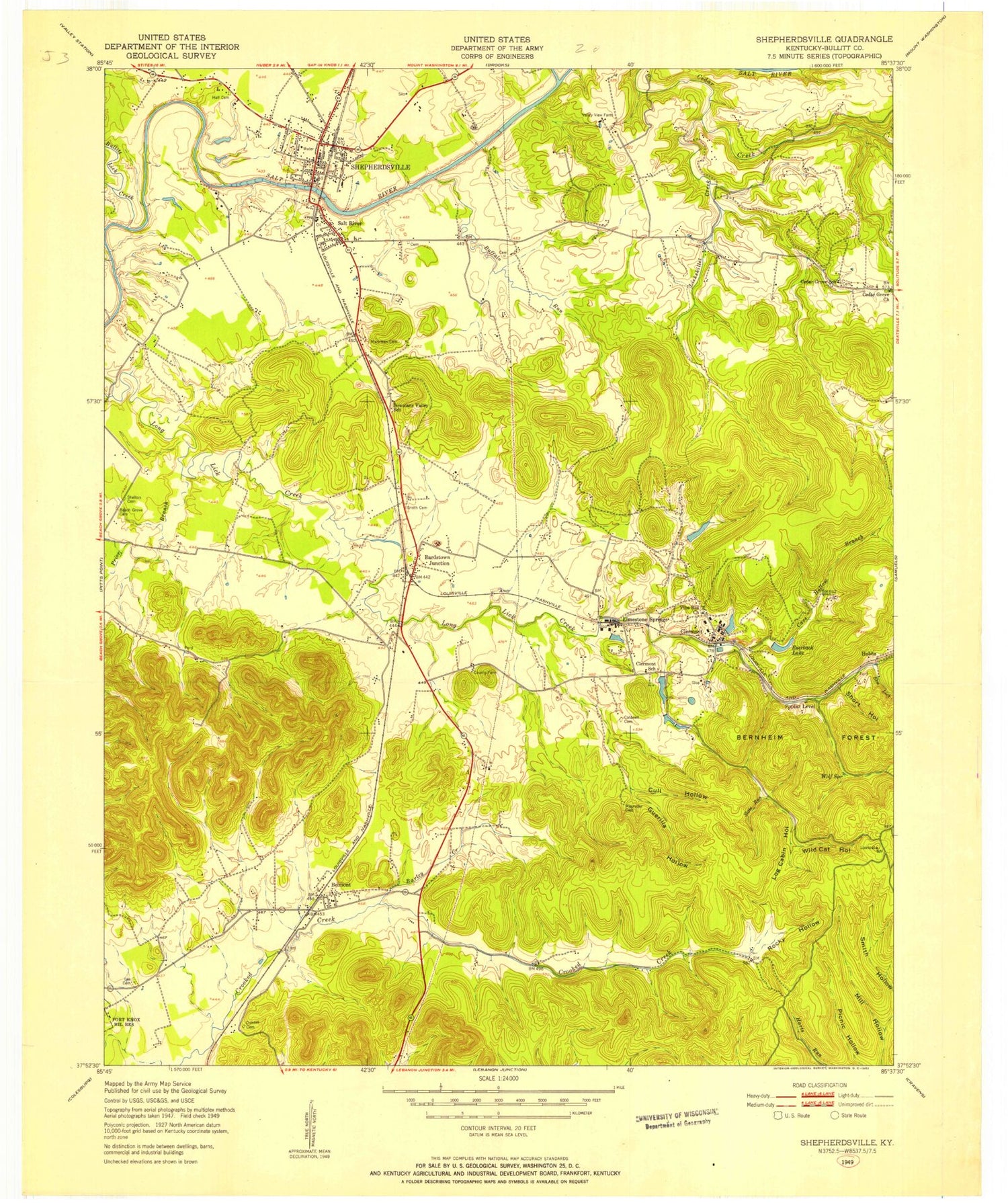
Historical USGS topographic quad map of Shepherdsville in the state of Kentucky. Typical map scale is 1:24,000, but may vary for certain years, if available. Print size: 24" x 27"
This quadrangle is in the following counties: Bullitt.
The map contains contour lines, roads, rivers, towns, and lakes. Printed on high-quality waterproof paper with UV fade-resistant inks, and shipped rolled.
Contains the following named places: Bardstown Junction, Barley Creek, Beech Grove Cemetery, Belmont, Knobs State Forest and Wildlife Management Area, Big Level, Bowmans Valley Church, Britts Knob, Buffalo Run, Bullitt Lick Creek, Cave Hollow Branch, Cedar Lakes, Clermont, Cull Hollow, Cundiff Cemetery, Elm Lick, Everback Lake, Floyds Fork, Guerilla Hollow, Hall Cemetery, Houck Knob, Indian Knob, Lee Cemetery, Lickskillet Creek, Log Cabin Hollow, Maraman Cemetery, Mill Hollow, Lake Nevin, Prior Branch, Roby School, Rock Run, Rocky Hollow, Salt River, Shelton Cemetery, Shepherdsville, Short Hollow, Slate Run, Smith Cemetery, Sugar Tree Hollow, Vine Hill Church, Wildcat Hollow, Cedar Grove, Hobbs, Limestone Springs, Poplar Level, Bullitt County, Bardstown Junction Post Office (historical), Lebanon Junction Division, City of Shepherdsville, Shady Acres Airport, Shepherdsville Wastewater Treatment Plant, Bernheim Middle School, Bullitt Central High School, Cedar Grove Elementary School, Zoneton Middle School, Southeast Bullitt Fire Department, Southeast Bullitt Fire and Rescue Department, Southeast Bullitt Fire and Rescue, Shepherdsville Fire Department Station 2, Bullitt County Emergency Medical Services, Lick Skillet (historical), Oak Grove, Old Belmont (historical), Wolf Spring (historical), Fort De Wolf Historical Marker, Alexander Scott Bullitt Historical Marker, Louisville and Nashville Bridge Historical Marker, John Hunt Morgans Raid Historical Marker, Salt River Furnace Historical Marker, Bullitt County Sheriff's Office, Clermont Post Office, Bardstown Junction, Barley Creek, Beech Grove Cemetery, Belmont, Knobs State Forest and Wildlife Management Area, Big Level, Bowmans Valley Church, Britts Knob, Buffalo Run, Bullitt Lick Creek, Cave Hollow Branch, Cedar Lakes, Clermont, Cull Hollow, Cundiff Cemetery, Elm Lick, Everback Lake, Floyds Fork, Guerilla Hollow, Hall Cemetery, Houck Knob, Indian Knob, Lee Cemetery, Lickskillet Creek, Log Cabin Hollow, Maraman Cemetery, Mill Hollow, Lake Nevin, Prior Branch, Roby School, Rock Run, Rocky Hollow, Salt River, Shelton Cemetery, Shepherdsville, Short Hollow, Slate Run, Smith Cemetery, Sugar Tree Hollow, Vine Hill Church, Wildcat Hollow, Cedar Grove, Hobbs, Limestone Springs, Poplar Level, Bullitt County, Bardstown Junction Post Office (historical), Lebanon Junction Division, City of Shepherdsville, Shady Acres Airport, Shepherdsville Wastewater Treatment Plant, Bernheim Middle School, Bullitt Central High School, Cedar Grove Elementary School, Zoneton Middle School, Southeast Bullitt Fire Department, Southeast Bullitt Fire and Rescue Department, Southeast Bullitt Fire and Rescue, Shepherdsville Fire Department Station 2, Bullitt County Emergency Medical Services, Lick Skillet (historical), Oak Grove, Old Belmont (historical), Wolf Spring (historical), Fort De Wolf Historical Marker, Alexander Scott Bullitt Historical Marker, Louisville and Nashville Bridge Historical Marker, John Hunt Morgans Raid Historical Marker, Salt River Furnace Historical Marker, Bullitt County Sheriff's Office, Clermont Post Office, Bardstown Junction, Barley Creek, Beech Grove Cemetery, Belmont, Knobs State Forest and Wildlife Management Area, Big Level, Bowmans Valley Church, Britts Knob, Buffalo Run, Bullitt Lick Creek, Cave Hollow Branch, Cedar Lakes, Clermont, Cull Hollow, Cundiff Cemetery, Elm Lick, Everback Lake, Floyds Fork, Guerilla Hollow, Hall Cemetery, Houck Knob, Indian Knob, Lee Cemetery, Lickskillet Creek, Log Cabin Hollow, Maraman Cemetery, Mill Hollow, Lake Nevin, Prior Branch, Roby School, Rock Run, Rocky Hollow, Salt River, Shelton Cemetery, Shepherdsville, Short Hollow, Slate Run, Smith Cemetery, Sugar Tree Hollow, Vine Hill Church, Wildcat Hollow, Cedar Grove, Hobbs, Limestone Springs, Poplar Level, Bullitt County, Bardstown Junction Post Office (historical), Lebanon Junction Division, City of Shepherdsville, Shady Acres Airport, Shepherdsville Wastewater Treatment Plant, Bernheim Middle School, Bullitt Central High School, Cedar Grove Elementary School, Zoneton Middle School, Southeast Bullitt Fire Department, Southeast Bullitt Fire and Rescue Department, Southeast Bullitt Fire and Rescue, Shepherdsville Fire Department Station 2, Bullitt County Emergency Medical Services, Lick Skillet (historical), Oak Grove, Old Belmont (historical), Wolf Spring (historical), Fort De Wolf Historical Marker, Alexander Scott Bullitt Historical Marker, Louisville and Nashville Bridge Historical Marker, John Hunt Morgans Raid Historical Marker, Salt River Furnace Historical Marker, Bullitt County Sheriff's Office, Clermont Post Office
