MyTopo
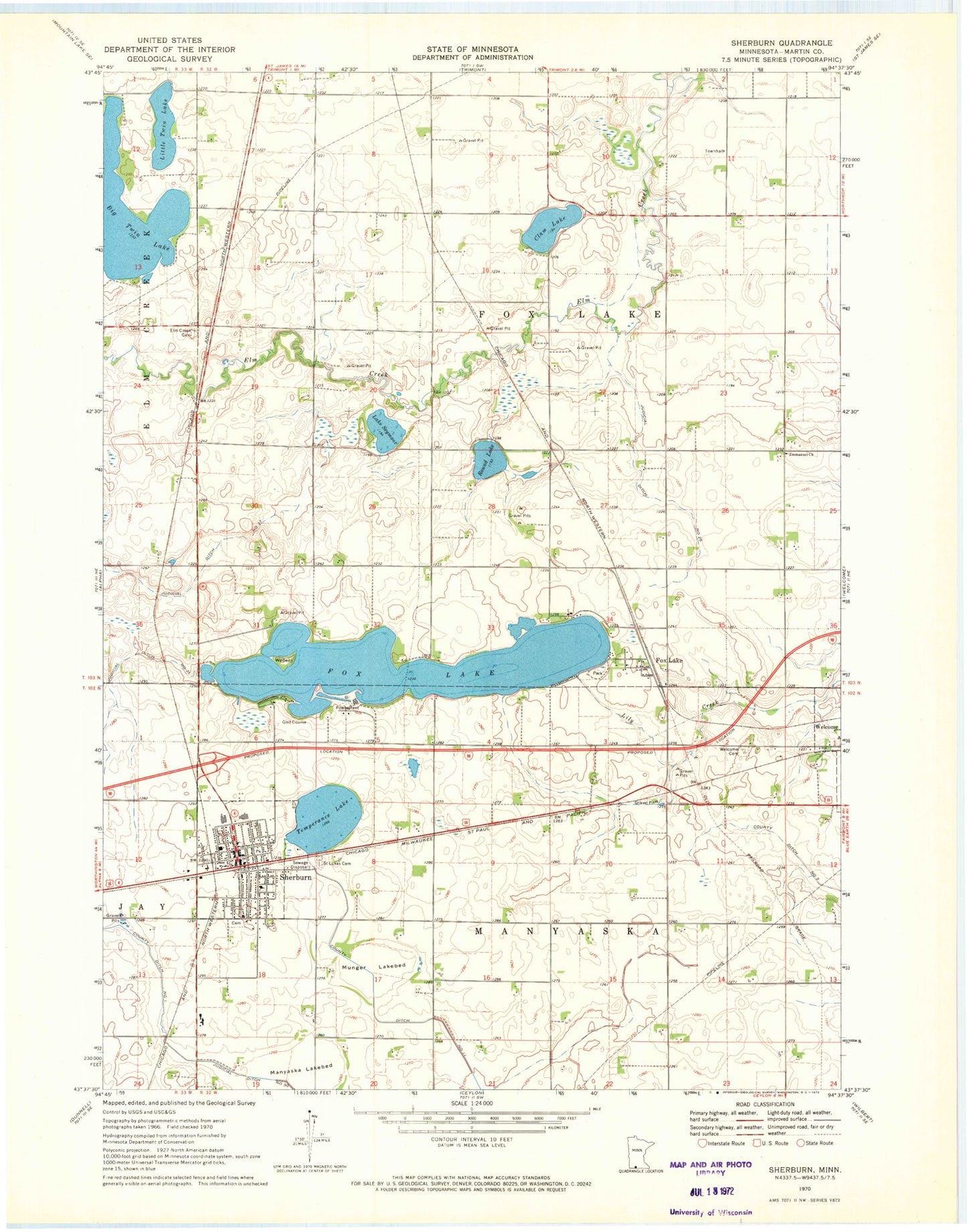
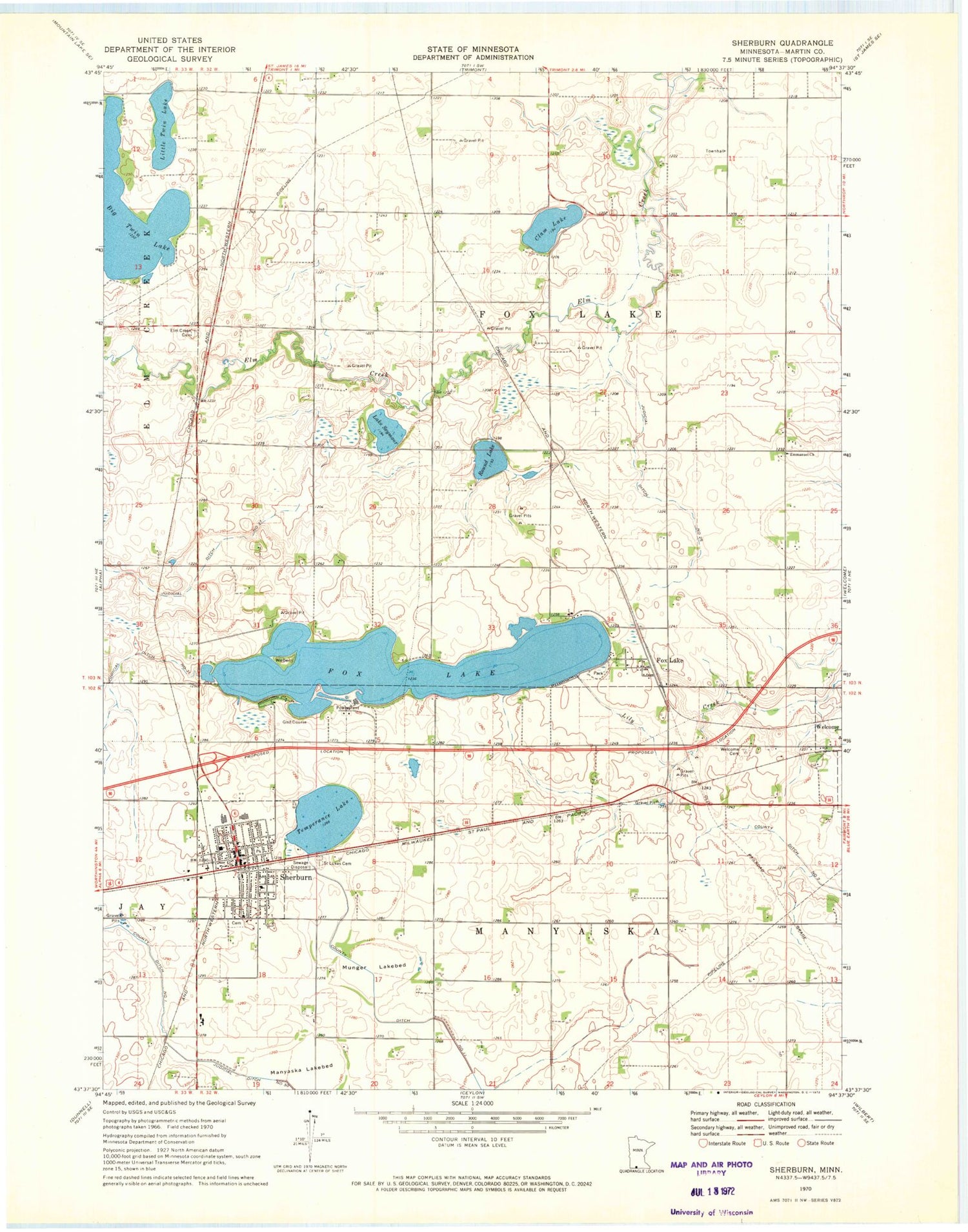
Classic USGS Sherburn Minnesota 7.5'x7.5' Topo Map
Couldn't load pickup availability
Historical USGS topographic quad map of Sherburn in the state of Minnesota. Map scale may vary for some years, but is generally around 1:24,000. Print size is approximately 24" x 27"
This quadrangle is in the following counties: Martin.
The map contains contour lines, roads, rivers, towns, and lakes. Printed on high-quality waterproof paper with UV fade-resistant inks, and shipped rolled.
Contains the following named places: Assembly of God Church, Big Twin Lake, Caven Mobile Home Park, Caven's Landing Campground, City of Sherburn, Clam Lake, Elm Creek Cemetery, Emmanuel Church, First Congregational Church, Fox Lake, Fox Lake Golf Club, Foxlake Post Office, Judicial Ditch Number Seventyone, Judicial Ditch Number Thirtyseven, Judicial Ditch Number Twentyfive, Lake Seymour, Little Twin Lake, Manyaska Lakebed, Martin County West High School, Munger Lakebed, P and J Modern Trailer Court, Rooney Run, Round Lake, Saint John's Lutheran Church, Saint Lukes Cemetery, Saint Luke's Church, Sherburn, Sherburn - Welcome Police Department, Sherburn Baptist Church, Sherburn City Cemetery, Sherburn Clinic, Sherburn Elementary School, Sherburn Library, Sherburn Post Office, Sherburn Southside Mobile Park, Sherburn Volunteer Fire Department, Temperance Lake, Township of Fox Lake, Township of Manyaska, United Methodist Church, Weber Island, Welcome Cemetery, ZIP Code: 56181