MyTopo
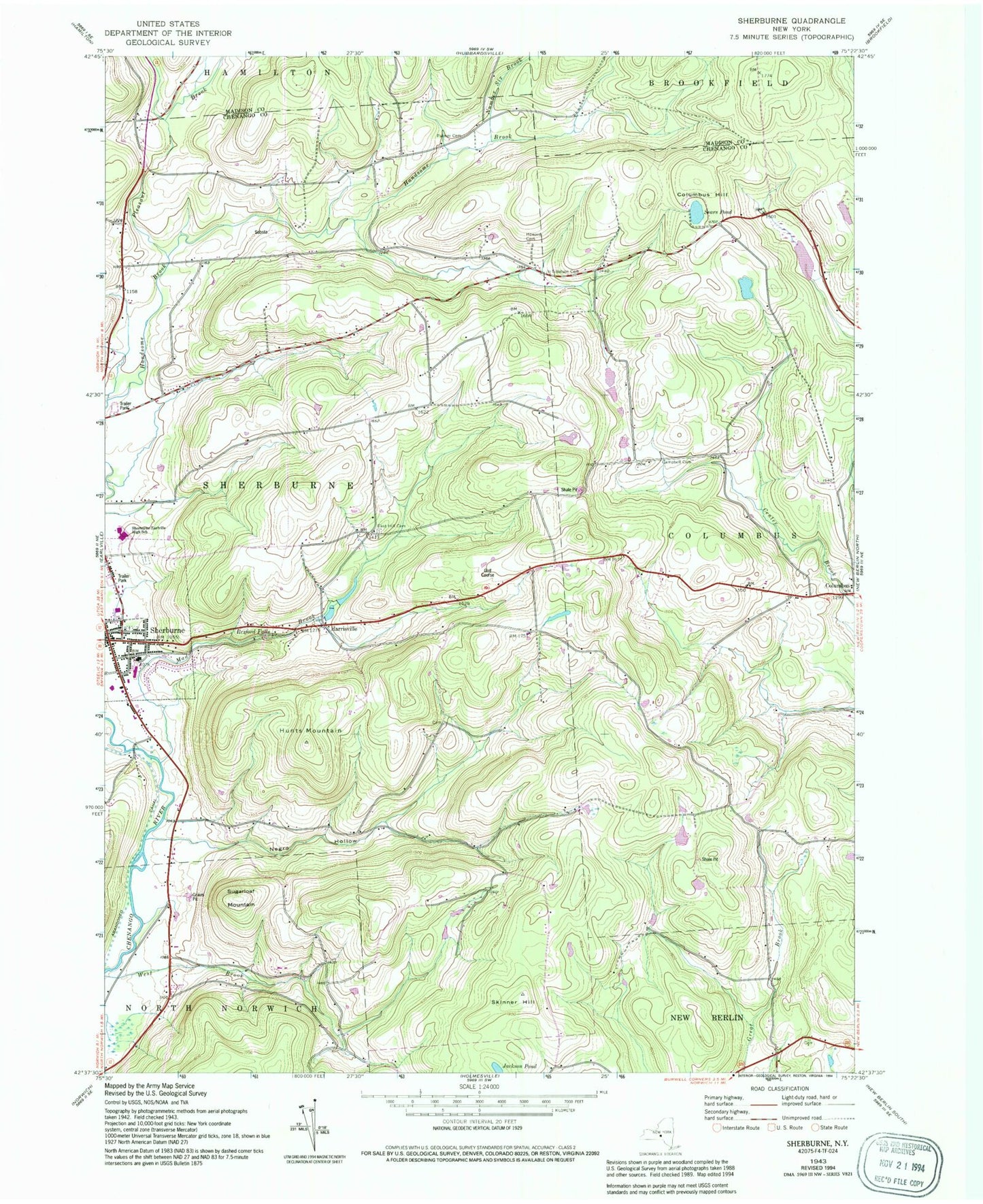
Classic USGS Sherburne New York 7.5'x7.5' Topo Map
Couldn't load pickup availability
Historical USGS topographic quad map of Sherburne in the state of New York. Map scale may vary for some years, but is generally around 1:24,000. Print size is approximately 24" x 27"
This quadrangle is in the following counties: Chenango, Madison.
The map contains contour lines, roads, rivers, towns, and lakes. Printed on high-quality waterproof paper with UV fade-resistant inks, and shipped rolled.
Contains the following named places: Campbell Cemetery, Christ Episcopal Church, Christian Baptist Church, Columbus Hill, East Hill Cemetery, First Congregational Church, Harrisville, Harrisville Cemetery, Howard Cemetery, Hunts Mountain, Jackson Pond, Mad Brook, Mountain Top Golf Course, Negro Hollow, Negro Hollow Church, Number Six Brook, Palmer Cemetery, Pleasant Brook, Pratt - Newton Memorial Home, Rexford Falls, Saint Malachy Cemetery, Saint Malachy's Roman Catholic Church, School Number 1, School Number 11, School Number 12, School Number 13, School Number 15, School Number 5, School Number 6, Sears Pond, Sherburne, Sherburne - Earlville Elementary School, Sherburne - Earlville Middle School, Sherburne Baptist Church, Sherburne Central School, Sherburne Grange, Sherburne Post Office, Sherburne Public Library, Sherburne Senior Housing Center, Sherburne United Methodist Church, Sherburne-Earlville High School, Skinner Hill, Sugarloaf Mountain, Tillotson Cemetery, Town of Sherburne, Village of Sherburne, West Brook, ZIP Code: 13460