
MyTopo
Classic USGS Sheridan Illinois 7.5'x7.5' Topo Map
Couldn't load pickup availability
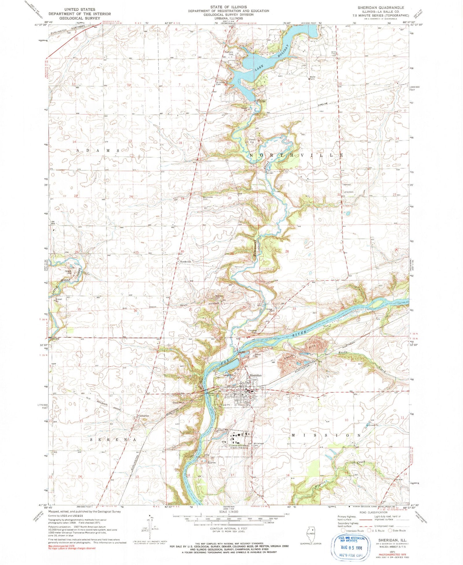
Historical USGS topographic quad map of Sheridan in the state of Illinois. Map scale may vary for some years, but is generally around 1:24,000. Print size is approximately 24" x 27"
This quadrangle is in the following counties: LaSalle.
The map contains contour lines, roads, rivers, towns, and lakes. Printed on high-quality waterproof paper with UV fade-resistant inks, and shipped rolled.
Contains the following named places: Baker School, Bowers Pit, Breuer School, Bronson School, Catharine, Century Acres Dairy Farm, Coultrip School, Cwian Field, Dreischmeir School, Elerding Cemetery, Family Church of the Nazarene, French Church, Glen Park, Harrington Farms Airport, Hobbs School, Johnson Airport, Lake Holiday, Lake Holiday Census Designated Place, Lake Holiday Dam, Lett Cemetery, Neff School, Northville, Northville Cemetery, Pooler School, Roods Creek, Saint John Catholic Cemetery, Saint Johns Lutheran Cemetery, Seaman Cemetery, Seventh Day Adventist Church, Sheridan, Sheridan Cemetery, Sheridan Correctional Center, Sheridan Elementary School, Sheridan Fire Protection District, Sheridan Police Department, Sheridan Post Office, Sheridan United Methodist Church, Sly School, Somonauk Creek, Suppes School, Township of Mission, Township of Northville, Troup Quarry, Union School, Village of Sheridan, Walnut Creek Airport, Whitehead Cemetery, ZIP Codes: 60549, 60551


