MyTopo
Classic USGS Sheridan Indiana 7.5'x7.5' Topo Map
Couldn't load pickup availability
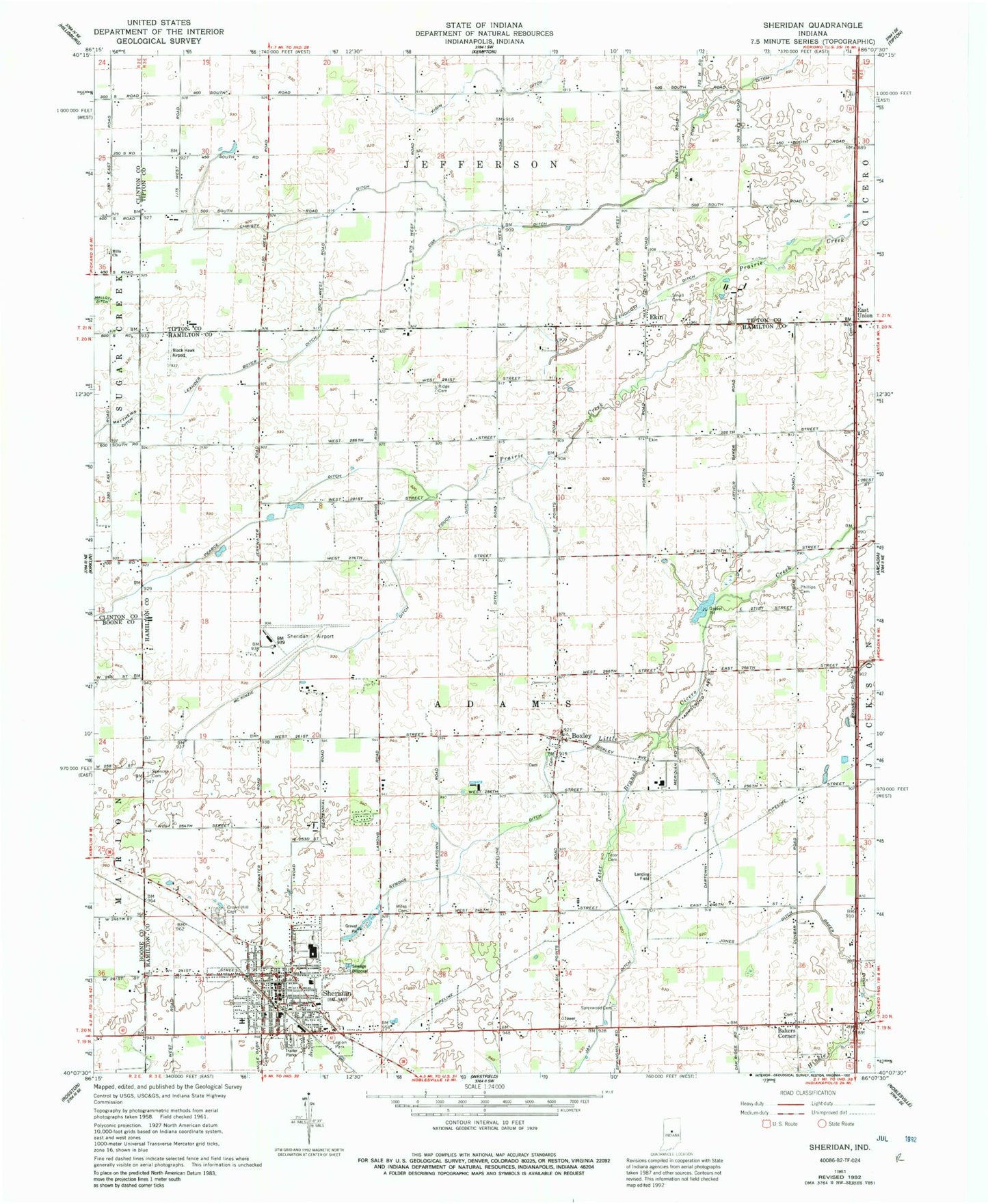
Historical USGS topographic quad map of Sheridan in the state of Indiana. Map scale may vary for some years, but is generally around 1:24,000. Print size is approximately 24" x 27"
This quadrangle is in the following counties: Boone, Clinton, Hamilton, Tipton.
The map contains contour lines, roads, rivers, towns, and lakes. Printed on high-quality waterproof paper with UV fade-resistant inks, and shipped rolled.
Contains the following named places: Adams Elementary School, Baker Ditch, Bakers Corner, Black Hawk Airport, Boxley, Christy Ditch, Cox Ditch, Crown View Cemetery, East Union, Ekin, Endicott Ditch, Fouch Ditch, Hill's Baptist Church Cemetery, Hills Church, Jay Ditch, Jones Ditch, K and S Farms, Leander Boyer Ditch, Legion Park, Marion-Adams High School, McKinzie Ditch, Pearce Ditch, Phillips Cemetery, Ridge Cemetery, Ross Ditch, Sheridan, Sheridan Airport, Sheridan Fire Department, Sheridan Police Department, Sheridan Post Office, Small Cemetery, Spencer Cemetery, Spicewood Cemetery, Symons Ditch, Teter Branch, Teter Cemetery, Town of Sheridan, Township of Adams, Union Cemetery, Wiles Cemetery, Windy Knoll Airport, ZIP Code: 46069