MyTopo
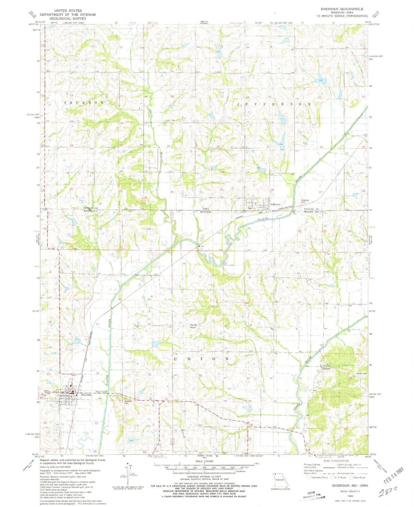
Classic USGS Sheridan Missouri 7.5'x7.5' Topo Map
Couldn't load pickup availability
Historical USGS topographic quad map of Sheridan in the states of Missouri, Iowa. Map scale may vary for some years, but is generally around 1:24,000. Print size is approximately 24" x 27"
This quadrangle is in the following counties: Taylor, Worth.
The map contains contour lines, roads, rivers, towns, and lakes. Printed on high-quality waterproof paper with UV fade-resistant inks, and shipped rolled.
Contains the following named places: Aldrich Lake, Arthur Scott Dam, Arthur Scott Lake, Athelstan, Athelstan Cemetery, Athelstan Census Designated Place, Athelstan Post Office, Bonnies Lake, Columbia School, Devils Horn, Gravel Hill School, Hibbs Farm Airport, Hoover Lake, Iona City, Isadora, Isadora Cemetery, Isadora School, Mission Ridge School, Mononame 29 Lake, Platte Branch, Platte Dell School, Platte River Tributaries Dam 3-B, Platte River Tributaries Watershed Dam 1-B, Platte River Tributaries Watershed Dam 2-A, Platte River Tributaries Watershed Dam 8-B, Platte River Tributaries Watershed Dam 8-C, Pleasant Hill School, Sanders Lake, Sheridan, Sheridan Cemetery, Sheridan Fire Protection District, Sheridan Post Office, Sheridan School, Town of Sheridan, Township of Jefferson, Township of Union, ZIP Code: 64486