MyTopo
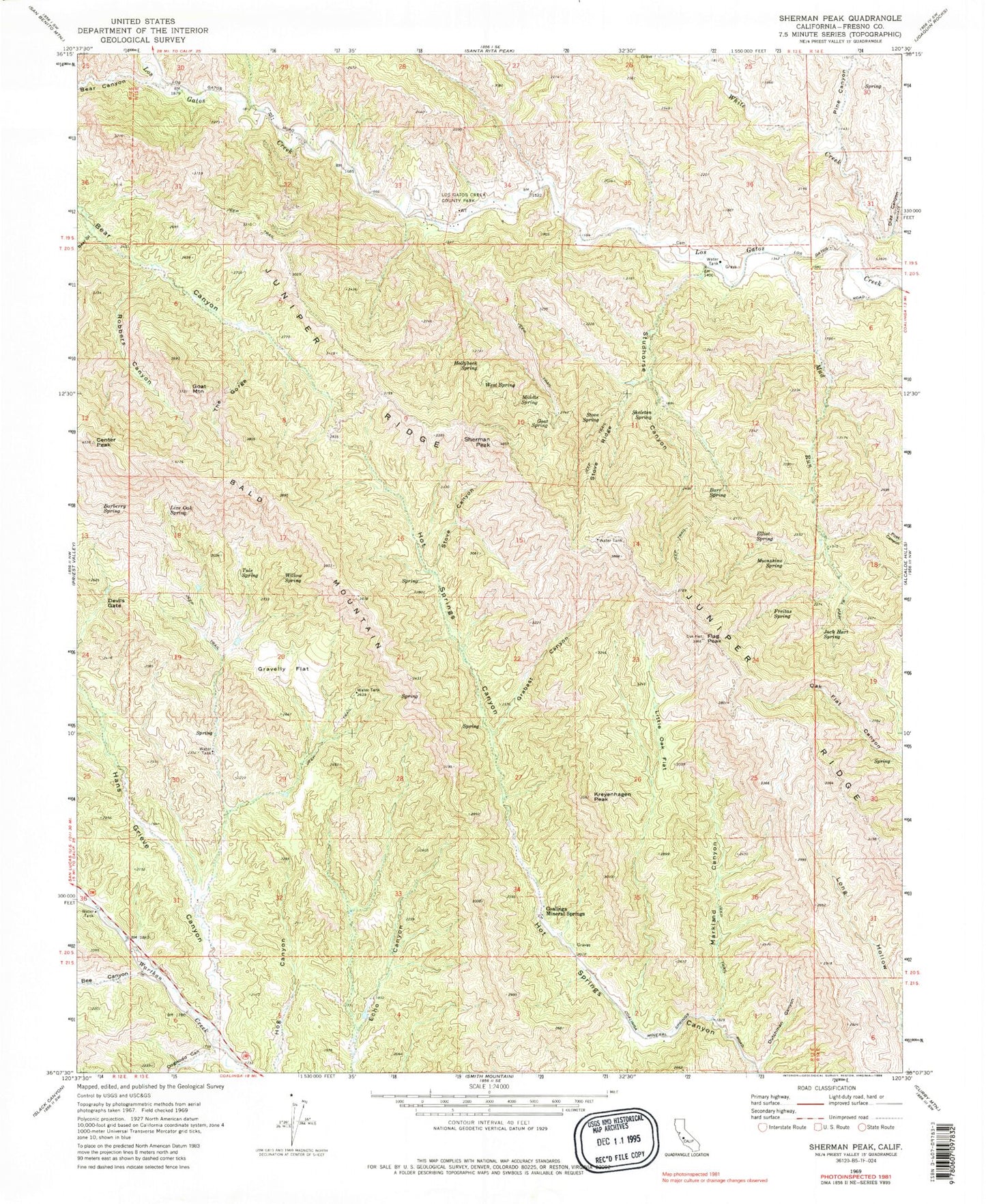
Classic USGS Sherman Peak California 7.5'x7.5' Topo Map
Couldn't load pickup availability
Historical USGS topographic quad map of Sherman Peak in the state of California. Typical map scale is 1:24,000, but may vary for certain years, if available. Print size: 24" x 27"
This quadrangle is in the following counties: Fresno.
The map contains contour lines, roads, rivers, towns, and lakes. Printed on high-quality waterproof paper with UV fade-resistant inks, and shipped rolled.
Contains the following named places: Bald Mountain, Barberry Spring, Barr Spring, Bear Gulch, Bee Canyon, Center Peak, Devils Gate, Diaz Canyon, Dogwood Canyon, Dutchman Canyon, Elliot Spring, Flag Peak, Freitas Spring, Goat Mountain, Goat Spring, Grabast Canyon, Gravelly Flat, Hans Grieve Canyon, Hollyhock Spring, Jack Hart Spring, Juniper Ridge, Kreyenhagen Peak, Little Oak Flat, Live Oak Spring, Los Gatos Creek County Park, Markland Canyon, Middle Spring, Moonshine Spring, Mud Run, Pine Canyon, Robbers Canyon, Sherman Peak, Skeleton Spring, Stove Canyon, Stove Ridge, Stove Spring, Studhorse Canyon, The Gorge, Tule Spring, West Spring, Willow Spring, Coalinga Mineral Springs, Chimney Canyon, Rock House Spring, Roberts Canyon, Lewis Canyon, Skelton Spring