MyTopo
Classic USGS Sherman Peak Washington 7.5'x7.5' Topo Map
Regular price
$16.95
Regular price
Sale price
$16.95
Unit price
per
Couldn't load pickup availability
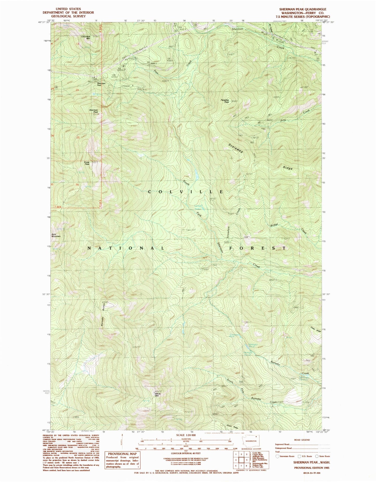
Historical USGS topographic quad map of Sherman Peak in the state of Washington. Typical map scale is 1:24,000, but may vary for certain years, if available. Print size: 24" x 27"
This quadrangle is in the following counties: Ferry.
The map contains contour lines, roads, rivers, towns, and lakes. Printed on high-quality waterproof paper with UV fade-resistant inks, and shipped rolled.
Contains the following named places: Barnaby Buttes, Cedar Ridge, Columbia Mountain, McGahee Creek, Paradise Peak, Pass Creek, Scalawag Ridge, Sherman Pass, Sherman Peak, Snow Peak, Snowshoe Camp, Snowshoe Creek, White Mountain, Sherman Pass Campground, Columbia Mountain Lookout, White Mountain Lookout