MyTopo
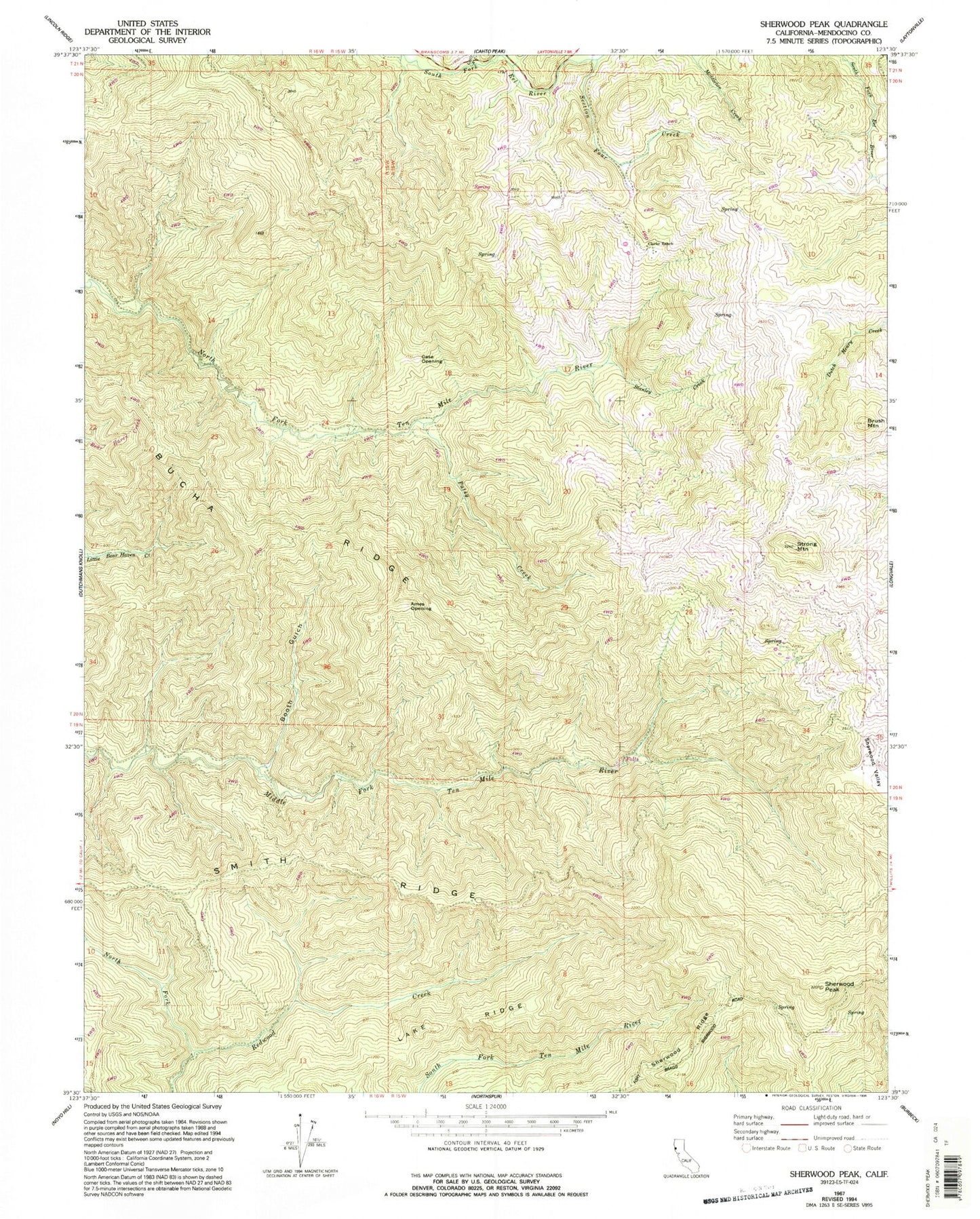
Classic USGS Sherwood Peak California 7.5'x7.5' Topo Map
Regular price
$16.95
Regular price
Sale price
$16.95
Unit price
per
Couldn't load pickup availability
Historical USGS topographic quad map of Sherwood Peak in the state of California. Map scale may vary for some years, but is generally around 1:24,000. Print size is approximately 24" x 27"
This quadrangle is in the following counties: Mendocino.
The map contains contour lines, roads, rivers, towns, and lakes. Printed on high-quality waterproof paper with UV fade-resistant inks, and shipped rolled.
Contains the following named places: Ames Opening, Baxman Ranch, Booth Gulch, Brush Mountain, Bucha Ridge, Case Opening, Clarke Ranch, Lake Ridge, Little Rock Creek, North Fork Redwood Creek, Patsy Creek, Section Four Creek, Sherwood Peak, Sherwood Ridge, Smith Ridge, Stanley Creek, Strong Mountain