
MyTopo
Classic USGS Shields Illinois 7.5'x7.5' Topo Map
Couldn't load pickup availability
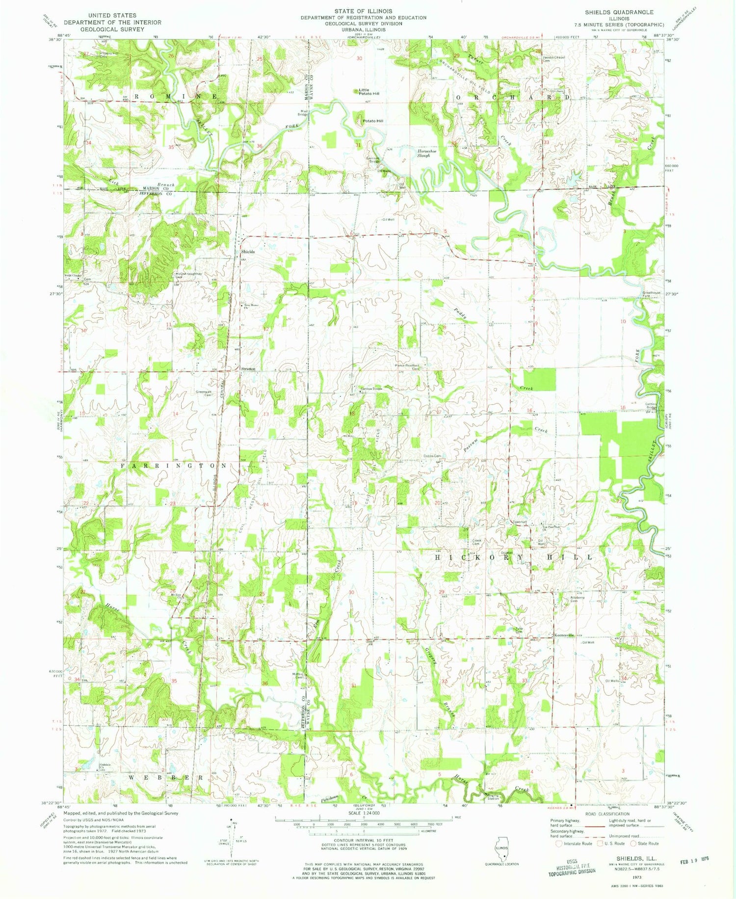
Historical USGS topographic quad map of Shields in the state of Illinois. Map scale may vary for some years, but is generally around 1:24,000. Print size is approximately 24" x 27"
This quadrangle is in the following counties: Jefferson, Marion, Wayne.
The map contains contour lines, roads, rivers, towns, and lakes. Printed on high-quality waterproof paper with UV fade-resistant inks, and shipped rolled.
Contains the following named places: Atteberry Cemetery, Bradford Cemetery, Brush Creek, Coil Oil Field, Coil West Oil Field, Concord School, Crask Cemetery, Dobbs Cemetery, Eagle School, Ellis School, Elm Creek, Farrington School, Garrison Bridge, Garrison School, Garrison Temple, Garrison Temple Cemetery, Gettins Bridge, Greathouse Ford, Greenwalt Cemetery, Gregory Branch, Hickory Hill Cemetery, Hickory Hill Church, Hickory Hill School, Hickory Hill Townhall, Horseshoe Slough, Jacobs Chapel, Jacobs Chapel Cemetery, Keenesville, Lick Branch, Little Potatoe Hill, Logansville Post Office, McConnaughhay Cemetery, Mifflin Cemetery, Miller Shrub Swamp Nature Preserve, Mills School, Mount Zion Cemetery, Mount Zion Church, Mud Bridge, New Bradford School, New Hartford School, New Home Cemetery, New Home Church, North Lilly School, Oakdale Cemetery, Oakdale Church, O'Daniel Lodge Lake, O'Daniel Lodge Lake Dam Number 1, O'Daniel Lodge Lake Dam Number 2, Orchardville Oil Field, Paddy Creek, Park School, Possum Creek, Potatoe Hill, Puncheon Creek, Rapp School, Shields, South Lilly School, Stratton, Ten Post Oak Baptist Church, Ten Post Oak Cemetery, Township of Hickory Hill, Turner Creek, Tyler Cemetery, Wells Chapel, Wells Chapel Cemetery, Zion Church, ZIP Codes: 62814, 62851


