
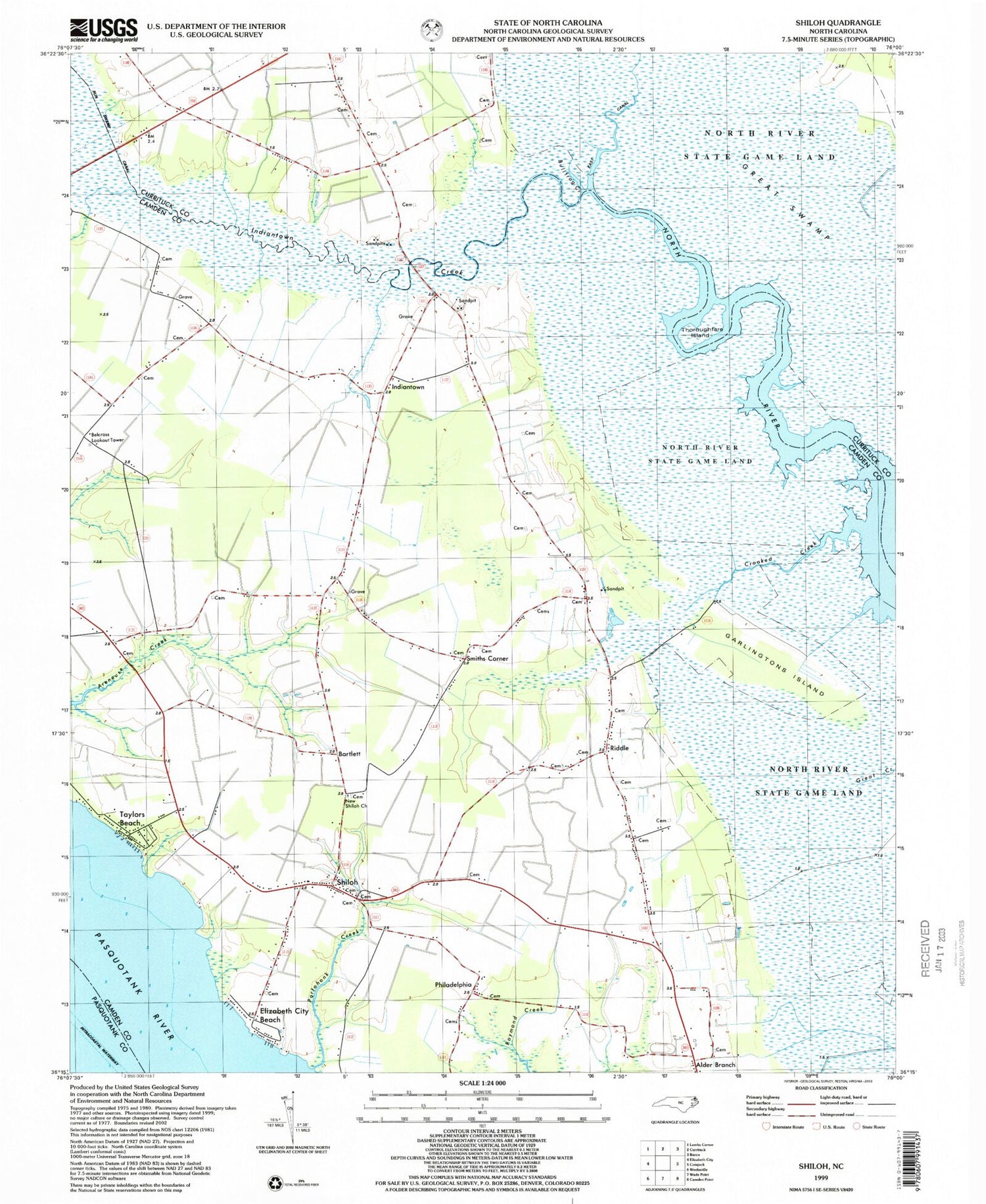
MyTopo
Classic USGS Shiloh North Carolina 7.5'x7.5' Topo Map
Couldn't load pickup availability
Historical USGS topographic quad map of Shiloh in the state of North Carolina. Map scale may vary for some years, but is generally around 1:24,000. Print size is approximately 24" x 27"
This quadrangle is in the following counties: Camden, Currituck, Pasquotank.
The map contains contour lines, roads, rivers, towns, and lakes. Printed on high-quality waterproof paper with UV fade-resistant inks, and shipped rolled.
Contains the following named places: Alder Branch, Bartlett, Belcross Lookout Tower, Black Swamp, Bogues Cemetery, Bullfrog Creek, Burgess Cemetery, Cartwright Family Cemetery, Crooked Creek, Croome Acres Mobile Home Park, Cutrell Family Cemetery, Duncan Cemetery, East Canal, Elizabeth City Beach, Farrell - Ferrell Cemetery, Forbes Cemetery, Gallop Cemetery, Garlingtons Island, Gregory Family Cemetery, Indiantown, Indiantown Creek, Isaac Prichard Cemetery, James and Alice Forbes Cemetery, Johnnie Sawyer Cemetery, Jones Cemetery, Jones Mill, Joseph Seymour Cemetery, Margaret Williams Cemetery, McKimmey Cemetery, McPherson Cemetery, Mercer Family Cemetery, Needham Cemetery, New Shiloh Baptist Church Cemetery, New Shiloh Church, Philadelphia, Philadelphia Baptist Church Cemetery, Portohonk Creek, Pugh Cemetery, Riddle, Riggs Children Cemetery, Roberts Cemetery, Sawyer Family Cemetery, Shiloh, Shiloh Baptist Church Cemetery, Shiloh Post Office, Smiths Corner, Smiths Corner Cemetery, South Camden Volunteer Fire Department / Rescue Station 11, Spellman Family Cemetery, Squires and Eason Cemetery, Squires Cemetery, Staples - Kight Cemetery, Stevens Cemetery, Taylors Beach, Thoroughfare Island, Tillitt Cemetery, Walker Family Cemetery, West Cemetery, Williams Cemetery, ZIP Code: 27973


