MyTopo
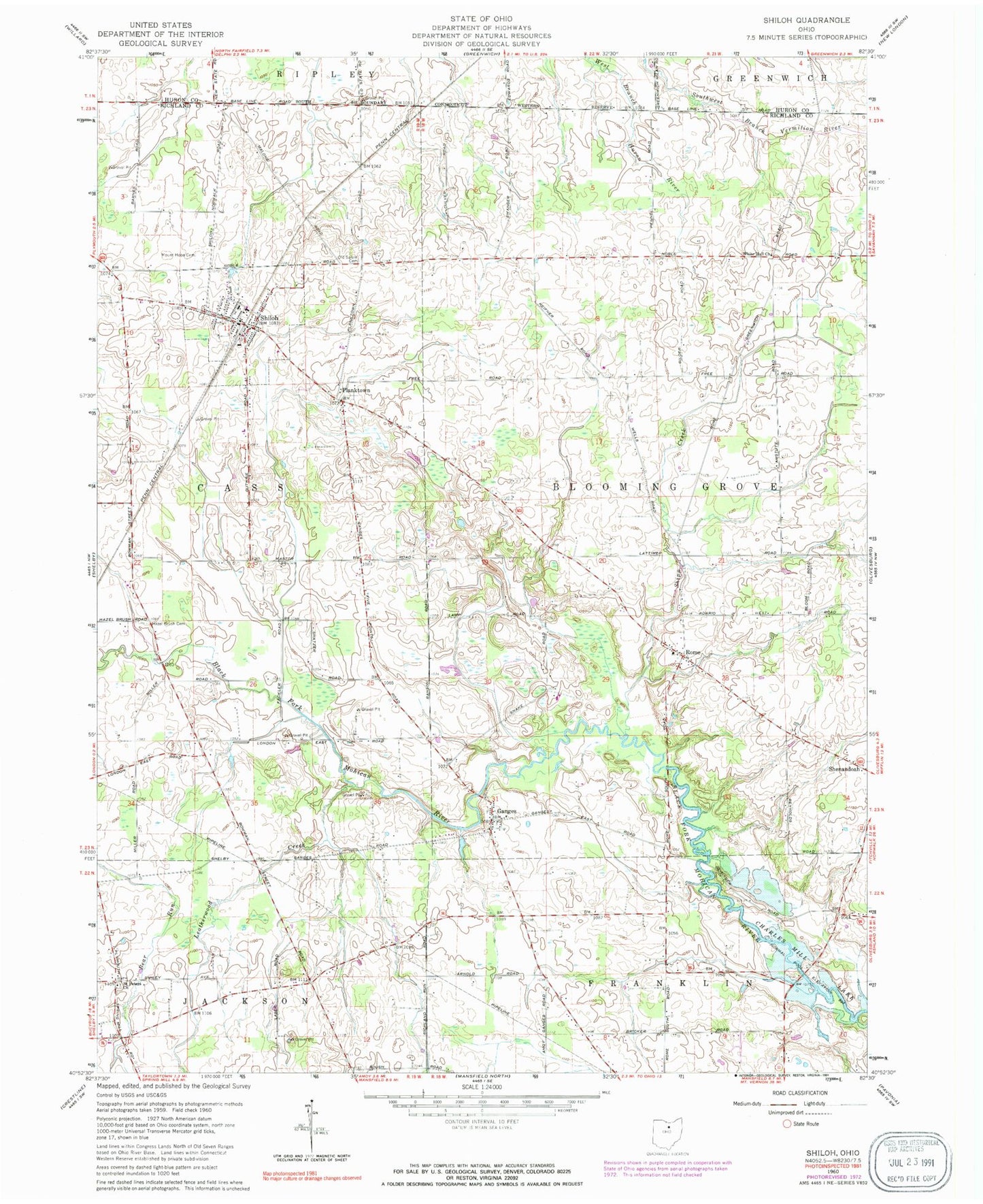
Classic USGS Shiloh Ohio 7.5'x7.5' Topo Map
Couldn't load pickup availability
Historical USGS topographic quad map of Shiloh in the state of Ohio. Map scale may vary for some years, but is generally around 1:24,000. Print size is approximately 24" x 27"
This quadrangle is in the following counties: Huron, Richland.
The map contains contour lines, roads, rivers, towns, and lakes. Printed on high-quality waterproof paper with UV fade-resistant inks, and shipped rolled.
Contains the following named places: Bevier Farms, Cass Blooming Grove and Shiloh Fire Department, Evangelical German Reform Cemetery, Ganges, Ganges Cemetery, Ganges Post Office, Hazel Brush Cemetery, Leatherwood Creek, London Cemetery, Mount Hope Cemetery, Old Salem Cemetery, Planktown, Presbyterian Cemetery, Rome, Saint Peters Church, School Number 2, School Number 3, School Number 5, School Number 7, Shenandoah Cemetery, Shiloh, Shiloh Elementary School, Shiloh Middle School, Shiloh Post Office, Shipp Creek, Springmills Post Office, Township of Bloominggrove, Township of Cass, Village of Shiloh, White Hall Church, ZIP Code: 44878