MyTopo
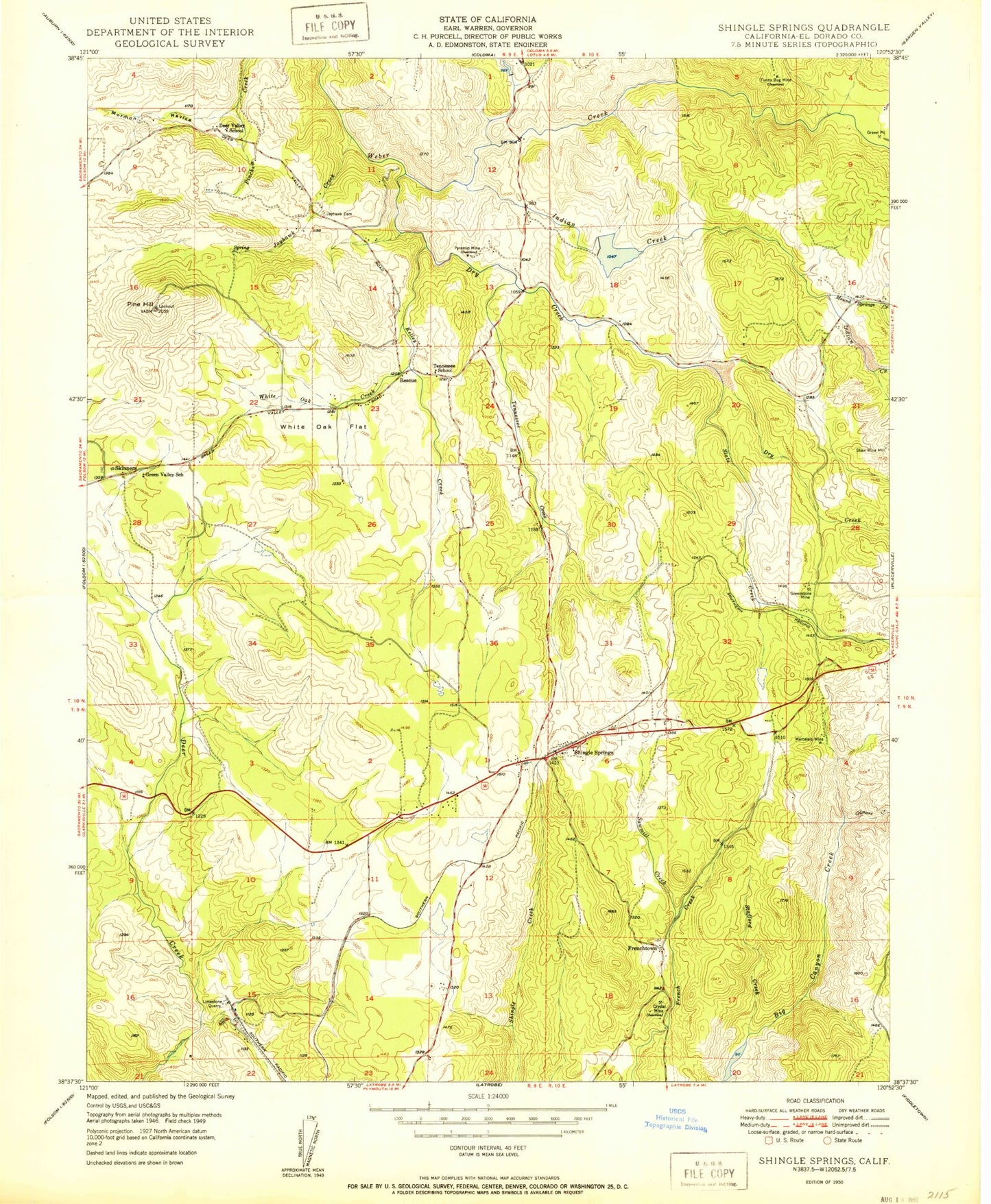
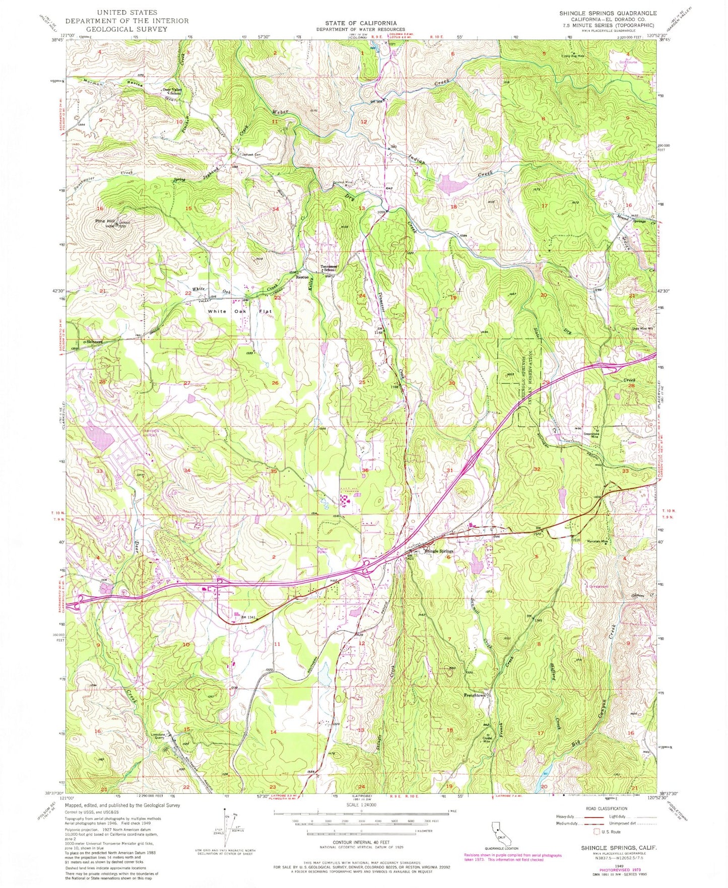
Classic USGS Shingle Springs California 7.5'x7.5' Topo Map
Couldn't load pickup availability
Historical USGS topographic quad map of Shingle Springs in the state of California. Typical map scale is 1:24,000, but may vary for certain years, if available. Print size: 24" x 27"
This quadrangle is in the following counties: El Dorado.
The map contains contour lines, roads, rivers, towns, and lakes. Printed on high-quality waterproof paper with UV fade-resistant inks, and shipped rolled.
Contains the following named places: Crystal Mine, Deer Valley School, Dry Creek, Funny Bug Mine, Gilmore Creek, Greenstone Mine, Indian Creek, Jayhawk Cemetery, Jayhawk Creek, Kelley Creek, Marcelais Mine, Mormon Ravine, Mound Springs Creek, Pine Hill, Pyramid Mine, Rescue, Sawmill Creek, Shaw Mine Mill, Shingle Springs Rancheria, Slate Creek, Stafford Creek, Tennessee Creek, Tennessee School, White Oak Creek, White Oak Flat, Kingsville, Cameron Park Airport, Frenchtown, Shingle Springs, Skinners, Warren Hollister 53-004 Dam, Holiday Lake 1079 Dam, Indian Creek 1462 Dam, Barnett 1464 Dam, Volo Mining Company 1468 Dam, Bamom (historical), Big Canyon Reservoir, Bonanza Park, Buckeye Flat (historical), Buckeye Elementary School, Burke Junction Shopping Center, Cambridge Plaza Shops Shopping Center, Cameron Airpark Estates, Cameron Oaks Shopping Center, Cameron Park, Cameron Park Community Service Center, Cameron Park Country Club, Cameron Park Lake, Cold Springs Golf and Country Club, Coloma Road State Historic Landmark 747, Durock Shopping Center, Department of Forestry and Fire Protection Cameron Park Station 89, French Creek Shopping Center, Goldorado Shopping Center, Hacienda Park, Indian Creek Reservoir, Jayhawk, Mariemont, Old Mill Creek, Pine Hill State Ecological Reserve, Ponderosa High School, Pony Express State Historic Landmark 703, Rescue Elementary School, Rescue Post Office, Royal Oaks Park, Shingle Spring Community Center, Shingle Springs Park Plaza, Shingle Spring Plaza Shopping Center, Shingle Springs Post Office, Shingle Springs State Historic Landmark 456, Skinner Winery (historical), Sprekelsville, Sprekels Quarry, Sunny Oak Farm and Vineyard, Winery Plaza Shopping Center, Cameron Park Census Designated Place, Shingle Springs Census Designated Place, Shingle Springs Rancheria Fire Department, Department of Forestry and Fire Protection Cameron Park Station 88, Rescue Fire Protection District Station 83, El Dorado County Fire District Station 28, Diamond Springs - El Dorado Fire Protection District Station 47, Weber Creek Quarry, Frenchtown Cemetery, Skinner Ranch Cemetery, Shingle Springs Cemetery