MyTopo
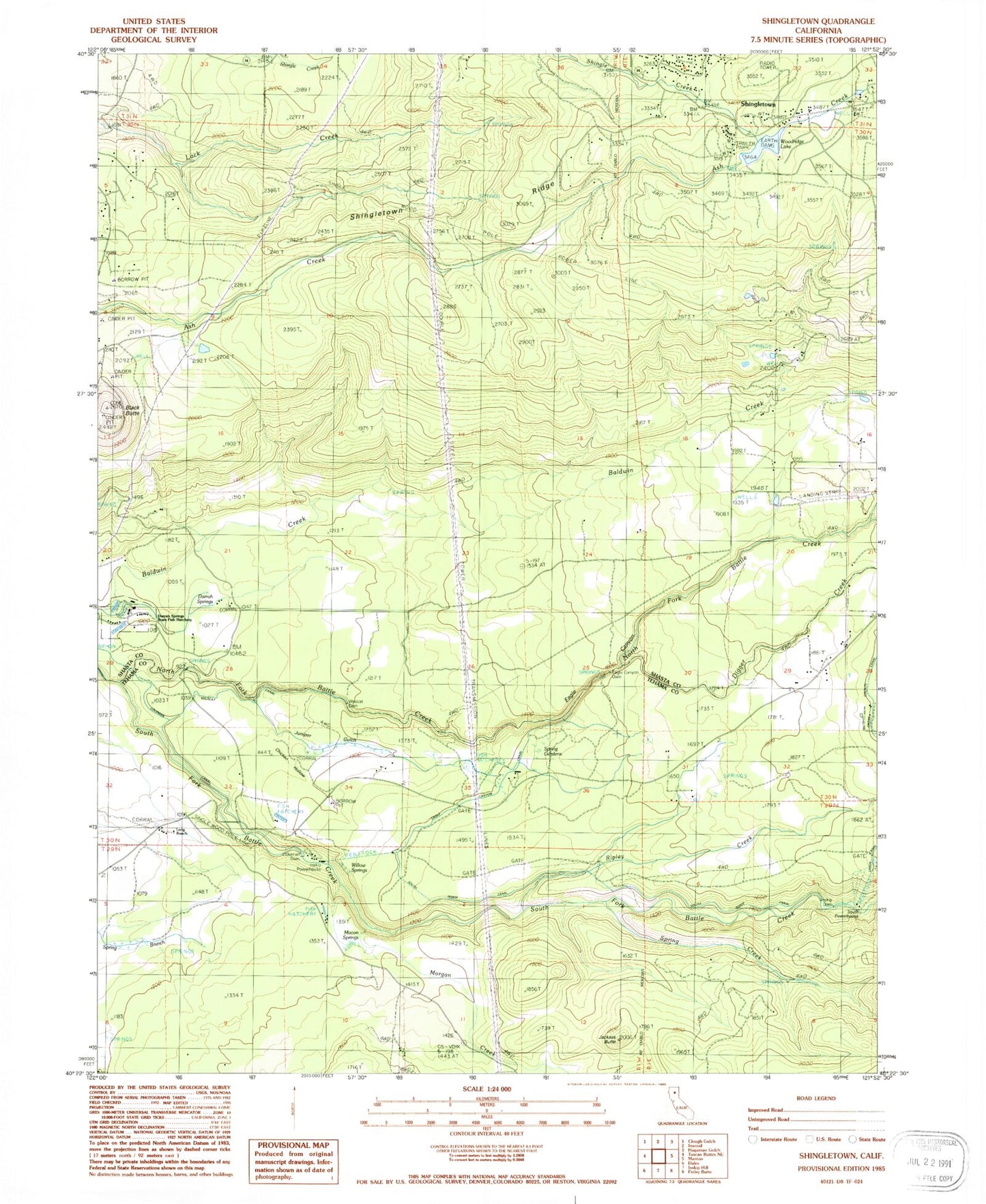
Classic USGS Shingletown California 7.5'x7.5' Topo Map
Couldn't load pickup availability
Historical USGS topographic quad map of Shingletown in the state of California. Map scale may vary for some years, but is generally around 1:24,000. Print size is approximately 24" x 27"
This quadrangle is in the following counties: Shasta, Tehama.
The map contains contour lines, roads, rivers, towns, and lakes. Printed on high-quality waterproof paper with UV fade-resistant inks, and shipped rolled.
Contains the following named places: Black Butte, Chicken Hollow, Coleman Dam, Darrah Springs, Darrah Springs State Fish Hatchery, Digger Creek, Double Creek Airpark, Eagle Canyon, Eagle Canyon Dam, Eagle Canyon Ditch, Inskip Dam, Inskip Powerhouse, Jackass Butte, Juniper Gulch, Long Ranch, Macam School, Macon Springs, Millseat Creek, North Fork Battle Creek, Ripley Creek, Shingletown, Shingletown Post Office, Shingletown Ridge, Shingletown Sheriff's Office, Sierra School, South Ditch, South Fork Battle Creek, South Powerhouse, Spring Creek, Spring Gardens, Truett 2221 Dam, Wildcat Dam, Wildcat Ditch, Willow Springs, Woodridge Lake