MyTopo
Classic USGS Ship Mountain Point Utah 7.5'x7.5' Topo Map
Regular price
$16.95
Regular price
Sale price
$16.95
Unit price
per
Couldn't load pickup availability
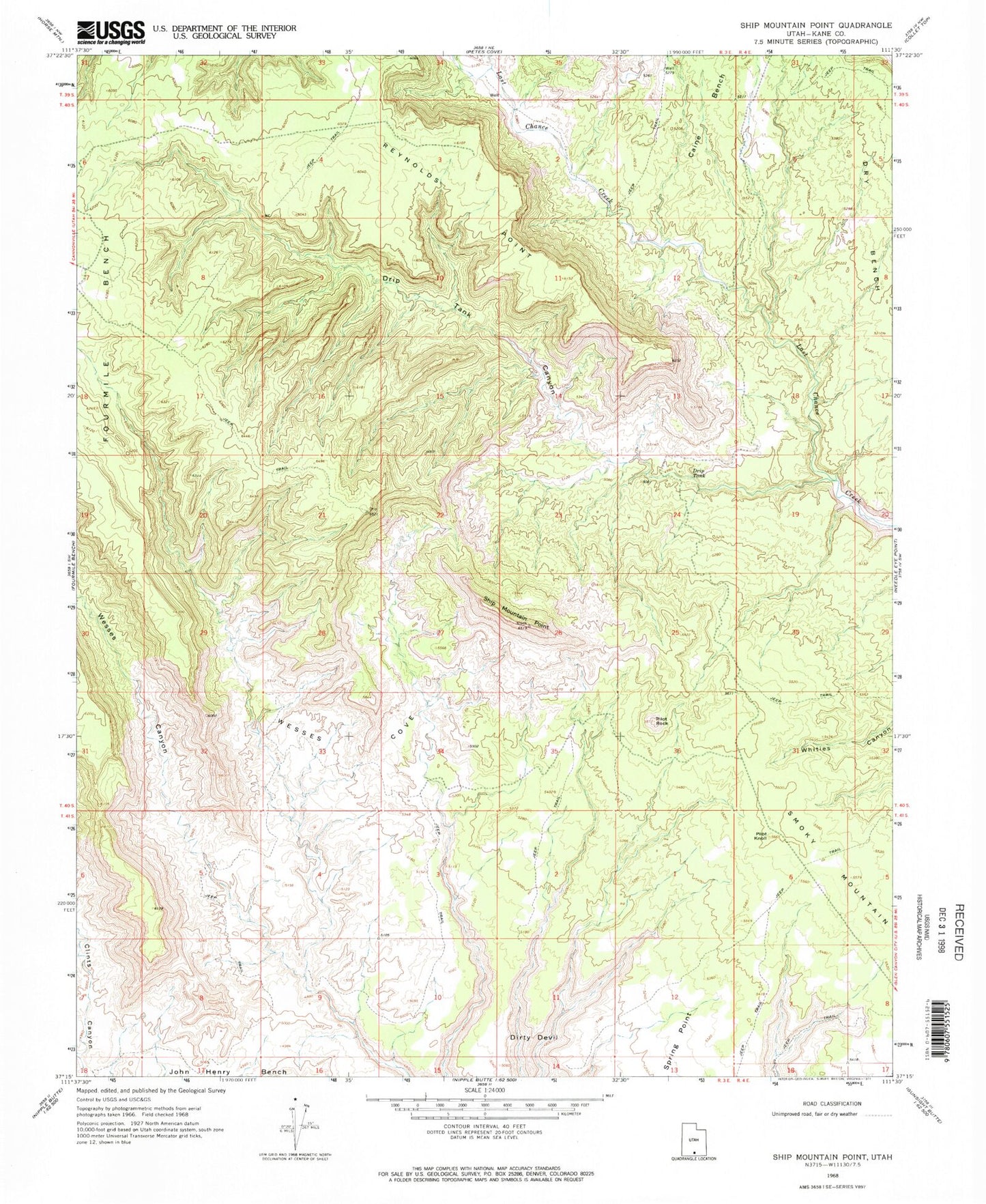
Historical USGS topographic quad map of Ship Mountain Point in the state of Utah. Map scale may vary for some years, but is generally around 1:24,000. Print size is approximately 24" x 27"
This quadrangle is in the following counties: Kane.
The map contains contour lines, roads, rivers, towns, and lakes. Printed on high-quality waterproof paper with UV fade-resistant inks, and shipped rolled.
Contains the following named places: Caine Bench, Dirty Devil, Drip Tank, Drip Tank Canyon, Dry Bench, Dry Fork Wesses Canyon, John Henry Bench, Pilot Knoll, Pilot Rock, Reynolds Point, Ship Mountain Point, Spring Point, Wesses Cove