MyTopo
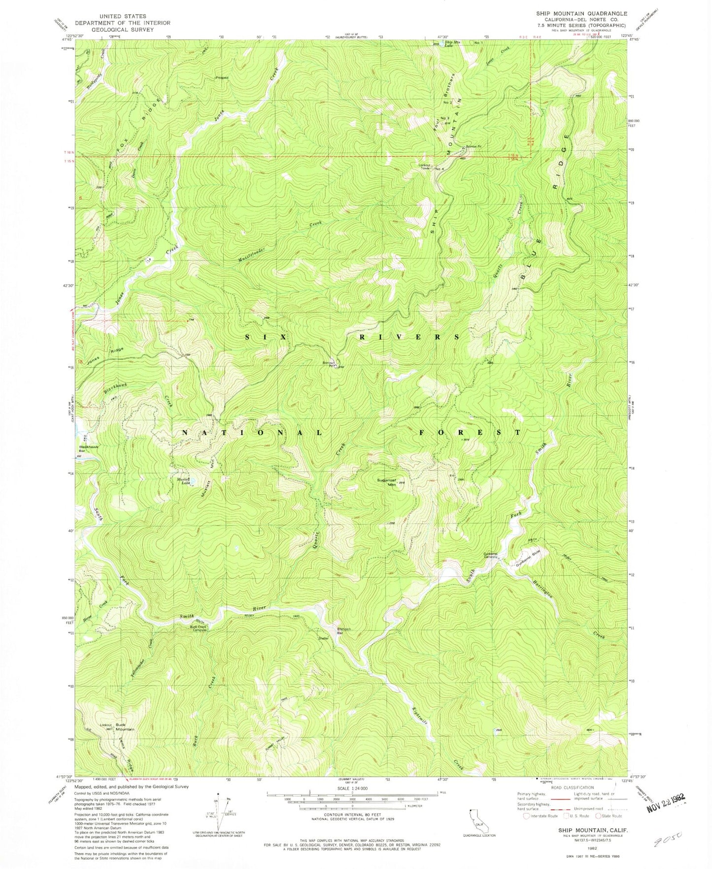
Classic USGS Ship Mountain California 7.5'x7.5' Topo Map
Couldn't load pickup availability
Historical USGS topographic quad map of Ship Mountain in the state of California. Map scale may vary for some years, but is generally around 1:24,000. Print size is approximately 24" x 27"
This quadrangle is in the following counties: Del Norte.
The map contains contour lines, roads, rivers, towns, and lakes. Printed on high-quality waterproof paper with UV fade-resistant inks, and shipped rolled.
Contains the following named places: Blackhawk Bar, Blue Ridge, Buck Creek, Buck Creek Campsite, Buck Mountain, Buck Mountain Lookout, Eightmile Creek, Elkhorn Bar, Four Brothers, Gunbarrel Campsite, Gunbarrel Slide, Gunbarrel Trail, Harrington Creek, Horse Creek, Jones Ridge, Lems Ridge Trail, Muslatt Lake, Muslatt Mountain, Muzzleloader Creek, Number 3, Number Four, Number One, Number Two, Prescott Fork, Quartz Creek, Ship Mountain, Ship Mountain Lake, Ship Mountain Lookout, Ship Mountain Trail, Six Rivers National Forest, Sugarloaf Mountain, Upper Smith River Trail, Williams Ranch, Yellowjacket Creek