MyTopo
Classic USGS Shipshewana Indiana 7.5'x7.5' Topo Map
Couldn't load pickup availability
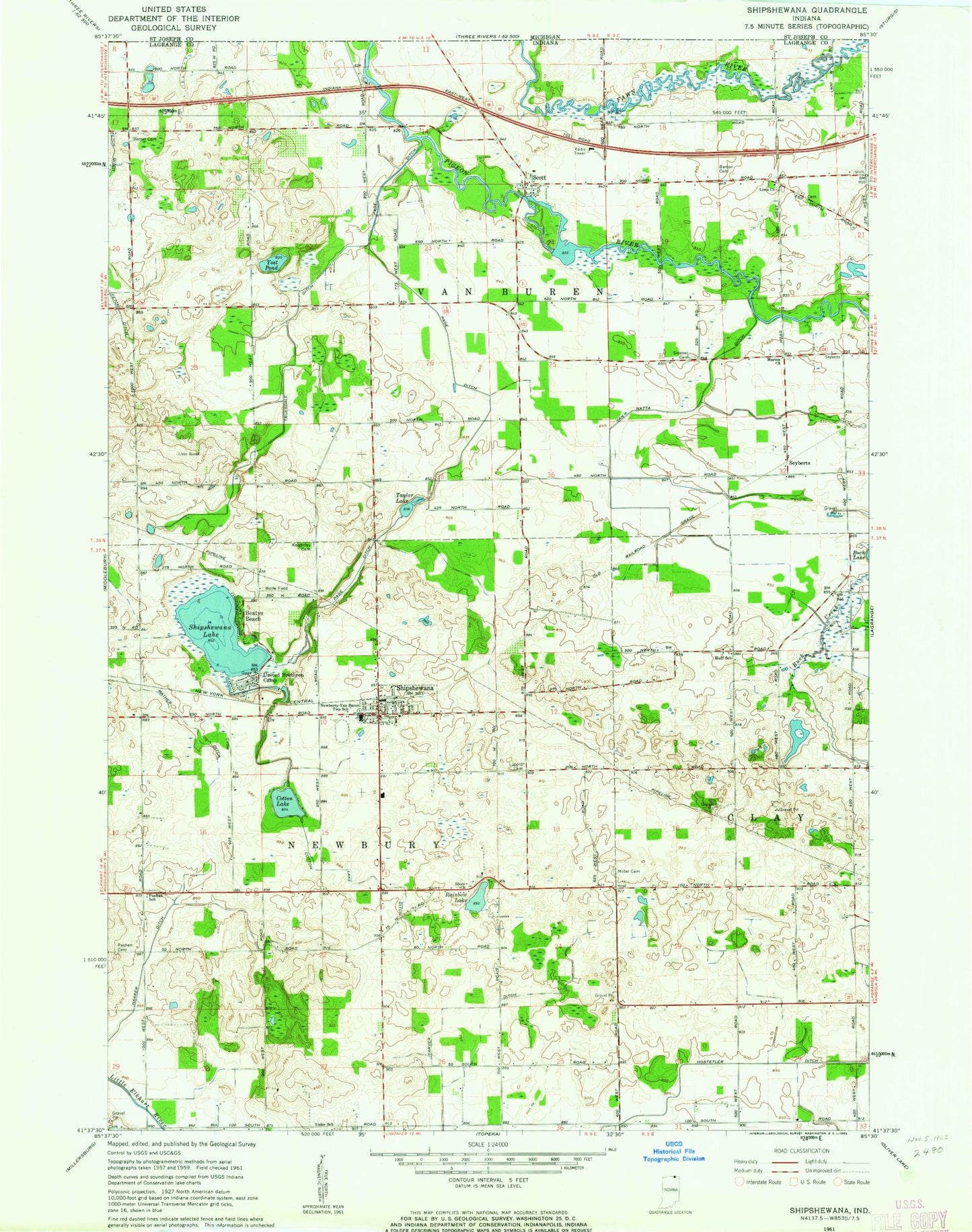
Historical USGS topographic quad map of Shipshewana in the state of Indiana. Map scale may vary for some years, but is generally around 1:24,000. Print size is approximately 24" x 27"
This quadrangle is in the following counties: LaGrange.
The map contains contour lines, roads, rivers, towns, and lakes. Printed on high-quality waterproof paper with UV fade-resistant inks, and shipped rolled.
Contains the following named places: Barton Cemetery, Beatys Beach, Bethel Cemetery, Cotton Lake, Cotton Lake Ditch, Farver Ditch, Fetch Ditch, Haarer Ditch, Hostetler Ditch, Huff School, Lima Church, Lupold Cemetery, Marion Church, Miller Cemetery, Page Ditch, Pashan Cemetery, Pashan School, Rainbow Lake, Scott, Scott Mill Pond Public Fishing Area, Seyberts, Shipshewana, Shipshewana Lake, Shipshewana Police Department, Shipshewana Post Office, Shipshewana Volunteer Fire Department, Shipshewana-Scott Elementary School, Shore Church, Sidener Cemetery, Taylor Lake, Town of Shipshewana, Township of Newbury, Township of Van Buren, Truesdale Ditch, United Brethren Camp, Van Natta Ditch, Wolfe Field, Yoder School, ZIP Code: 46565