MyTopo
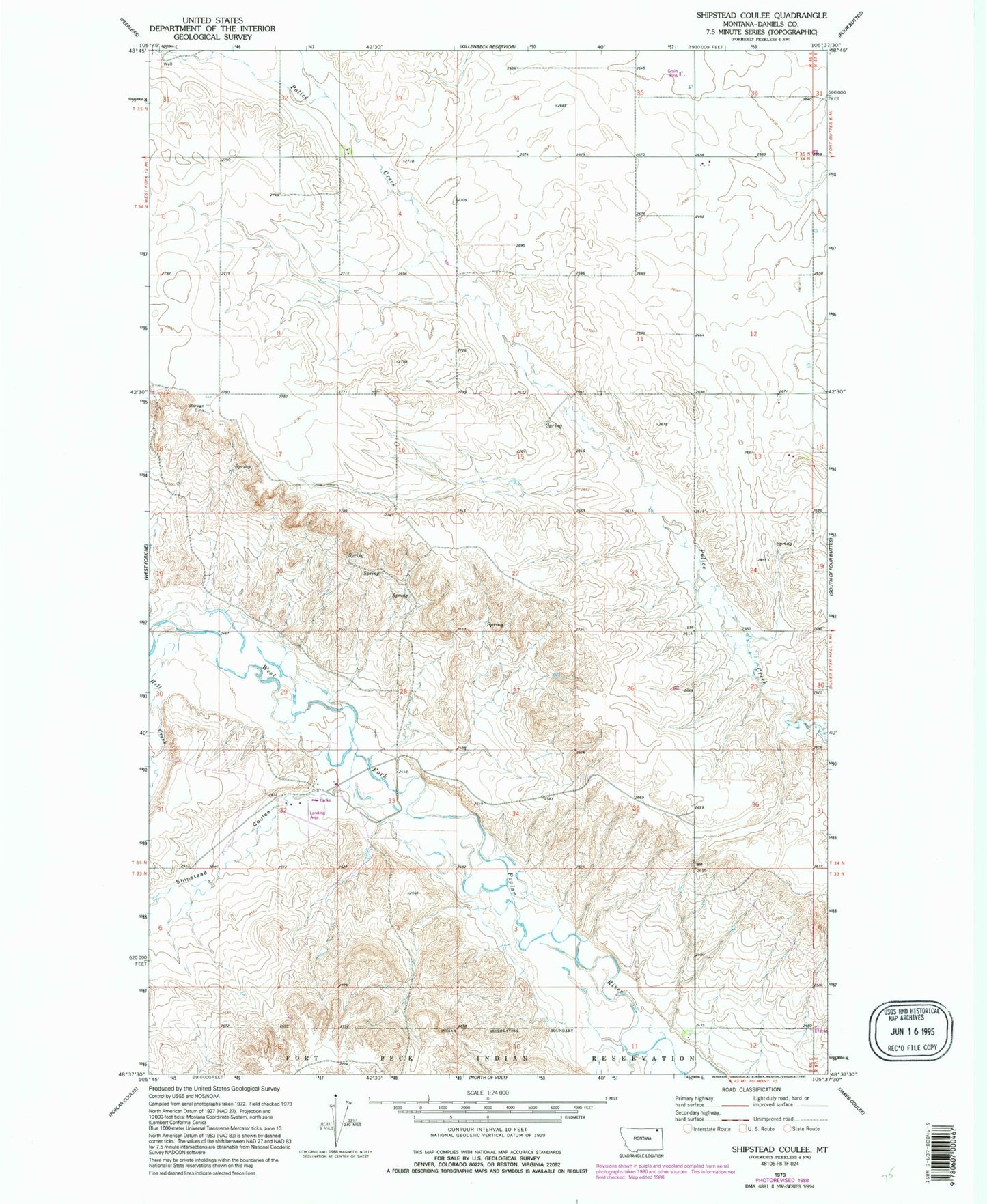
Classic USGS Shipstead Coulee Montana 7.5'x7.5' Topo Map
Couldn't load pickup availability
Historical USGS topographic quad map of Shipstead Coulee in the state of Montana. Map scale may vary for some years, but is generally around 1:24,000. Print size is approximately 24" x 27"
This quadrangle is in the following counties: Daniels.
The map contains contour lines, roads, rivers, towns, and lakes. Printed on high-quality waterproof paper with UV fade-resistant inks, and shipped rolled.
Contains the following named places: 33N46E02CDAD01 Well, 34N46E01BBBC01 Well, 34N46E01BBBD01 Well, 34N46E03CDCD01 Well, 34N46E05ACBD01 Well, 34N46E07DCCB01 Well, 34N46E13ABAA01 Well, 34N46E13ABAA02 Well, 34N46E13ABAD01 Well, 34N46E18AAAA01 Well, 35N46E31ABCB01 Well, 35N46E32BDDA01 Well, 35N46E35ADAC01 Well, Shipstead Coulee