MyTopo
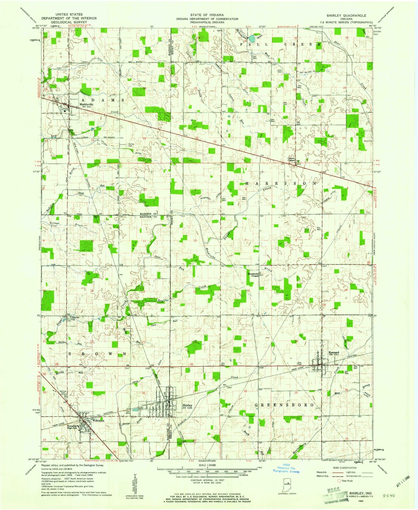
Classic USGS Shirley Indiana 7.5'x7.5' Topo Map
Couldn't load pickup availability
Historical USGS topographic quad map of Shirley in the state of Indiana. Map scale may vary for some years, but is generally around 1:24,000. Print size is approximately 24" x 27"
This quadrangle is in the following counties: Hancock, Henry, Madison.
The map contains contour lines, roads, rivers, towns, and lakes. Printed on high-quality waterproof paper with UV fade-resistant inks, and shipped rolled.
Contains the following named places: Center Chapel, Chadwick Ditch, Chick Run, Collier Cemetery, Collier Ditch, Corn Run, Farmer Ditch, Fort Ditch, Grain Creek, Harlan Church, Harlan Run, Hendricks Brook, Hendricks Chapel, Judge Ditch, Kennard, Kennard Post Office, Kennard Volunteer Fire Department, Maize Run, Markleville, Markleville Post Office, McCray Cemetery, McCray Run, Mont Branch, Nelson Ditch, Oats Run, Owner Run, Pee Dee Ditch, Pierce Ditch, Shirley, Shirley Drain, Shirley Police Department, Shirley Post Office, Shirley Volunteer Fire Department, Smith Ditch, Sugar Creek Air Park, Town of Kennard, Town of Markleville, Town of Shirley, Town of Wilkinson, Township of Adams, Township of Greensboro, Township of Harrison, Van Meter Ditch, Weeks Ditch, Wilkinson, Wilkinson Ditch, Wilkinson Fire Department, Wilkinson Post Office, Wilkinson Volunteer Fire Department, Woodville, ZIP Codes: 46056, 47351, 47384