

MyTopo
Classic USGS Shirley Massachusetts 7.5'x7.5' Topo Map
Couldn't load pickup availability
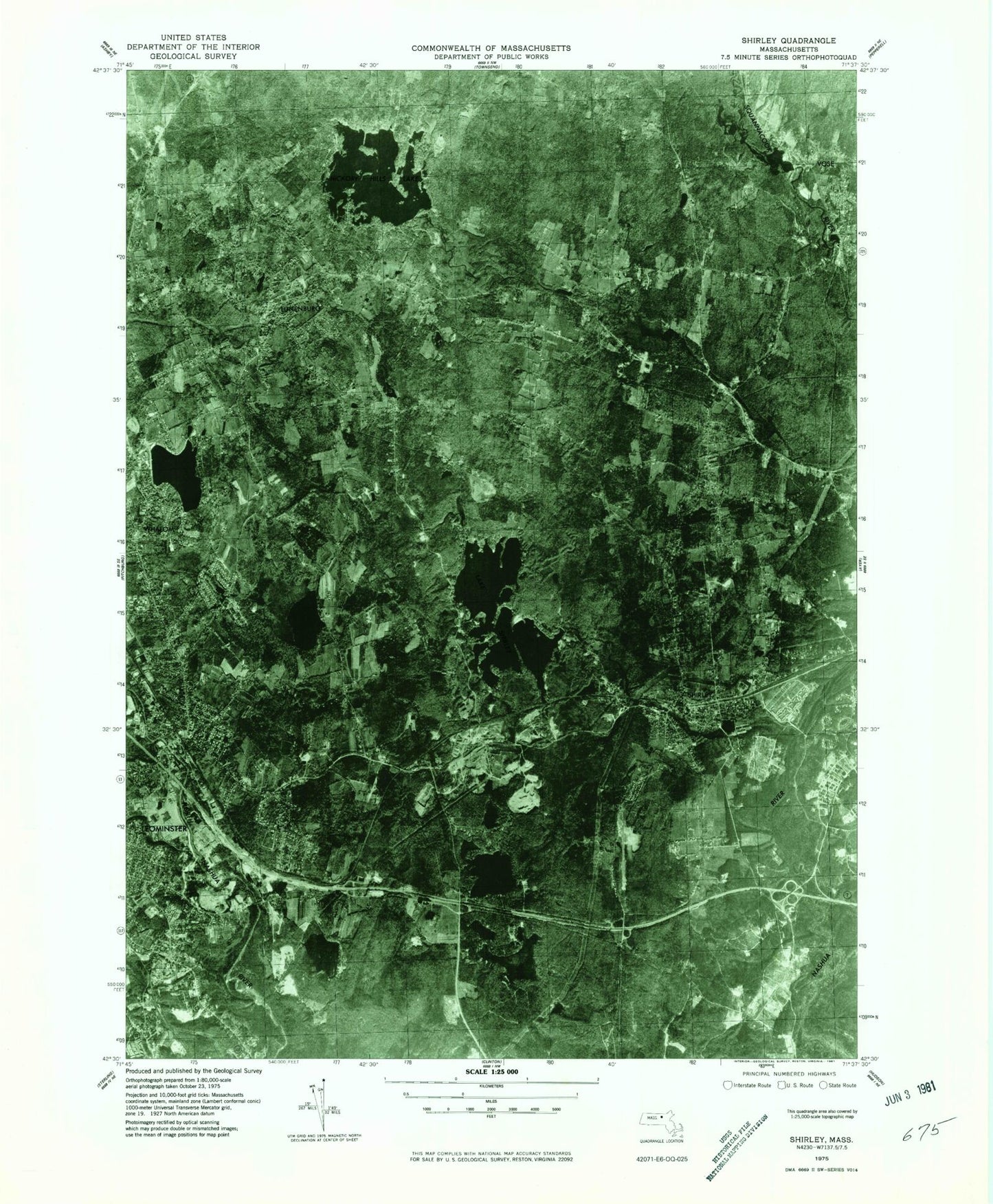
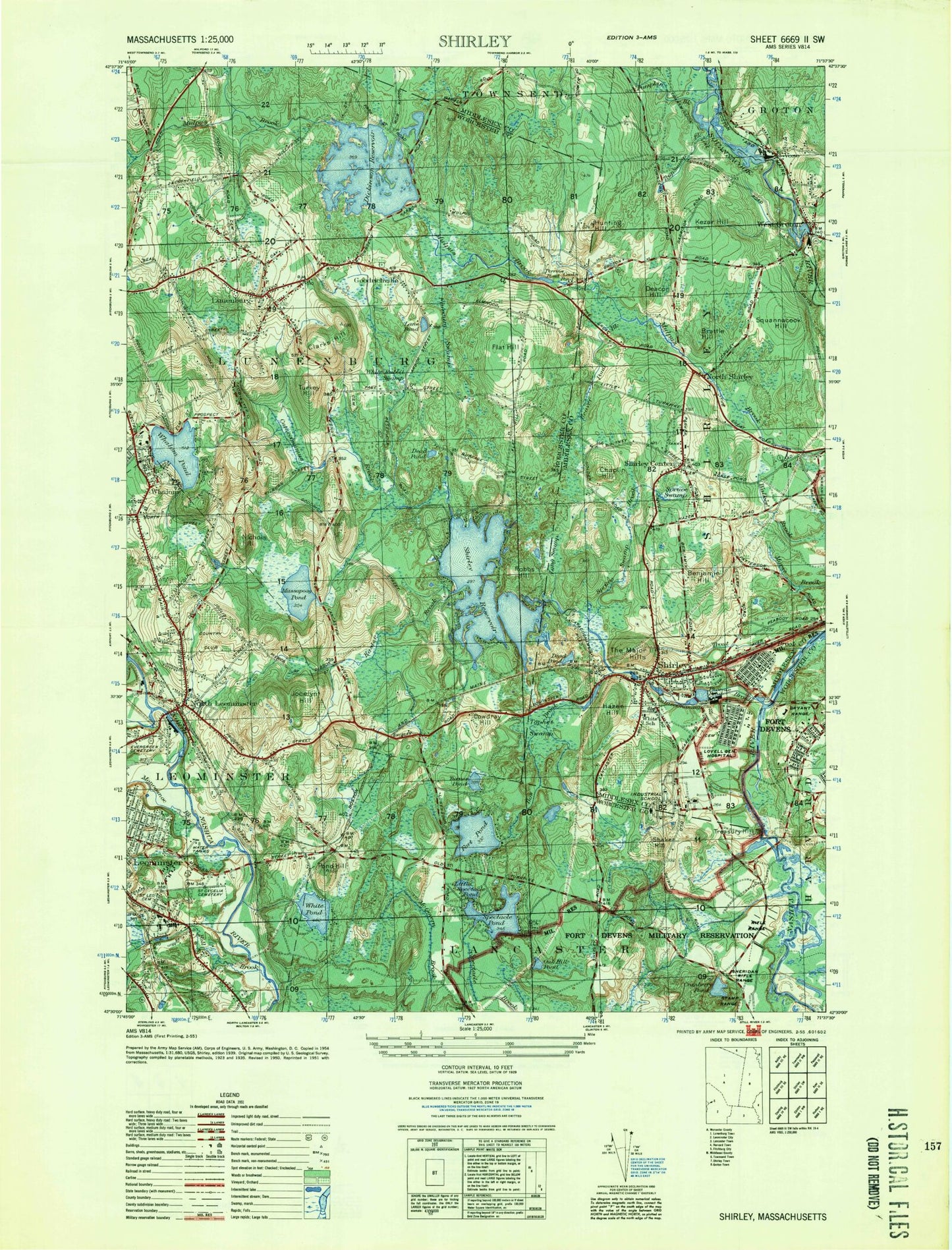
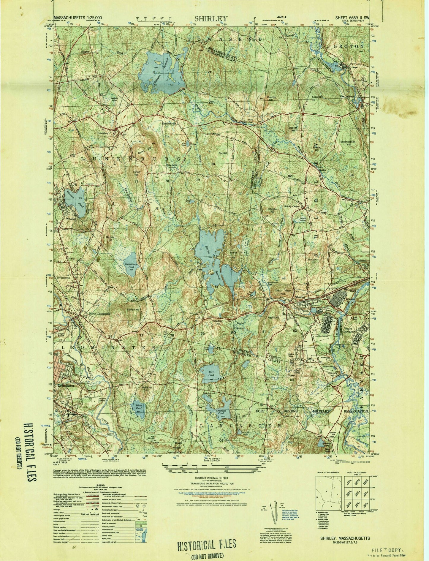
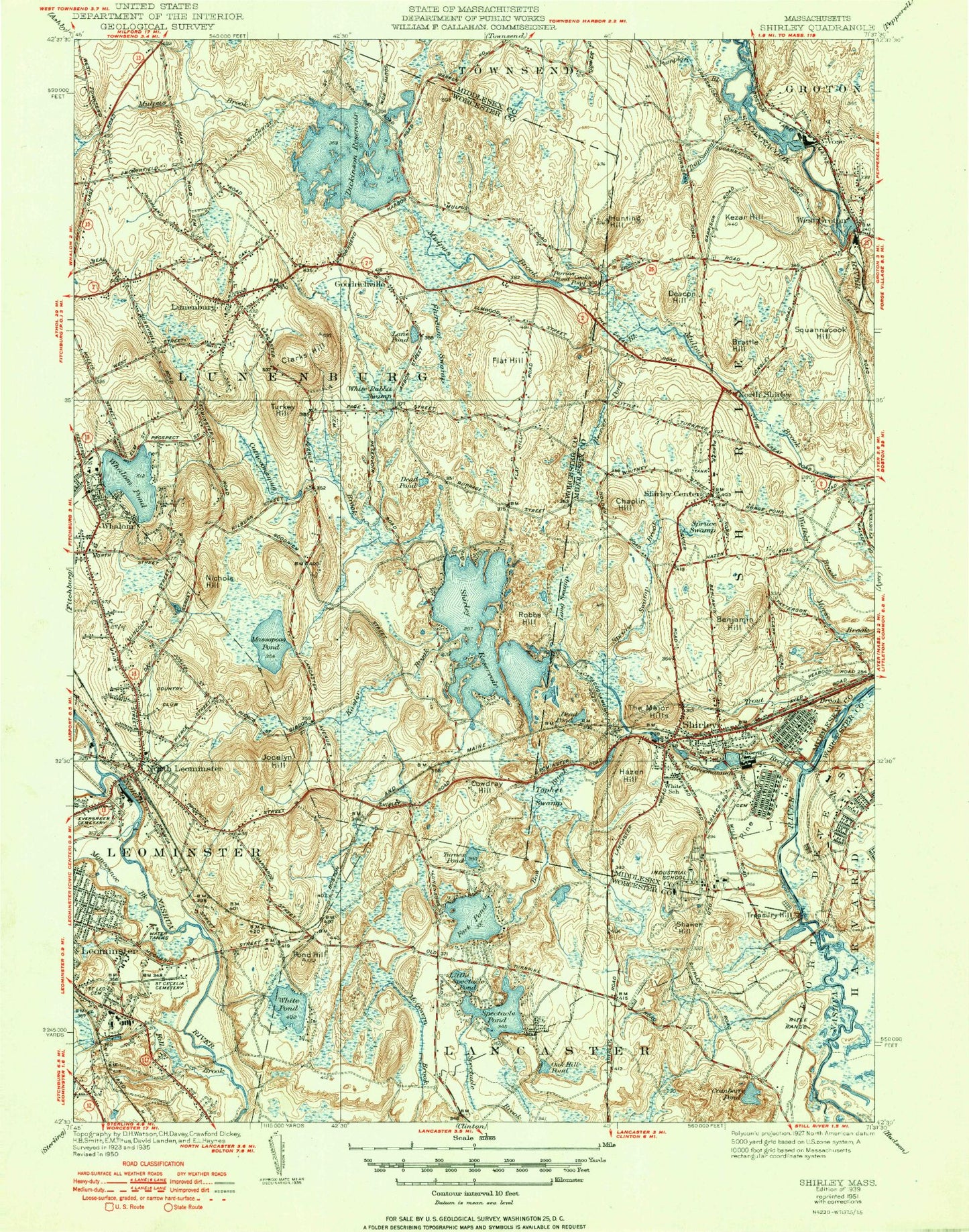
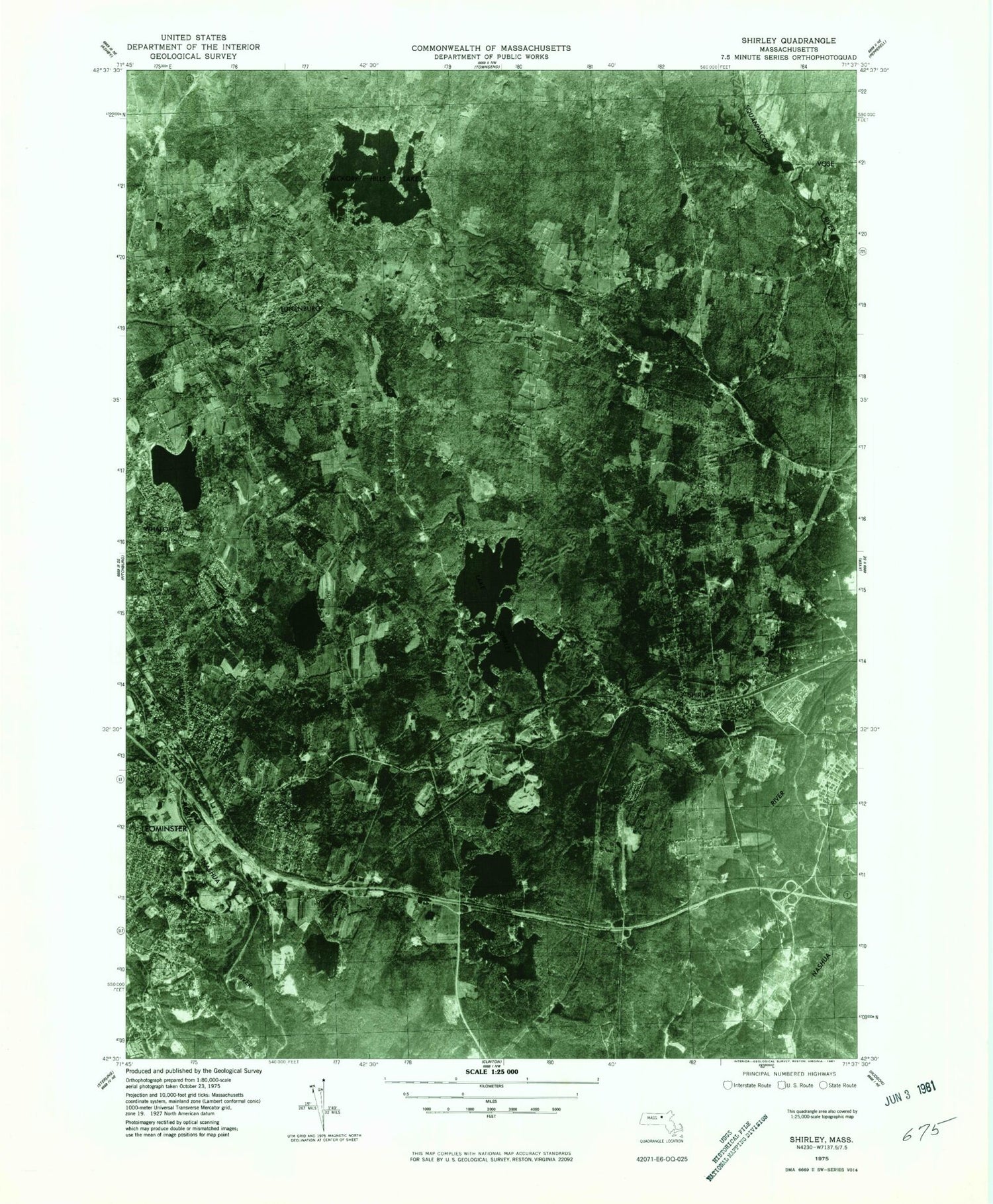
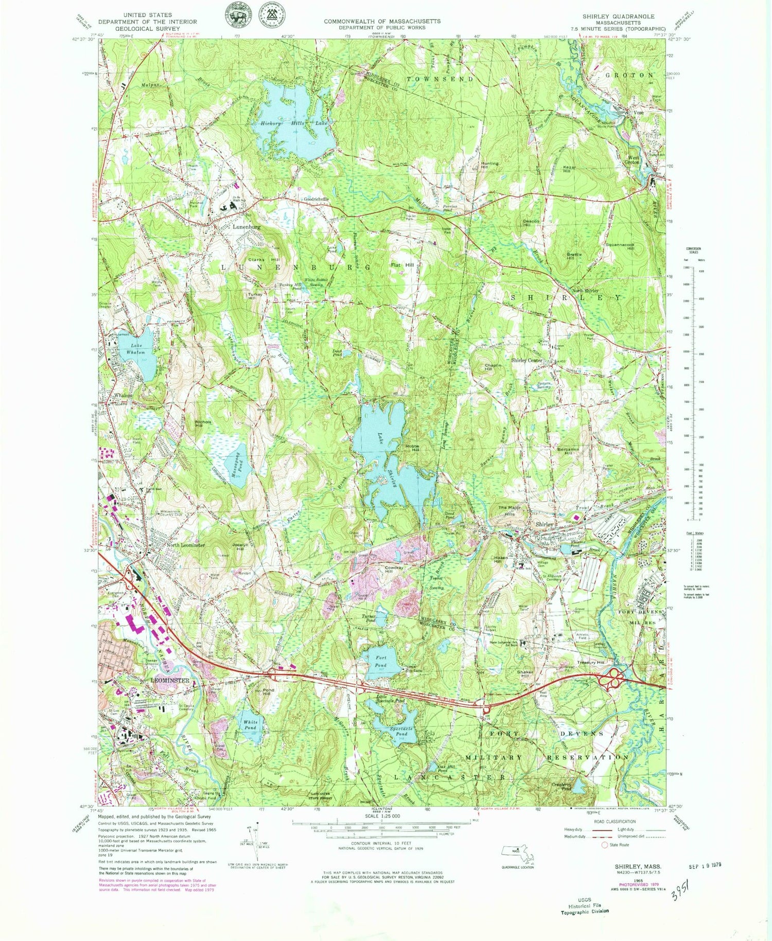
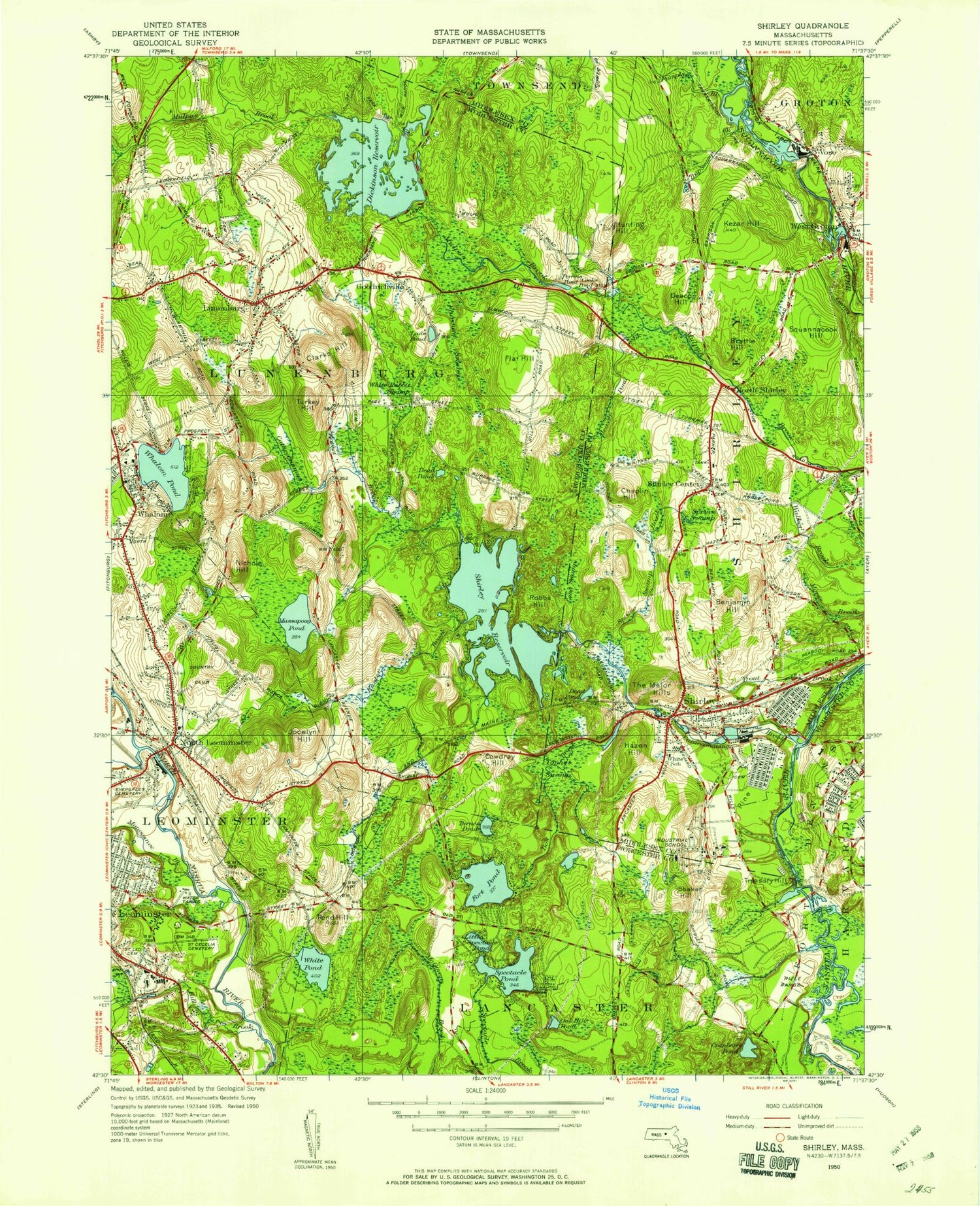
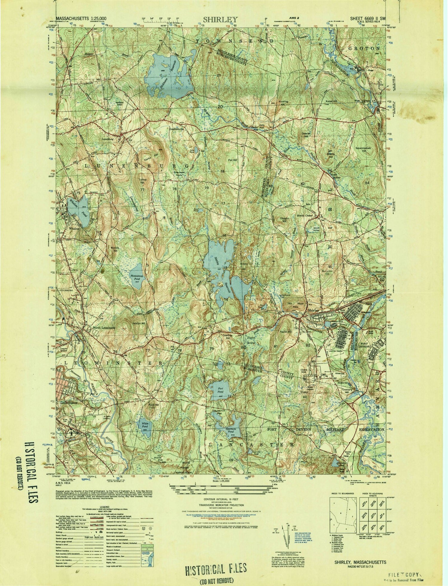
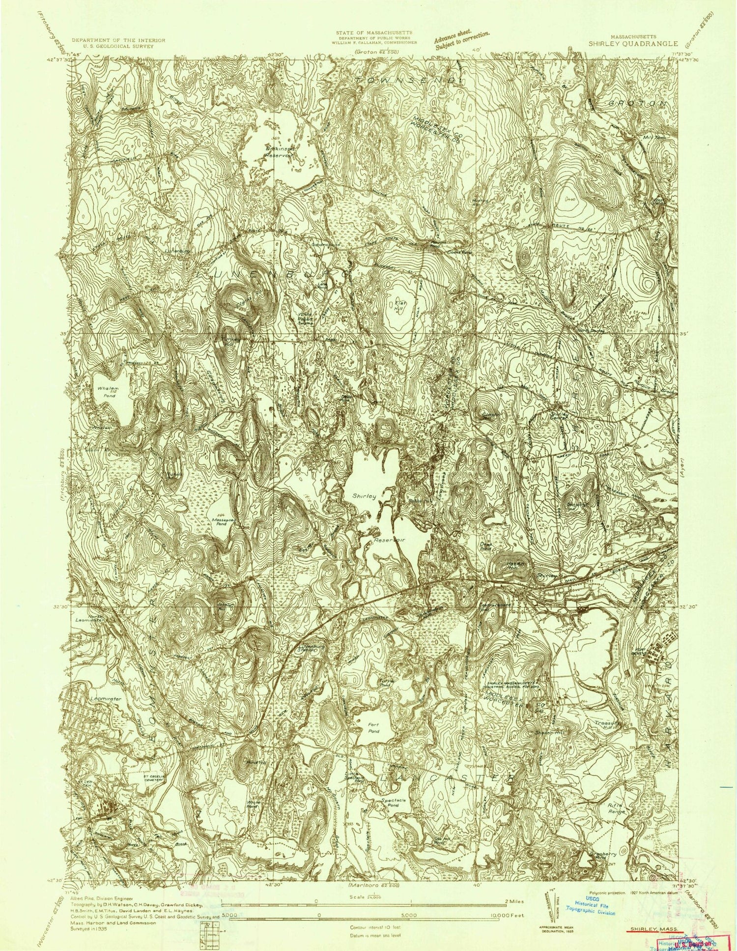
Historical USGS topographic quad map of Shirley in the state of Massachusetts. Typical map scale is 1:24,000, but may vary for certain years, if available. Print size: 24" x 27"
This quadrangle is in the following counties: Middlesex, Worcester.
The map contains contour lines, roads, rivers, towns, and lakes. Printed on high-quality waterproof paper with UV fade-resistant inks, and shipped rolled.
Contains the following named places: White Pond, YMCA Day Camp, Harris Field, Saint Leo Cemetery, Lura A White School, Saint Anthony's Cemetery, Village Cemetery, Shirley Center School, Tarbell School, North Cemetery, Lunenburg Junior-Senior High School, North East School, Evergreen Cemetery, Marshall Park, South Cemetery, Monoosnock Country Club, Massachusetts State Industrial School for Boys, White Pond Dam, Fort Pond Dam, Phoenix Pond Dam, Bow Brook Reservoir, Bow Brook Dam, Lake Shirley Dam, Squannacook River Dam, Squannacook River Reservoir, Hickory Hills Lake Dam, Squannacook River Dam, Squannacook River Reservoir, Lancaster State Forest, Massachusetts Correctional Institution - Shirley, Shirley Airport (historical), Evergreen Cemetery, Pierce School, Monoosnock Country Club, White School, The Major Hills, Village Cemetery, Johnny Appleseed Elementary School, Center Elementary School, Marshall Park, Saint Bonaface Church, Turkey Hill Middle School, Squannacook River Wildlife Management Area, Beaver Pond Brook, Benjamin Hill, Bow Brook, Brattle Hill, Catacoonamug Brook, Chaplin Hill, Clarks Hill, Cowdray Hill, Cranberry Pond, Deacon Hill, Dead Pond, Dead Pond, Easter Brook, Fall Brook, Flat Hill, Flurcum Swamp, Fort Pond, Goodrichville, Hazen Hill, Hickory Hills Lake, Hunting Hill, Jocelyn Hill, Kezar Hill, Lane Pond, Little Spectacle Pond, Long Swamp, Lunenburg, Massapoag Pond, Monoosnoc Brook, Nichols Hill, North Leominster, North Shirley, Oak Hill Pond, Perrins Pond, Phoenix Pond, Pond Hill, Pumpkin Brook, Robbs Hill, Shaker Hill, Shirley, Shirley Center, Lake Shirley, Spectacle Pond, Spruce Swamp, Spruce Swamp Brook, Squannacook Hill, Tophet Swamp, Trap Swamp Brook, Treasury Hill, Trout Brook, Turkey Hill, Turkey Hill Pond, Turner Pond, Vose, West Groton, Whalom, Lake Whalom, White Rabbit Swamp, Lunenburg Station, Shaker Village, Town of Shirley, Town of Lunenburg, WCMX-AM (Leominster), Benjamin Hill Municipal Pool, Christian Union Church, Hazen Memorial Library, Shirley Post Office, Shirley Center Historic District, Shirley Municipal Building, Shirley Town Hall, West Groton Post Office, Christian Union Church, Greater Gethsemane Church of God in Christ, Saint Anthonys Religious Center, Trinity Chapel, Brick Tavern Cemetery, Congregation Church of Christ, Cowdrey Nature Center, Desantis Field, Fairlane Mobile Home Park, Houghtons Mill Pond, Kingdom Hall of Jehovahs Witnesses, Lunenburg High School, Lunenburg Historic District, Lunenburg Post Office, Lunenburg United Parish House, Market Basket Plaza Shopping Center, Meadow Wood Trailer Park, Pilgrim Convenant Church, Pioneer Industrial Park, Ritter Memorial Library, Searstown Mall Shopping Center, T C Passois Elementary School, Whalom Park, Johnny Appleseed School Library, Lunenburg High School Library, Massachusetts Correctional Institute Shirley Minimum Security Library, North Leominster Station, Shirley Middle School, Shirley Station, Sky View Middle School, Souza Baronowski Correctional Center Library, Lunenburg Census Designated Place, Shirley Census Designated Place, Fort Devens, Flat Hill Orchards, Lanni Orchards, Shirley Fire Department Station 1 Headquarters, Lunenburg Fire Department, Leominster Fire Department Station 3, Shirley Fire Department Station 2, Shirley Ambulance Service, Souza - Baranowski Correctional Center, Lunenburg Police Department, Shirley Police Department, Massachusetts State Police Station C4 Leominster Barracks, Saint Cecilia Cemetery, White Pond, YMCA Day Camp, Harris Field, Saint Leo Cemetery, Lura A White School, Saint Anthony's Cemetery, Village Cemetery, Shirley Center School, Tarbell School, North Cemetery, Lunenburg Junior-Senior High School, North East School, Evergreen Cemetery, Marshall Park, South Cemetery, Monoosnock Country Club, Massachusetts State Industrial School for Boys, White Pond Dam, Fort Pond Dam, Phoenix Pond Dam, Bow Brook Reservoir, Bow Brook Dam, Lake Shirley Dam, Squannacook River Dam, Squannacook River Reservoir, Hickory Hills Lake Dam, Squannacook River Dam, Squannacook River Reservoir, Lancaster State Forest, Massachusetts Correctional Institution - Shirley, Shirley Airport (historical), Evergreen Cemetery, Pierce School, Monoosnock Country Club, White School, The Major Hills, Village Cemetery, Johnny Appleseed Elementary School, Center Elementary School, Marshall Park, Saint Bonaface Church, Turkey Hill Middle School, Squannacook River Wildlife Management Area, Beaver Pond Brook, Benjamin Hill, Bow Brook, Brattle Hill, Catacoonamug Brook, Chaplin Hill, Clarks Hill, Cowdray Hill, Cranberry Pond, Deacon Hill, Dead Pond, Dead Pond, Easter Brook, Fall Brook, Flat Hill, Flurcum Swamp, Fort Pond, Goodrichville, Hazen Hill, Hickory Hills Lake, Hunting Hill, Jocelyn Hill, Kezar Hill, Lane Pond, Little Spectacle Pond, Long Swamp, Lunenburg, Massapoag Pond, Monoosnoc Brook, Nichols Hill, North Leominster, North Shirley, Oak Hill Pond