MyTopo
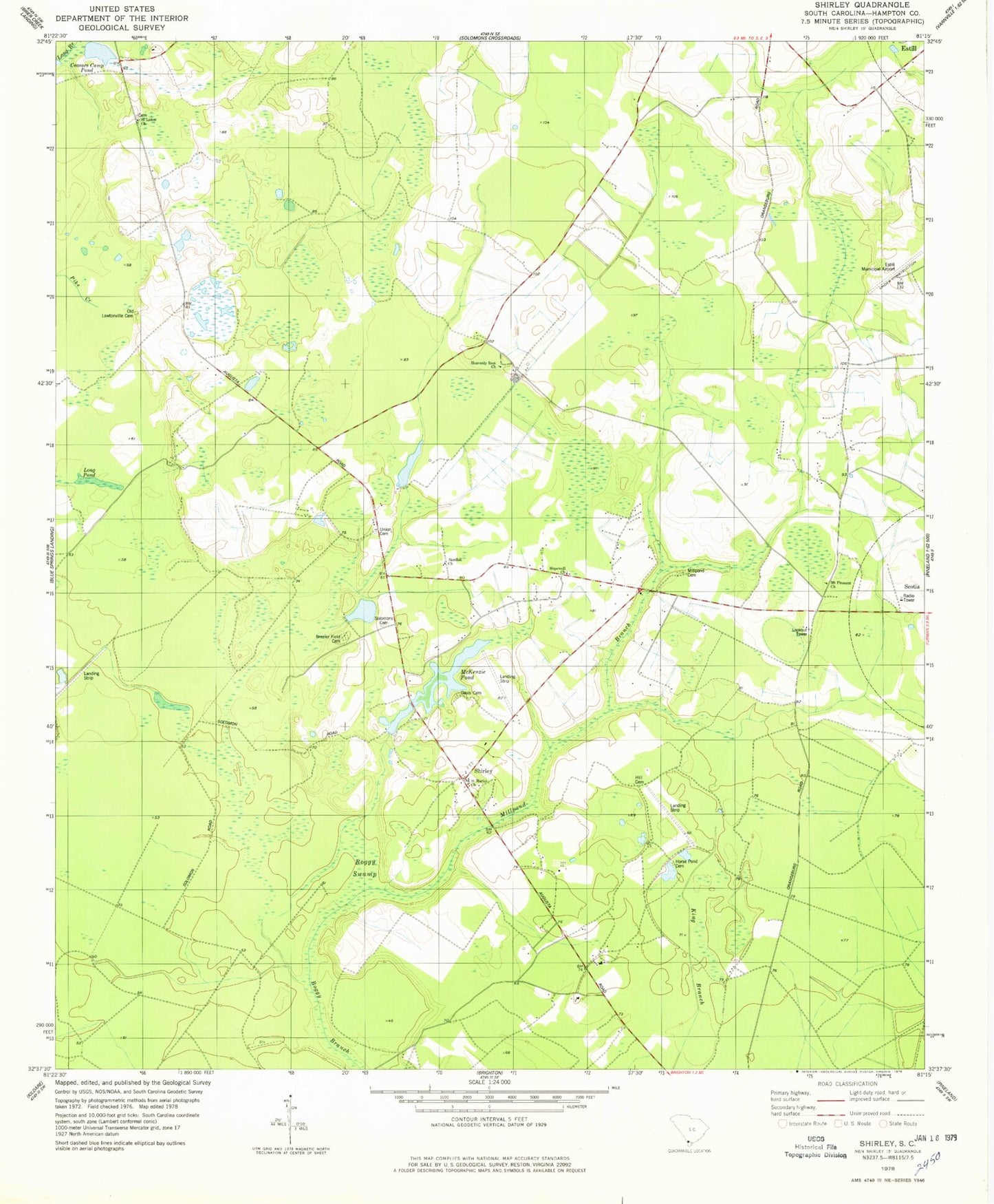
Classic USGS Shirley South Carolina 7.5'x7.5' Topo Map
Couldn't load pickup availability
Historical USGS topographic quad map of Shirley in the state of South Carolina. Map scale may vary for some years, but is generally around 1:24,000. Print size is approximately 24" x 27"
This quadrangle is in the following counties: Hampton.
The map contains contour lines, roads, rivers, towns, and lakes. Printed on high-quality waterproof paper with UV fade-resistant inks, and shipped rolled.
Contains the following named places: Blake Plantation Pond Number One D-2607 Dam, Breeler Field Cemetery, Brighton School, Ceasars Camp Pond, Cypressvale School, Daley Branch, Davis Airport, Davis Cemetery, Federal Correctional Institution Estill, Furman-Scotia Division, Gracel Hill Plantation, Grant School, Hampton Fire Department Station 12, Haskell Barony Swamp, Heavenly Rest Church, Hill Cemetery, Hopewell Church, Hopewell School, Horse Pond Cemetery, Huntington Club, Jones Place, Kenyon Church, Lafitte Pond, Long Pond, McKenzie Pond, Millpond Branch, Millpond Cemetery, Morrison Store, Morrison Switch, Mount Pleasant Church, Old Lawtonville Cemetery, Ramseys Pond, Saint Lukes Church, Saint Marks Camp Ground, Saint Marks Church, Sand Hill School, Sandhill Church, Shirley, Shirley School, Solomons Cemetery, South Carolina Noname 25014 D-2593 Dam, South Carolina Noname 25020 D-2611 Dam, South Carolina Noname 25021 D-2598 Dam, Sweet Branch School, Union Cemetery, Union Church, ZIP Code: 29922