MyTopo
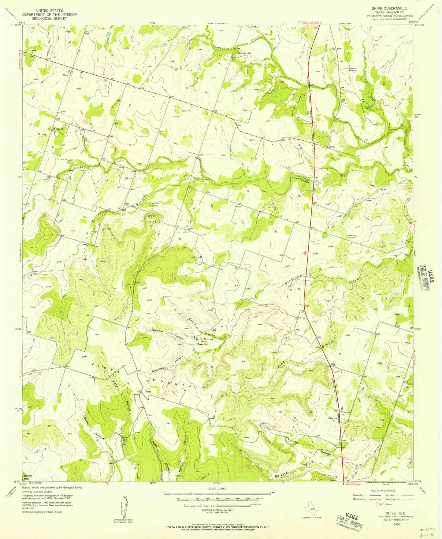
Classic USGS Shive Texas 7.5'x7.5' Topo Map
Couldn't load pickup availability
Historical USGS topographic quad map of Shive in the state of Texas. Map scale may vary for some years, but is generally around 1:24,000. Print size is approximately 24" x 27"
This quadrangle is in the following counties: Hamilton.
The map contains contour lines, roads, rivers, towns, and lakes. Printed on high-quality waterproof paper with UV fade-resistant inks, and shipped rolled.
Contains the following named places: Barner Hollow, Blackburn Hollow, Buzzard Hollow, Caldwell Lake Number 1, Caldwell Lake Number 1 Dam, Caldwell Lake Number 2, Caldwell Lake Number 2 Dam, Cave Hollow, Hoffman Branch, Little Cowhouse Cemetery, Little Cowhouse Creek, Little Round Mountain, New Hope Cemetery, Partridge Creek, Perkins Cemetery, Pete Hollow, Saint Pauls Church, Sand Branch, Schoolerville, Shive, Snake Hollow, Vista, Vista Mountain, West Point, West Point Cemetery, Whitlock Hollow