MyTopo
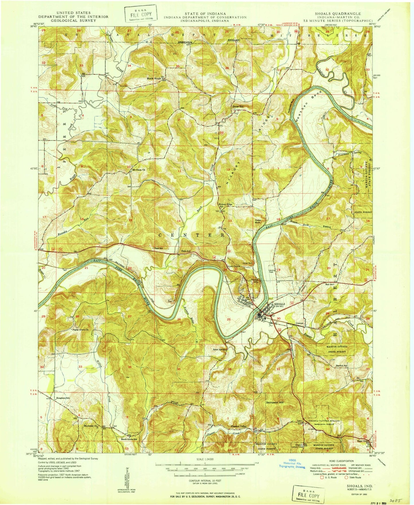
Classic USGS Shoals Indiana 7.5'x7.5' Topo Map
Couldn't load pickup availability
Historical USGS topographic quad map of Shoals in the state of Indiana. Map scale may vary for some years, but is generally around 1:24,000. Print size is approximately 24" x 27"
This quadrangle is in the following counties: Martin.
The map contains contour lines, roads, rivers, towns, and lakes. Printed on high-quality waterproof paper with UV fade-resistant inks, and shipped rolled.
Contains the following named places: American Run, Beaver Creek, Beech Creek, Branch Run, Buck Knob, Buck Knob Creek, Buzzard Run, Cedar Bluff, Cedar Brook, Chalybeate Springs, Church Brook, Dover Hill, Dover Hill Census Designated Place, Dover Run, Flood Run, Free Run, Freemans Spring Branch, French Run, Friendship Church, Grove Brook, Gushing Creek, Hall Cemetery, Heathen Bend, Henry Creek, Hickory Ridge, Hickory Run, Hill Branch, Hindostan Church, Houghton Run, House Rock, House Rock Branch, Indian Creek, Indian Run, Iron Creek, Ironton, Jet Run, Knob Branch, Lacy, Lacy Drain, Leaf Branch, Lemon Run, Limb Run, Lime Run, Martin County, Martin County Civil Defense and Fire Department, Martin County Jail, Martin County Sheriff's Office, Martin County State Forest, McBrides Bluff, McBrides Cemetery, Mount Union Church, Mountain Stream, Nest Brook, Nubbin Ridge Branch, Nut Brook, Opossum Creek, Overlook Drain, Peek Cut, Peek Run, Pinnacle Rock, Pleasant Valley, Poplar Grove Church, River Drain, Root Brook, Sampson Hill, Seed Tick Creek, Shell Mound, Sherfick Stream, Shoals, Shoals Community Elementary School, Shoals Community High School, Shoals Community Middle School, Shoals Overlook, Shoals Post Office, Shoals Town Marshal, Shoals Volunteer Fire Department, Sholts Cemetery, Sod Run, Speel Creek, Spout Spring, Spurt Run, Squirt Run, Steep Hollow Cemetery, Sum Creek, Town of Shoals, Township of Center, Union Creek, Windy Run, ZIP Code: 47581


