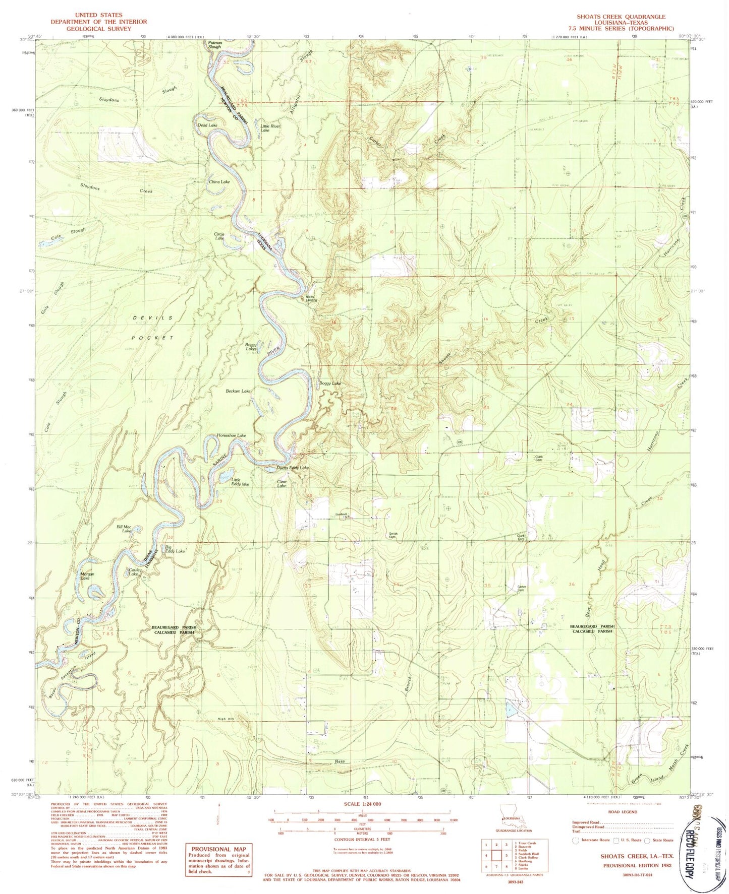
MyTopo
Classic USGS Shoats Creek Louisiana 7.5'x7.5' Topo Map
Couldn't load pickup availability
Historical USGS topographic quad map of Shoats Creek in the states of Louisiana, Texas. Map scale may vary for some years, but is generally around 1:24,000. Print size is approximately 24" x 27"
This quadrangle is in the following counties: Beauregard, Calcasieu, Newton.
The map contains contour lines, roads, rivers, towns, and lakes. Printed on high-quality waterproof paper with UV fade-resistant inks, and shipped rolled.
Contains the following named places: Alligator Lake, Alligator Slough, Babe Clark Cemetery, Bayou Deception Island, Beckam Lake, Big Eddy Lake, Boggy Lake, Boggy Lakes, Burnt Stump Lake, Carter Cemetery, Carter Creek, Cauley Lake, Circle Lake, Clark Cemetery, Clear Lake, Dead Lake, Devils Pocket, Duetts Eddy Lake, Gambrell Baptist Church, Green Island Marsh Creek, High Hill, Horseshoe Lake, Hurricane Creek, Little Eddy Lake, Little River Lake, Morgan Lake, Nicks Ferry, Nicks Landing, North Starks Oil Field, Shoats Creek, Slaydons Creek, Slaydons Slough, Smith Cemetery, South Bancroft Gas Field