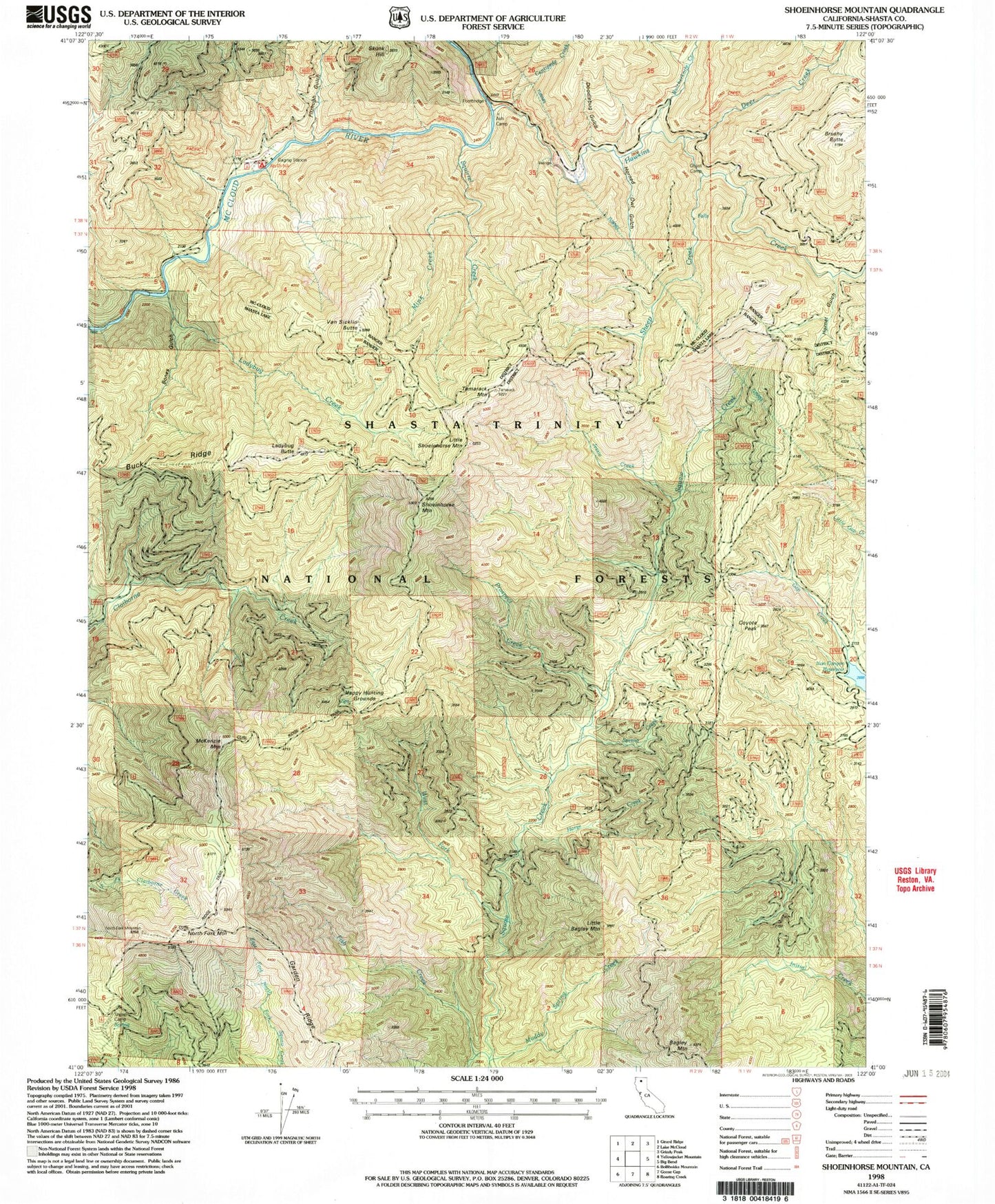
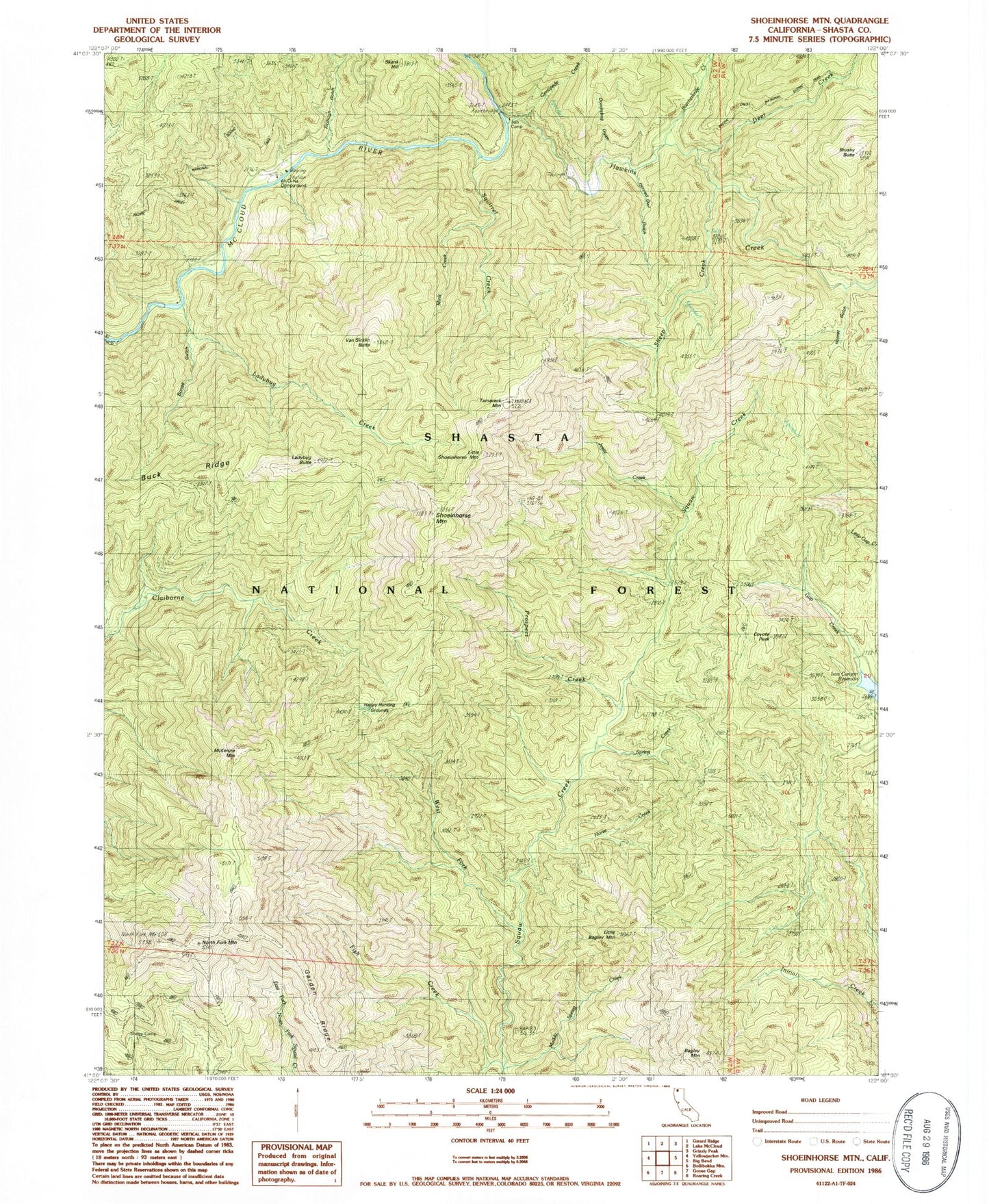
MyTopo
Classic USGS Shoeinhorse Mountain California 7.5'x7.5' Topo Map
Couldn't load pickup availability
Historical USGS topographic quad map of Shoeinhorse Mountain in the state of California. Map scale may vary for some years, but is generally around 1:24,000. Print size is approximately 24" x 27"
This quadrangle is in the following counties: Shasta.
The map contains contour lines, roads, rivers, towns, and lakes. Printed on high-quality waterproof paper with UV fade-resistant inks, and shipped rolled.
Contains the following named places: Ah-Di-Na, Ah-Di-Na Campground, Ash Camp, Bones Gulch, Brushy Butte, Buck Ridge, Butcherknife Creek, Centipede Creek, Coyote Peak, Curl Ridge Jeep Trail, Deer Creek, Doodlebug Gulch, Fish Creek, Fitzhugh Gulch, Gap Creek, Garden Ridge, Ghost Camp, Happy Hunting Grounds, Hawkins Creek, Horned Owl Gulch, Hornet Gulch, Horse Creek, Jessie Creek, Ladybug Butte, Ladybug Creek, Little Bagley Mountain, Little Shoeinhorse Mountain, McKenzie Mountain, Mink Creek, Muddy Spring Creek, North Fork Mountain, Prospect Creek, Sheep Camp, Sheep Creek, Shoeinhorse Mountain, Spring Creek, Squirrel Creek, Tamarack Mountain, Van Sicklin Butte, West Fork Squaw Creek