MyTopo
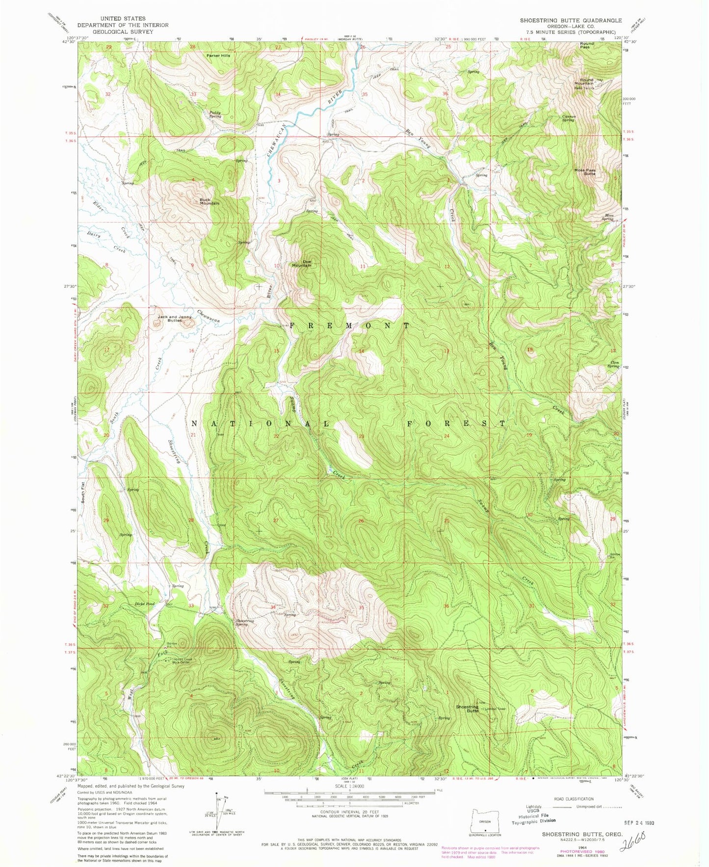
Classic USGS Shoestring Butte Oregon 7.5'x7.5' Topo Map
Couldn't load pickup availability
Historical USGS topographic quad map of Shoestring Butte in the state of Oregon. Map scale may vary for some years, but is generally around 1:24,000. Print size is approximately 24" x 27"
This quadrangle is in the following counties: Lake.
The map contains contour lines, roads, rivers, towns, and lakes. Printed on high-quality waterproof paper with UV fade-resistant inks, and shipped rolled.
Contains the following named places: Ben Young Creek, Buck Mountain, Cannon Spring, Clem Spring, Dairy Creek, Dicks Pond, Doe Mountain, Elder Creek, Farrow Creek, Gaylord Ranch, Jack and Jenny Buttes, Lucky Six Spring, Moss Pass Butte, Moss Spring, Paddy Spring, Parker Hills, Round Mountain, Round Pass, Schuster Place, Schuster Spring, Shoestring Butte, Shoestring Creek, Shoestring Spring, South Creek, Swamp Creek, Thomas Creek Work Center, West Fork Shoestring Creek