MyTopo
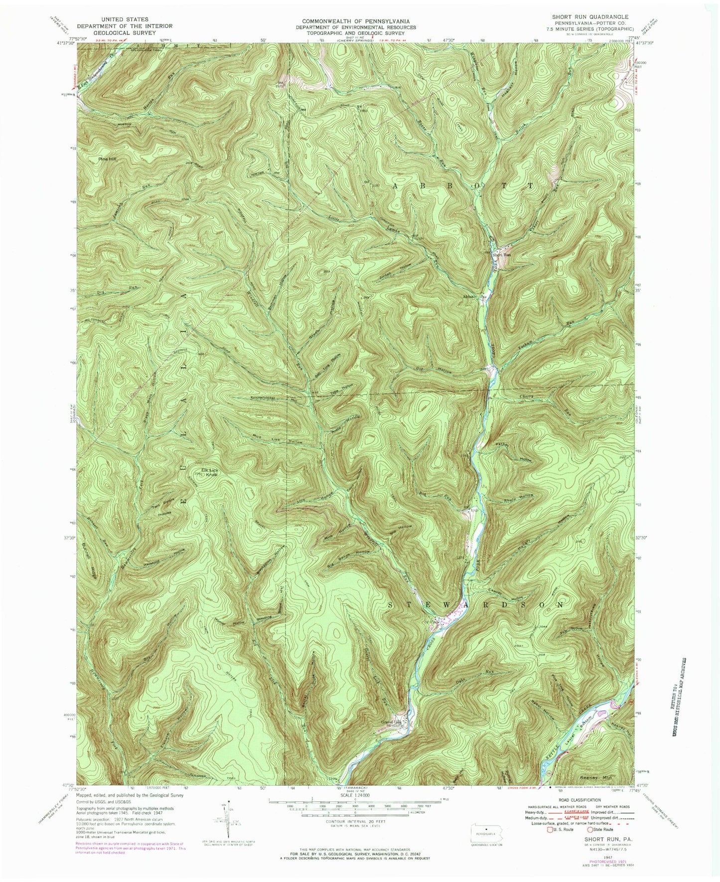
USGS Classic Short Run Pennsylvania 7.5'x7.5' Topo Map
Couldn't load pickup availability
Historical USGS topographic quad map of Short Run in the state of Pennsylvania. Scale: 1:24000. Print size: 24" x 27"
This quadrangle is in the following counties: Potter.
The map contains contour lines, roads, rivers, towns, lakes, and grids including latitude / longitude and UTM / MGRS. Printed on high-quality waterproof paper with UV fade-resistant inks.
Contains the following named places: Ash Tree Hollow, Bachman Hollow, Barrel Slide Hollow, Bergstresser Hollow, Big Bench Hollow, Big Run, Black Mark Hollow, Blacksmith Hollow, Bolich Run, Bunnell Run, Cassidy Hollow, Cherry Run, Coon Hollow, Dry Hollow, Dry Hollow, Dyke Run, Elk Lick Knob, Elkhorn Hollow, Elkhorn Trail, Gravel Lick Run, Gravel Lick Trail, Green Hollow, Green Hollow, Hailstone Hollow, Hammersley Trail, Hogback Hollow, Hollow Ridge Trail, Hoover Hollow, Horton Run Trail, Hungry Hollow, Jordan Hollow, Keeney Hollow, Knickerbocker Hollow, Laurel Bottom, Lick Hollow, Lick Ridge Trail, Little Burdick Hollow, Little Lyman Run, Mink Hollow, Mud Lick Hollow, Parker Hollow, Pine Hill, Pine Tree Hollow, Rebel Hollow, Rhulo Hollow, Ridge Trail, Road Hollow, Robin Hollow, Short Run, Slip Hollow, Splash Dam Trail, Stepping Stone Hollow, Tobe Hollow, Tub Hollow, Twin Sisters Hollows, Twin Sisters Trail, Windfall Run, Wingerter Run, Yochum Run, Boone Run, Cross Fork Trail, Elk Lick Run, Keeney Mountain, Jamison Run Vista, Horton Run Vista, Abbott, Gravel Lick, Short Run, Road District of East Fork (historical)