MyTopo
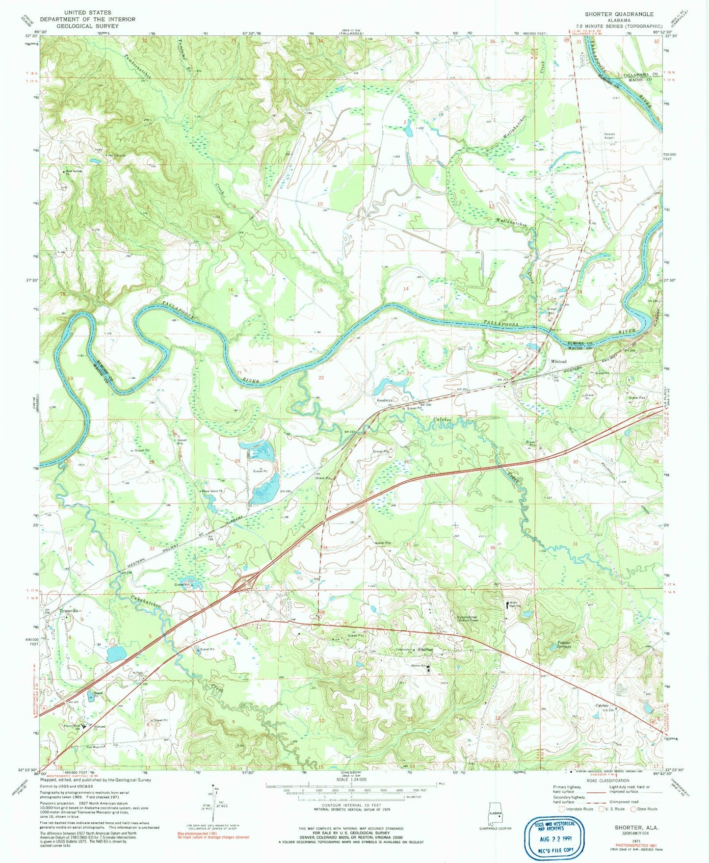
Classic USGS Shorter Alabama 7.5'x7.5' Topo Map
Couldn't load pickup availability
Historical USGS topographic quad map of Shorter in the state of Alabama. Map scale may vary for some years, but is generally around 1:24,000. Print size is approximately 24" x 27"
This quadrangle is in the following counties: Elmore, Macon, Tallapoosa.
The map contains contour lines, roads, rivers, towns, and lakes. Printed on high-quality waterproof paper with UV fade-resistant inks, and shipped rolled.
Contains the following named places: Auburn University Agricultural Experiment Station, Auburn University Experiment Station, Autossee, Calabee Church, Calebee, Calebee Creek, Cubahatchee Baptist Church, Cubahatchee Creek, Cubahatchee Lookout Tower, First Baptist Church, Fort Decatur, Goodwyn, Hall Mitchell Church, Larsen Store, Mary Magdeline Baptist Church, Milstead, New Hope Church, Oak Grove Church, Oak Grove School, O'Daniel Bridge, Piney Grove Church, Polecat Springs, Prairie Farm School, Reeves Airport, Robinson Bend, Rock Springs Church, Rock Springs School, Saint Pauls Church, Shorter, Shorter Police Department, Shorter Post Office, Shorter Volunteer Fire Department, Shorters Church, Shorters Station, Sun Rise School, Tallassee Municipal Airport, Town of Shorter, Tuckabatchie, Tuckabatchie Bottoms, Tuckabatchie Monument, Tumkeehatchee Creek, Tumlame Branch, Tysonville, Tysonville Cemetery, Wallahatchee Creek, Wolfe High School, Wolfe-Shorter High School, ZIP Code: 36075