MyTopo
Classic USGS Shoshone California 7.5'x7.5' Topo Map
Regular price
$16.95
Regular price
Sale price
$16.95
Unit price
per
Couldn't load pickup availability
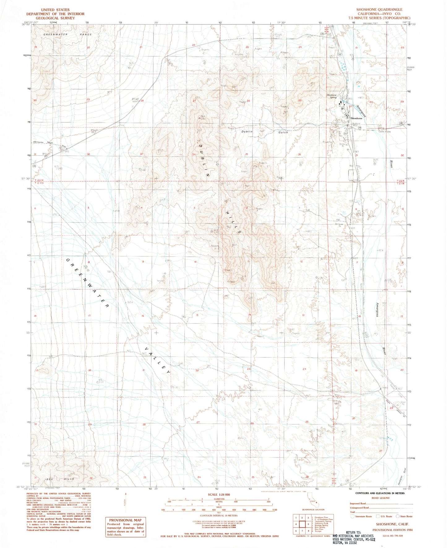
Historical USGS topographic quad map of Shoshone in the state of California. Map scale may vary for some years, but is generally around 1:24,000. Print size is approximately 24" x 27"
This quadrangle is in the following counties: Inyo.
The map contains contour lines, roads, rivers, towns, and lakes. Printed on high-quality waterproof paper with UV fade-resistant inks, and shipped rolled.
Contains the following named places: Castle in Clay, Dublin Gulch, Dublin Hills, Greenwater Valley, Ibex Wilderness, Shoshone, Shoshone Airport, Shoshone Census Designated Place, Shoshone Continuation High School, Shoshone Post Office, Shoshone Spring, Tecopa-Francis Elementary School