MyTopo
Classic USGS Shoup Idaho 7.5'x7.5' Topo Map
Regular price
$16.95
Regular price
Sale price
$16.95
Unit price
per
Couldn't load pickup availability
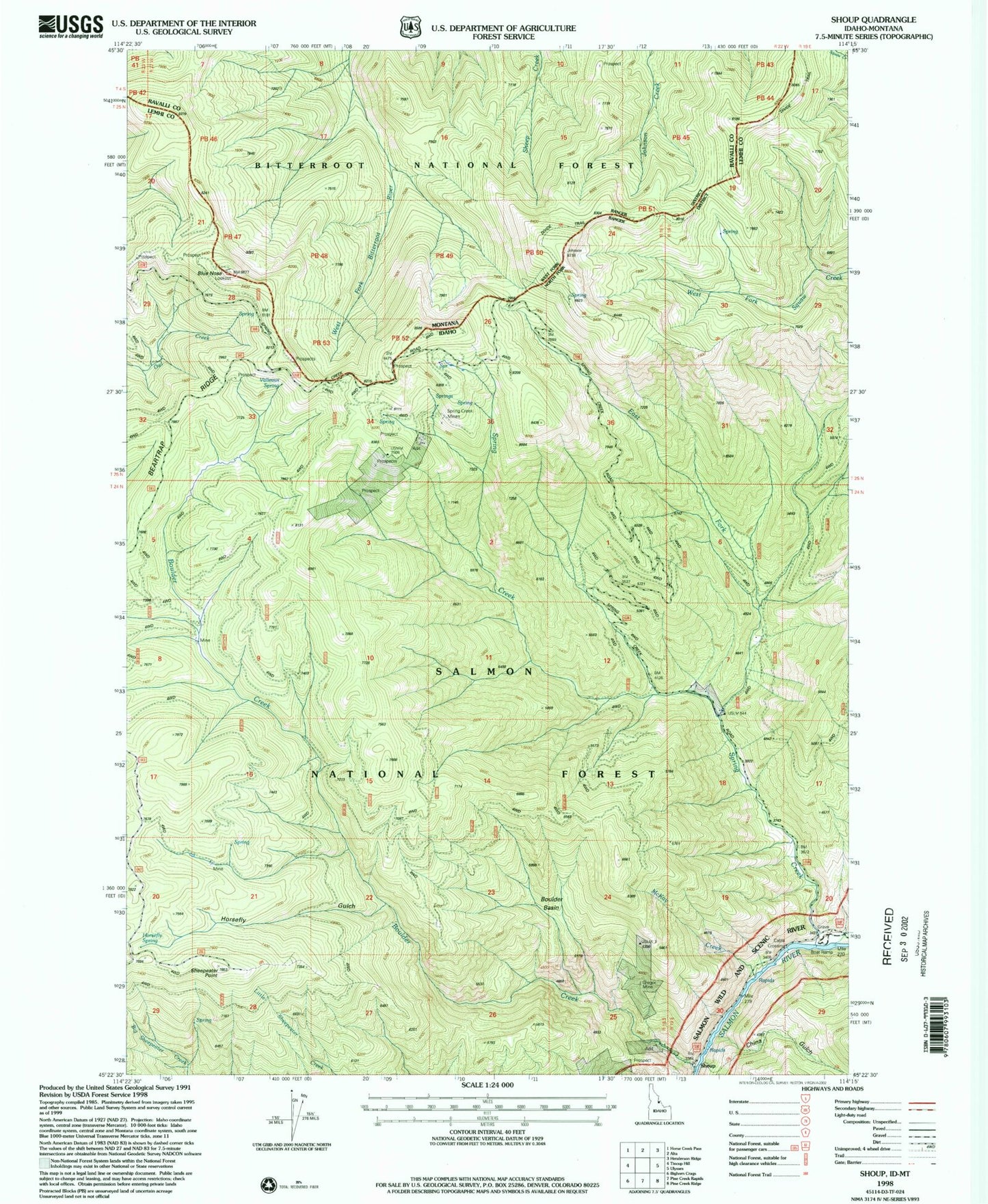
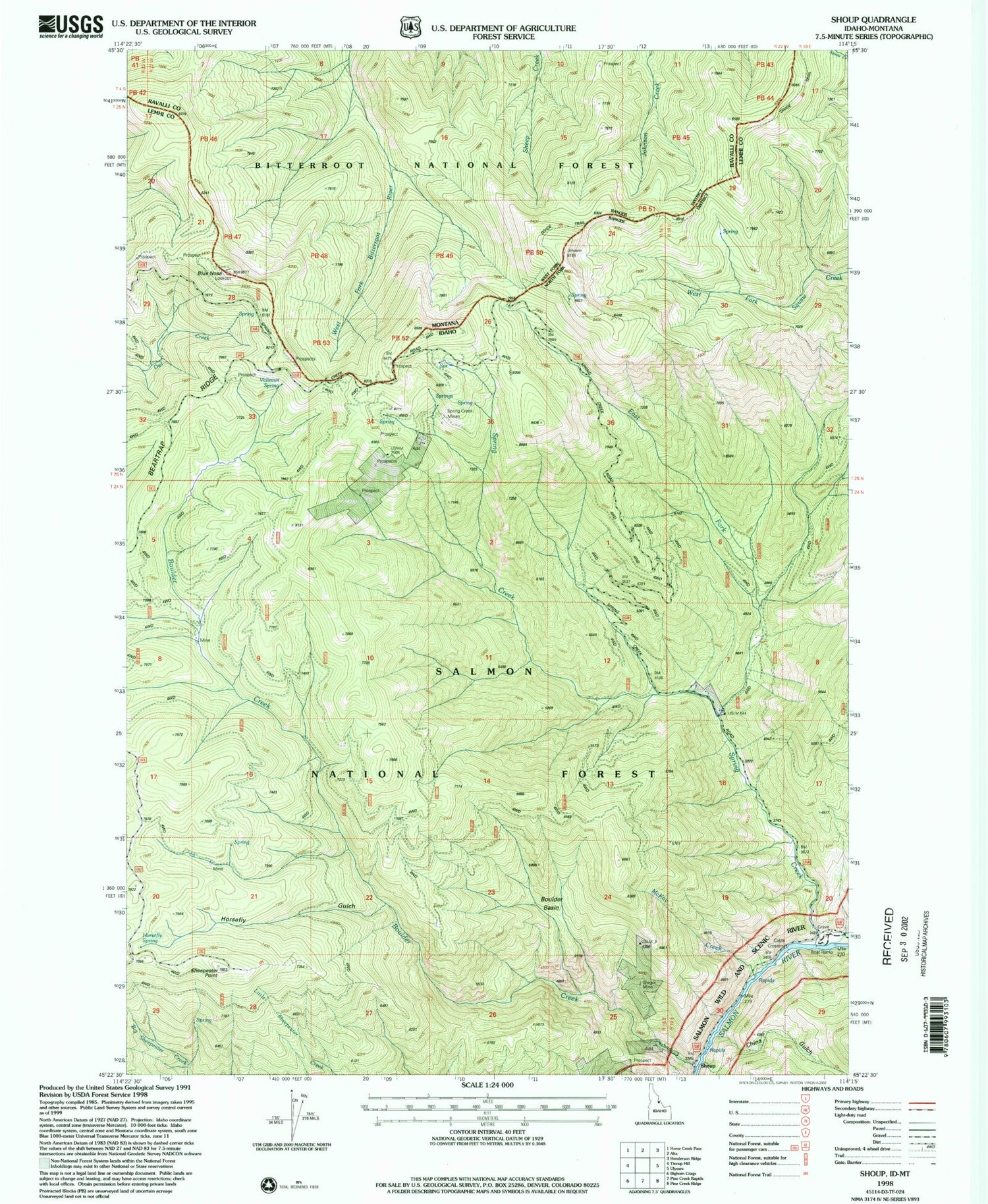
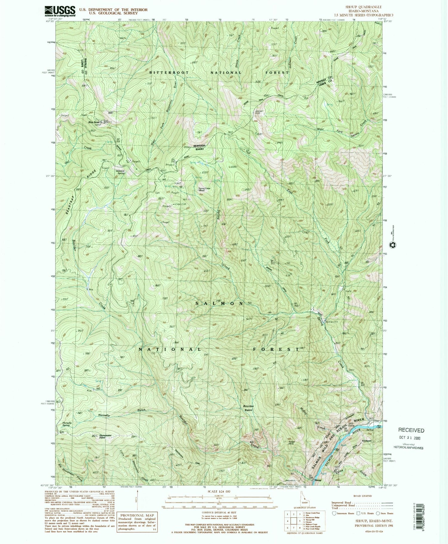
Historical USGS topographic quad map of Shoup in the states of Idaho, Montana. Map scale may vary for some years, but is generally around 1:24,000. Print size is approximately 24" x 27"
This quadrangle is in the following counties: Lemhi, Ravalli.
The map contains contour lines, roads, rivers, towns, and lakes. Printed on high-quality waterproof paper with UV fade-resistant inks, and shipped rolled.
Contains the following named places: Beartrap Ridge, Blue Nose, Boulder Basin, Boulder Creek, China Gulch, Divide Trail, East Fork Spring Creek, Gregor Mine, Horsefly Gulch, Horsefly Spring, McKay Creek, Sheepeater Point, Sheepeater Trail, Shoup, Spring Creek, Spring Creek Mines, Valieaux Spring