MyTopo
Classic USGS Showers Mountain California 7.5'x7.5' Topo Map
Couldn't load pickup availability
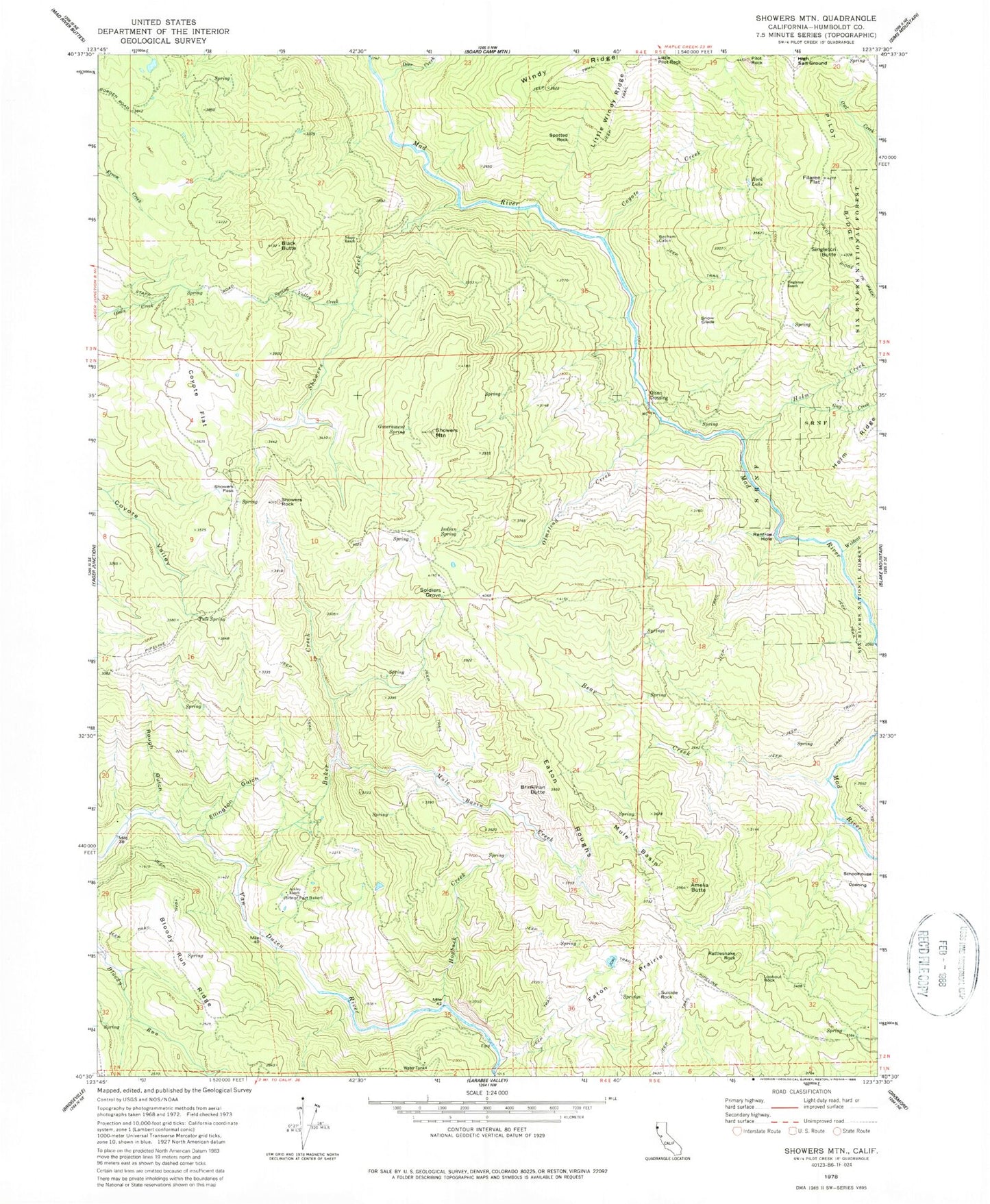
Historical USGS topographic quad map of Showers Mountain in the state of California. Map scale may vary for some years, but is generally around 1:24,000. Print size is approximately 24" x 27"
This quadrangle is in the following counties: Humboldt.
The map contains contour lines, roads, rivers, towns, and lakes. Printed on high-quality waterproof paper with UV fade-resistant inks, and shipped rolled.
Contains the following named places: Ackley Ranch, Amelia Butte, Baker Creek, Bear Creek, Becham Cabin, Black Butte, Brinkman Butte, Coyote Creek, Coyote Flat, Deer Creek, Eaton Prairie, Eaton Roughs, Ellington Gulch, Filaree Flat, Government Spring, Guy Creek, High Salt Ground, Hogback Creek, Holm Creek, Indian Spring, Little Pilot Rock, Little Windy Ridge, Lookout Rock, Mule Basin, Mule Basin Creek, Olmstead Creek, Olsen Crossing, Pilot Ridge Trail, Pilot Rock, Rattlesnake Rock, Renfroe Hole, Rock Lake, Rough Gulch, Schoolhouse Opening, Showers Creek, Showers Mountain, Showers Pass, Showers Rock, Singleton Butte, Singleton Ranch, Snow Glade, Soldiers Grove, Spotted Rock, Spring Valley Creek, Stapp Ranch, Suicide Rock, Tule Spring, Wildcat Creek