MyTopo
Classic USGS Shubrick Peak California 7.5'x7.5' Topo Map
Couldn't load pickup availability
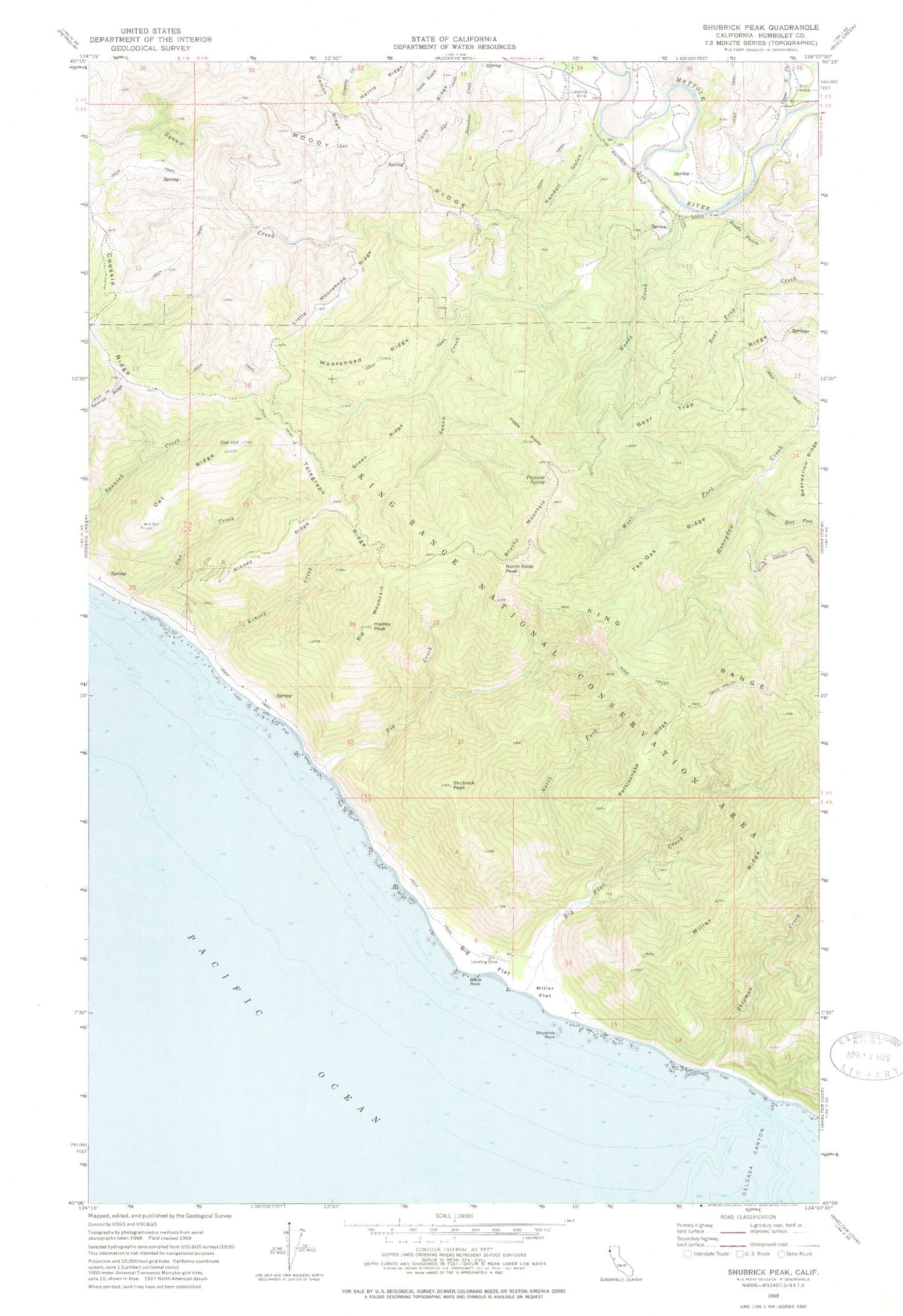
Historical USGS topographic quad map of Shubrick Peak in the state of California. Typical map scale is 1:24,000, but may vary for certain years, if available. Print size: 24" x 27"
This quadrangle is in the following counties: Humboldt.
The map contains contour lines, roads, rivers, towns, and lakes. Printed on high-quality waterproof paper with UV fade-resistant inks, and shipped rolled.
Contains the following named places: Upper North Fork Honeydew Creek, Bear Trap Ridge, Big Flat Creek, Black Rock, Brushy Mountain, Bundle Prairie, Cook Ridge, Damon Ridge, Delgada Canyon, Fiddle Prairie, Green Ridge, Hadley Peak, Harris Ridge, Kendall Gulch, King Crest Trail, King Range, Kinsey Creek, Little Moorehead Ridge, Miller Flat, Miller Ridge, Moody Ridge, Moorehead Ridge, North Fork Big Flat Creek, Oat Hill, Oat Ridge, Pinnacle Spring, Rattlesnake Ridge, Shipman Creek, Shubrick Peak, Shubrick Rock, Spanish Ridge, Tan Oak Ridge, Telegraph Ridge, Upper North Fork Mattole River, West Fork Honeydew Creek, Woods Creek, Big Creek, Big Flat, Kinsey Ridge, Oat Creek, Big Mountain, North Slide Peak, California Department of Forestry and Fire Protection Mattole Station, Honeydew Volunteer Fire Company, King Range Wilderness